
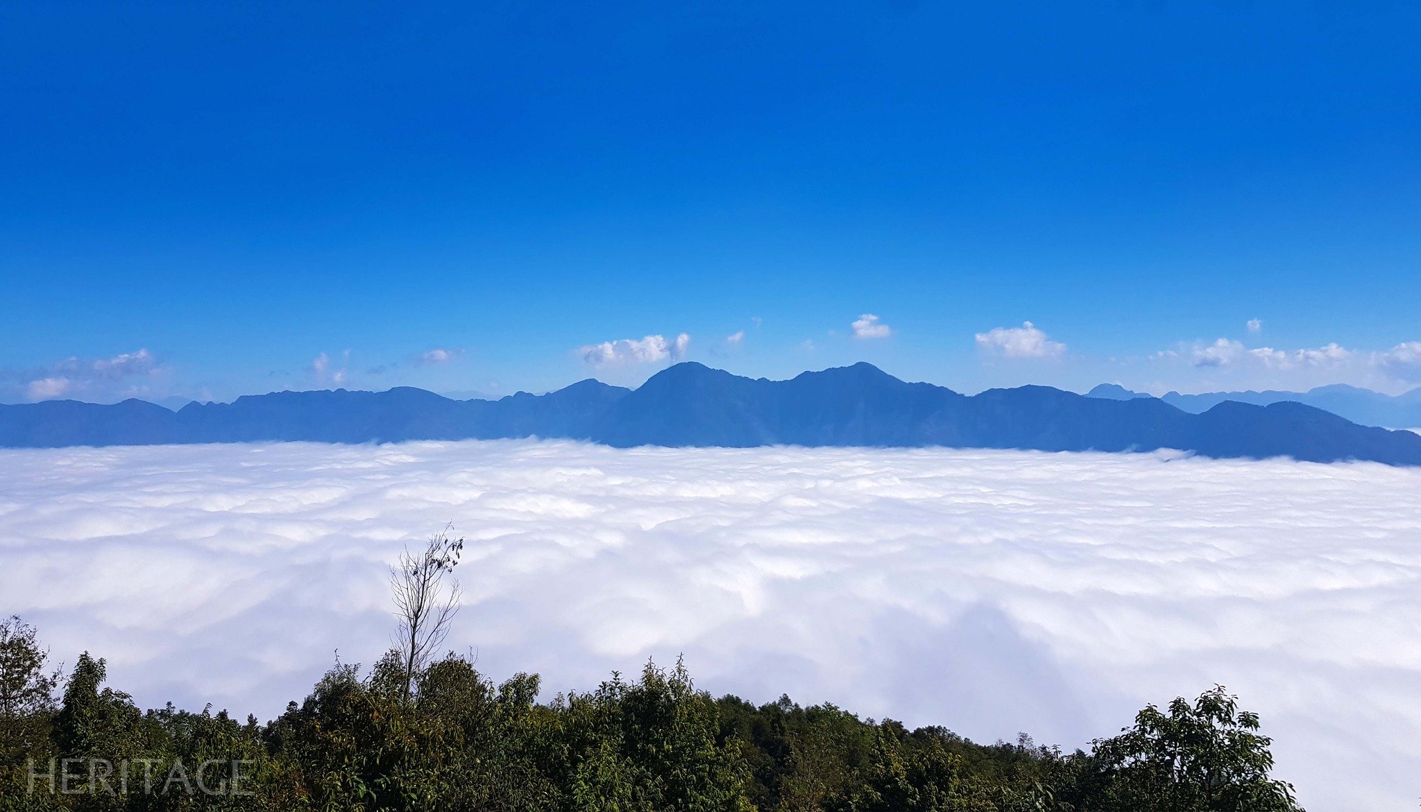
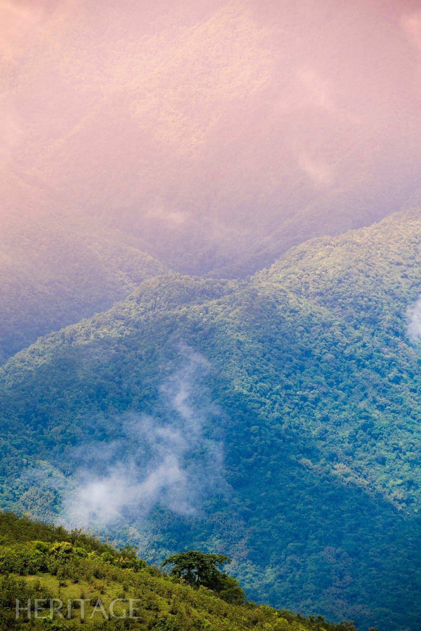
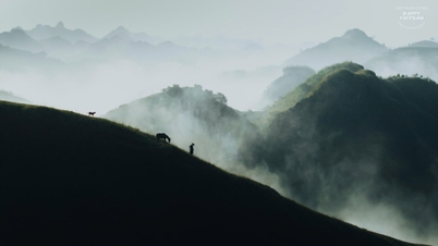
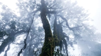
Fluffy clouds drift lazily, lingering in the tranquil mountains and hills. Lush vegetation and vibrant flowers fill the air. The path to the summit, viewed from above, resembles a thin thread winding across the ancient forest. Small villages appear and disappear amidst the swirling mist and clouds.
For adventure seekers, the pristine natural landscape of Pu Dao is the ideal destination. The trekking journey to the summit of Pu Dao begins from Nam Doong village, covering a distance of about 3-5km, with some challenging sections requiring self-orientation and careful searching for the way there and back.

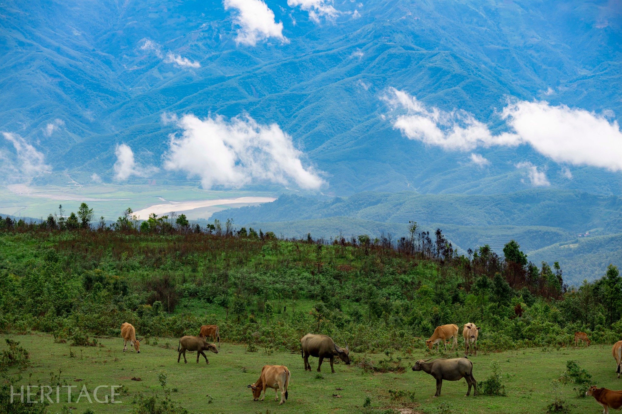
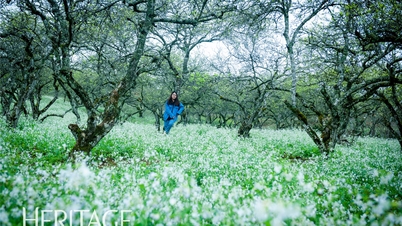
During the season of black turmeric flowers blooming, you can also see vast fields of pure white turmeric flowers showing off their beauty in the sun and wind. On the green grassy hillsides, buffaloes, cows and horses leisurely graze amidst the chirping of birds.
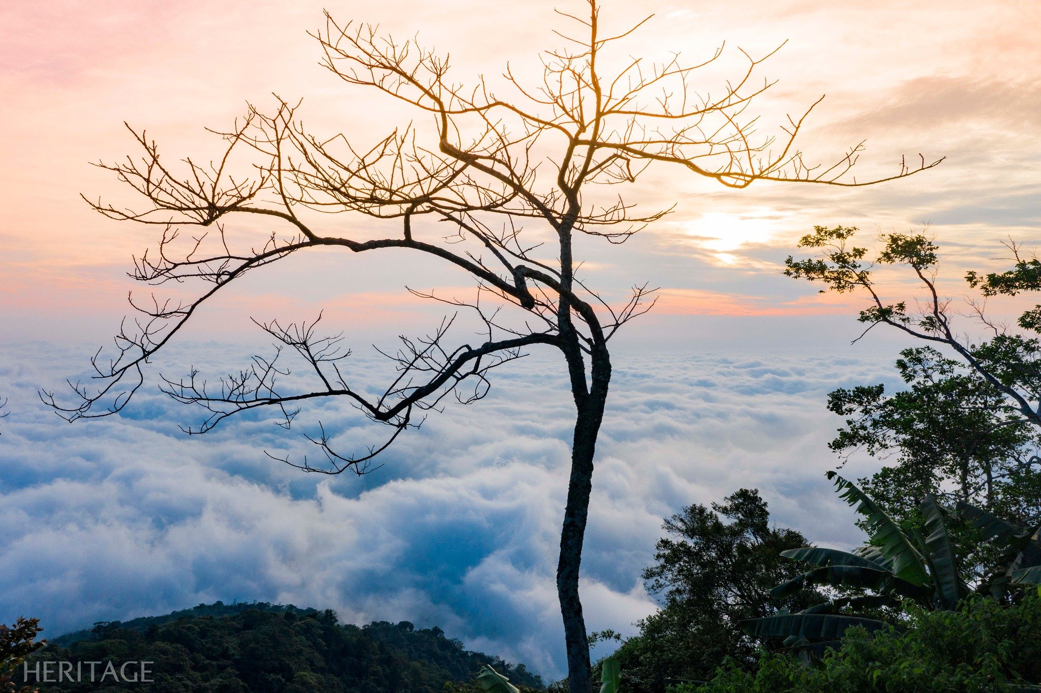
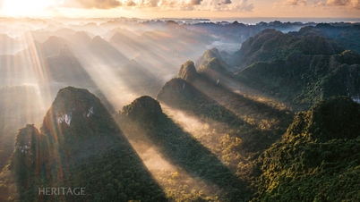
The route has many steep sections with high mountains and deep ravines that sometimes make you feel weary and tired, but eventually, the summit of Pú Đao appears. The air at the mountaintop is fresh and clean, making all fatigue disappear. Sparkling rays of sunlight shine straight down onto the meandering river below.
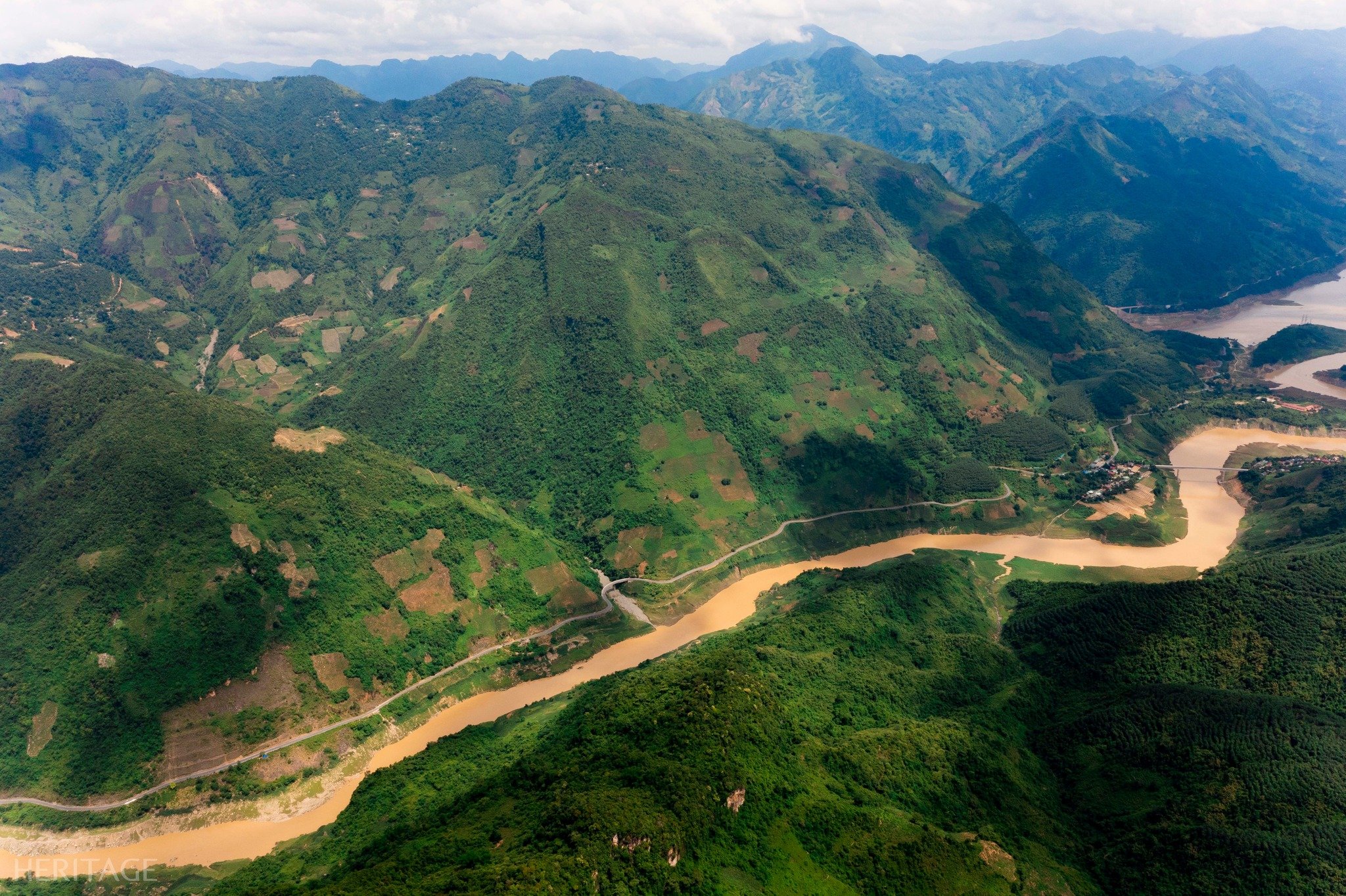
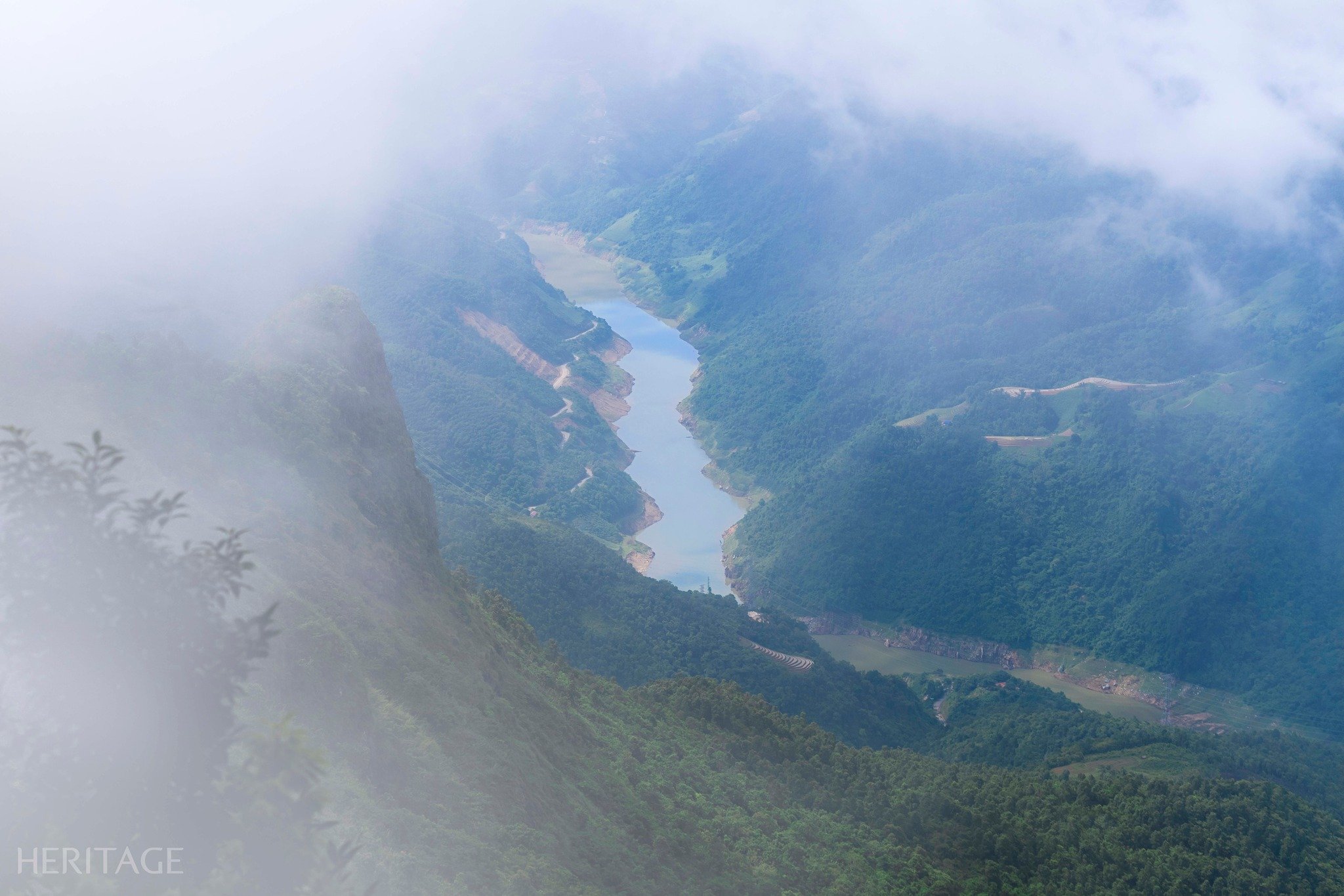
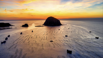
Looking east, one can see the Da River flowing tirelessly from the Northwest. At the confluence of the rivers, it becomes even more abundant as it receives additional water from the tributary of the Nam Na River. As the Da River flows through two mountain ranges, it forms a V-shaped intersection, and for a few days each year, the sun rises directly in the middle of this V – a sight only the luckiest have the chance to witness. The people of Lai Ha, Hang Tom, Doi Cao, Muong Lay, Le Loi, and other areas consider the river a close friend, as it has been with them since infancy and has nourished them with its abundant, cool water.
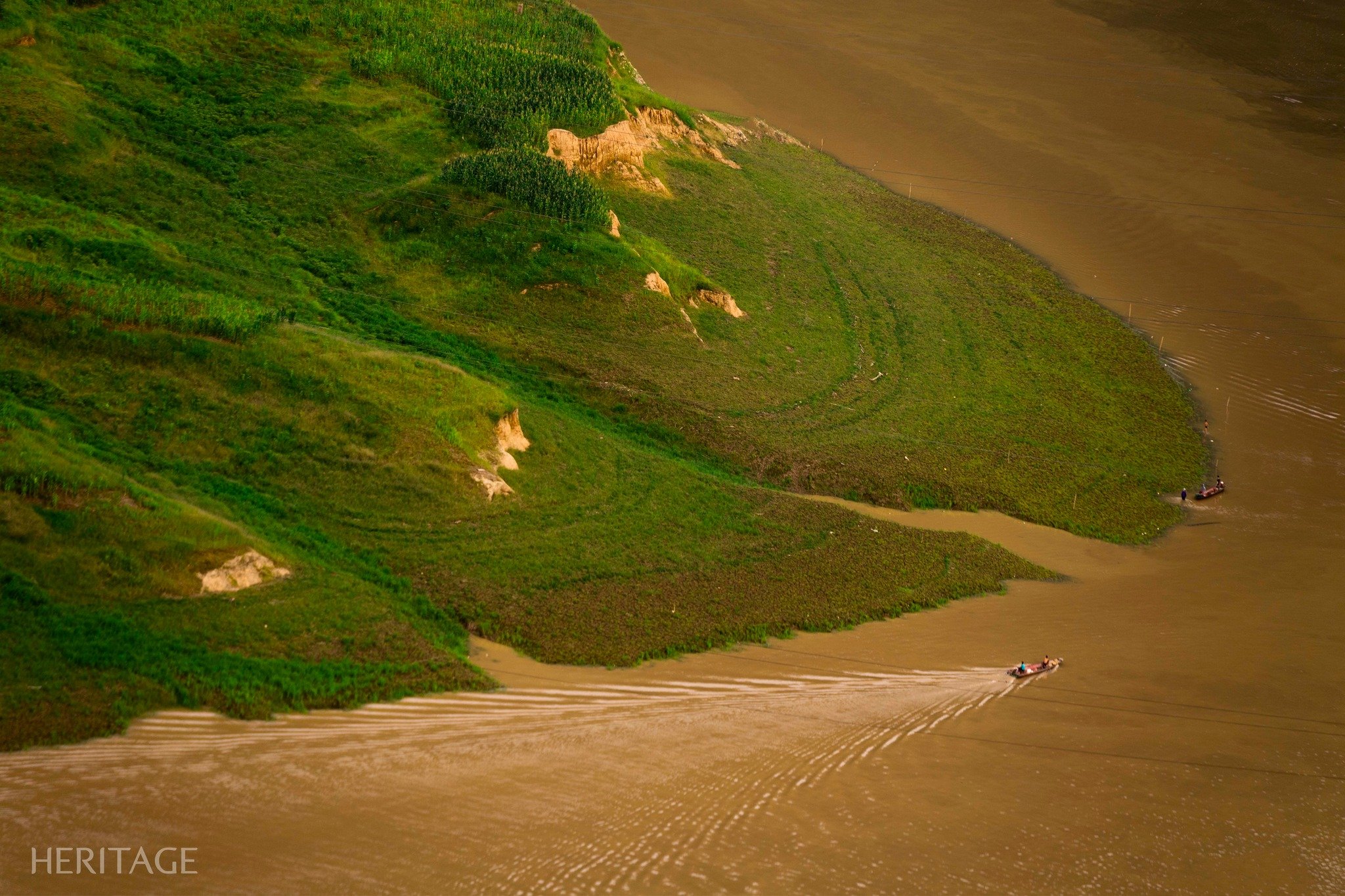
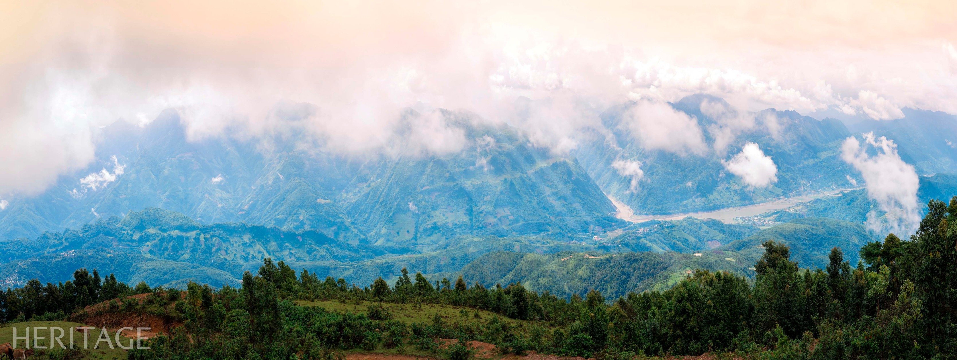
On the river, boats glide through the shimmering morning light, then lie peacefully, their reflections shimmering in the twilight. To the west, the Nam Na River flows gently, winding its way through the fertile fields of Chan Nua commune, Sin Ho district. Nearby are the peak of Pu Huoi Cho and the Le Loi stone stele, standing peacefully through countless seasons of rain and sunshine. Interestingly, at the end of the journey, visitors will head north through the forest to Nam Hang commune (bordering Le Loi and Pu Dao communes) instead of returning to the starting point.
Heritage Magazine
![[Photo] Explore the US Navy's USS Robert Smalls warship](/_next/image?url=https%3A%2F%2Fvphoto.vietnam.vn%2Fthumb%2F1200x675%2Fvietnam%2Fresource%2FIMAGE%2F2025%2F12%2F10%2F1765341533272_11212121-8303-jpg.webp&w=3840&q=75)


![[Photo] The captivating scenery of the fragrant maple forest in Quang Tri](/_next/image?url=https%3A%2F%2Fvphoto.vietnam.vn%2Fthumb%2F1200x675%2Fvietnam%2Fresource%2FIMAGE%2F2025%2F12%2F10%2F1765353233198_lan09046-jpg.webp&w=3840&q=75)


![[Photo] Explore the US Navy's USS Robert Smalls warship](https://vphoto.vietnam.vn/thumb/402x226/vietnam/resource/IMAGE/2025/12/10/1765341533272_11212121-8303-jpg.webp)


![[Video] The craft of making Dong Ho folk paintings has been inscribed by UNESCO on the List of Crafts in Need of Urgent Safeguarding.](https://vphoto.vietnam.vn/thumb/402x226/vietnam/resource/IMAGE/2025/12/10/1765350246533_tranh-dong-ho-734-jpg.webp)


Comment (0)