
(DN) - On the afternoon of July 30, according to the provincial Hydrometeorological Station, the water level at Ta Lai station ( Dong Nai river) continued to rise, with the possibility of reaching the flood peak at 113-113.2m from the evening of July 30 to the afternoon of July 31; 0.4-0.5m higher than the alarm level 3 (113m); about 0.8-0.9m lower than the water level of the historic flood (114.31m, observed on August 22, 1987).
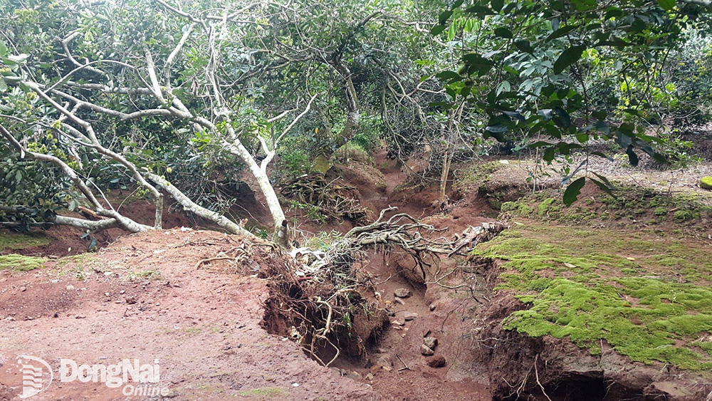 |
| An orchard in Hung Loc commune, Thong Nhat district was damaged by floods. Illustrative photo: B.Nguyen |
The water level at Phu Hiep Station (La Nga River) will continue to rise in the next 24 hours, likely reaching approximately alert level 2 (105.5m); 2.31m lower than the water level of the historic flood (107.81m, observed on August 1, 1999).
The provincial Hydrometeorological Station warns of the risk of flooding and the possibility of other natural disasters in low-lying areas along the Dong Nai River in the communes of Dac Lua, Nam Cat Tien, Nui Tuong, Ta Lai, Phu Thinh (Tan Phu District) and the communes of Thanh Son, Phu Vinh, Phu Tan, Ngoc Dinh (Dinh Quan District); low-lying areas along the La Nga River in communes of 2 districts: Tan Phu, Dinh Quan; 2 districts: Tanh Linh and Duc Linh ( Binh Thuan Province) are at risk of flooding due to floods.
People need to be on guard against the possibility of heavy rain combined with floods causing inundation and landslides on river banks, streams, and low-lying areas.
Regarding the level of natural disaster risk due to floods on Dong Nai River: level 2; La Nga River: level 1.5. The impact of floods on rivers and streams rising rapidly can cause flooding in low-lying areas along rivers and streams, affecting water transport activities, aquaculture, agricultural production in rivers, streams, river banks, and stream banks.
Kim Lieu
.
Source link


![[Photo] National Assembly Chairman Tran Thanh Man visits Vietnamese Heroic Mother Ta Thi Tran](https://vphoto.vietnam.vn/thumb/1200x675/vietnam/resource/IMAGE/2025/7/20/765c0bd057dd44ad83ab89fe0255b783)


Comment (0)