
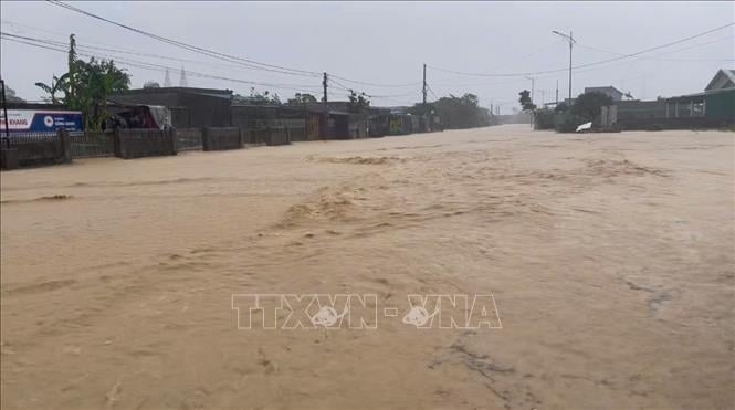
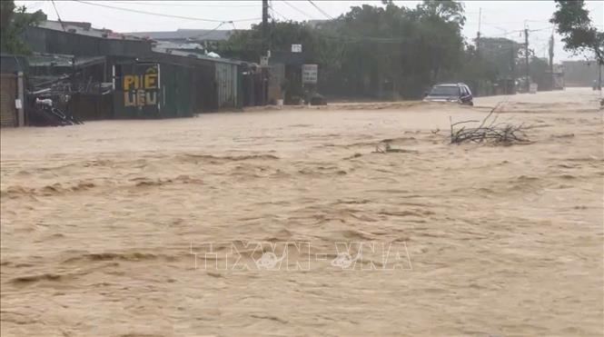
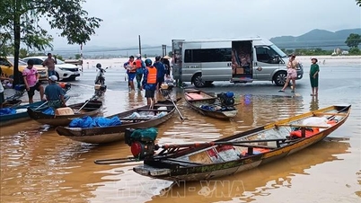
In Vung Ang ward, the road connecting National Highway 12C to Truong Lai area (residential groups: Truong Yen, Truong Phu, Canh Truong) and Tay Yen area is flooded; the flood level is nearly 1 meter.
At Km584+500 National Highway 1A in Thang Loi Residential Group, Hoanh Son Ward, there was flooding. At Km590+0 National Highway 1A in Quy Hue Residential Group, Hoanh Son Ward, there was a landslide. To ensure the safety of people and vehicles passing through the above area, the police force put up warning signs. Local authorities also mobilized people to evacuate to a safe place.
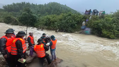
In Cam Due commune, heavy rains have also caused local flooding in 4 villages in the area. Local authorities are mobilizing police and military forces to support people in evacuating their property and livestock from flooded areas.
Faced with heavy rains, water flowing into irrigation and hydroelectric reservoirs in Ha Tinh increased rapidly, the operation management unit increased the flow rate regulated through the spillway. According to information from the Ha Tinh Irrigation Sub-Department, at 1 p.m. on October 30, the water level of Ke Go reservoir was 30.56/32.5 m, capacity 289/345 million m3; Song Rac reservoir was 23.98/23.2 m, capacity 124.5/124.5 million m3; Ngan Truoi reservoir was 44.16/52 m, capacity 481.16/775.7 million m3. The capacity of medium and small reservoirs reached 90 - 100% of the design capacity.
Currently, the discharge flow of the lakes is: Ke Go lake 90m3/second; Song Rac lake 353m3/second; Kim Son lake 30m3/second; Thuong Song Tri lake 60m3/second; Da Han lake 12m3/second; Boc Nguyen lake 5m3/second.
Ho Ho Hydropower Plant is regulating water through the spillway at a flow rate of 148 m3/s.
Source: https://baotintuc.vn/xa-hoi/ha-tinh-mua-lon-gay-ngap-lut-cuc-bo-o-mot-so-dia-phuong-20251030165511398.htm


![[Photo] Prime Minister Pham Minh Chinh attends the 5th National Press Awards Ceremony on preventing and combating corruption, waste and negativity](https://vphoto.vietnam.vn/thumb/1200x675/vietnam/resource/IMAGE/2025/10/31/1761881588160_dsc-8359-jpg.webp)
![[Photo] Da Nang: Water gradually recedes, local authorities take advantage of the cleanup](https://vphoto.vietnam.vn/thumb/1200x675/vietnam/resource/IMAGE/2025/10/31/1761897188943_ndo_tr_2-jpg.webp)


Comment (0)