
Finally, I had the opportunity to take a trip along the entire water supply canal from Song Luy Lake in Bac Binh District to the final destination, Da Bac Lake in Vinh Hao Commune, Tuy Phong District.
This is a large-scale inter-reservoir project to regulate and supplement water resources from Lam Dong province to the arid areas in the north of Binh Thuan province. This project connects large and small reservoirs in Tuy Phong and Bac Binh districts, creating an irrigation network covering the key economic zones of the two districts.
Since I learned that the project to supply water to Long Song and Da Bac lakes in Tuy Phong was underway, I have always felt very excited. As someone who has worked in the irrigation industry in Tuy Phong for decades, I understand one basic thing: if there is no additional source from the outside, water shortages in Tuy Phong will occur in the very near future. As people and the economy increase in an arithmetical progression, the demand for water and energy increases in a geometric progression. Life is inherently like that, it cannot be otherwise.
Therefore, I always hope that this project will be completed soon so that I can see its shape, so that I can see the drops of water from the far away Lam Dong mountains and forests being transported by irrigation works, passing hundreds of kilometers to this driest land in Vietnam.
We started our journey in the opposite direction, from Da Bac Lake at the end, upstream to the starting point of the project, Song Luy Lake. The project stretches and connects 4 reservoirs located in the north of Binh Thuan . Of which, Da Bac Lake is the smallest with a design capacity of 8.42 million m3. The remaining three lakes are Long Song Lake 34.15 million m3, Ca Giay Lake 37.24 million m3 and Song Luy Lake is the largest with a capacity of 99.90 million m3.
The project has been carried out for many years in phases. Only for the project in the current phase, the scale of the project is the largest. The length of the water channel starting from Ta Bu dam to the end point adjacent to the main Cay Ca canal is more than 42 km with countless works built along the canal. If the total length of the project from Song Luy lake to the end point at Da Bac lake is calculated, the total length of the canal is up to 75 km. This project not only has the task of bringing water to Tuy Phong but also has an equally important role of solving the water source for the high areas of Bac Binh district.
The project is designed in the form of an open canal, meaning that it only relies on the natural terrain to lead water from high places to lower places. From Ta Pu dam, the canal runs along the high ground of Bac Binh district. To maintain the elevation, the canal must follow the foot of the mountain, in many sections, it climbs up, lying precariously halfway up the mountain, rising above the flat land below by dozens of meters in height.
Starting from Phan Dien - Phan Son area, the canal almost hugs the mountainside of Uy Thay - Da Gia area of Bac Binh district then runs to Hon Mong - Kenh Kenh range of Tuy Phong district before joining the main Cay Ca canal. It is hoped that in addition to the water received from Song Luy lake, the canal will also be supplemented with rainwater from the mountainside, where the canal runs through. With a length of more than forty kilometers, this canal is no different from a small river. The rainwater along the canal will be a quite important source of additional water supply for the project. That is also a way to make the most of all the available possibilities in dry places like here.
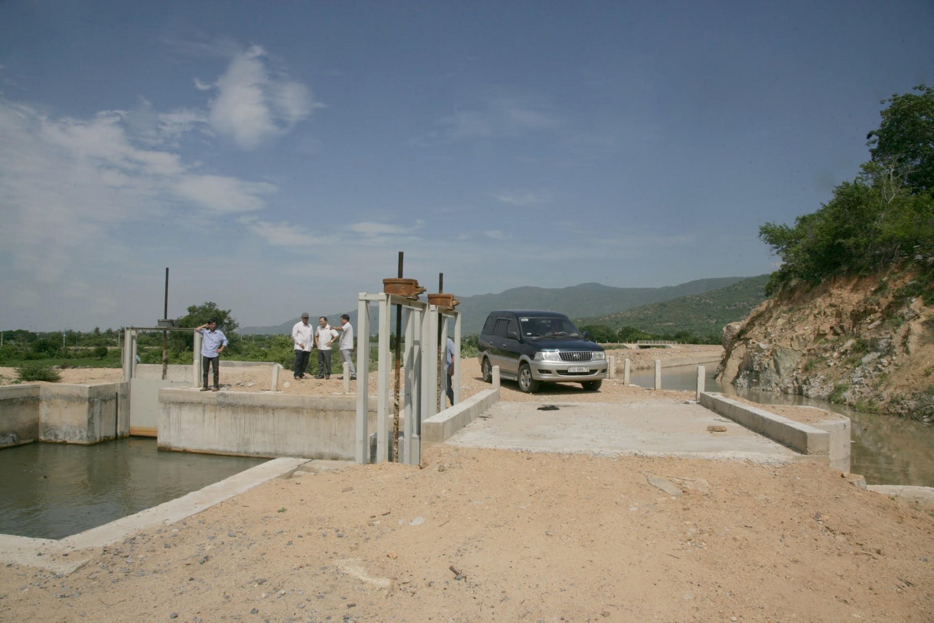
If there is a large canal, there must be a traffic route. In the past, along the main irrigation canals, there were often roads that people in the industry often called management roads. They were formed from the expansion of the canal banks to help project managers have a way to inspect, manage, maintain and repair the project. They were designed mainly for those working in irrigation. Therefore, these roads often had a small road surface due to limited funding.
Therefore, when I started my journey by car from Da Bac Lake to Ta Pu Dam, a distance of more than 60 kilometers along the canal, I felt a little worried but did not dare to say it. Usually, when the canal is completed, the road has just been completed. And that is an earthen road. Who knows what will happen on an earthen road that is dozens of kilometers long through the forest like that. On top of that, the road also has to cross many streams along its way. I was afraid that I would not be able to go all the way along the canal if at some place, the road had an accident or the construction work was still unfinished.
Fortunately, everything went smoothly. The entire road is almost complete. Except for a few places where the slopes are a bit steep and difficult to travel, the road surface is almost flat because it follows the small slope of the canal. Director of Tuy Phong Irrigation Branch Nguyen Duy Linh, who also went with us, said that this road was designed according to the standards of inter-district roads. The road surface is quite wide, two cars can pass each other comfortably. From now on, if the highland people of Bac Binh and Tuy Phong districts want to meet each other, they do not need to go around National Highway 1 like before. They now have their own route. In the future, asphalting or concrete the road is only a matter of time.
According to the information I have, the project is entering the testing phase and is completing the final work before going into operation. Now the next step is to prepare for the organization and management of the project.
Along the entire length of more than 60 kilometers, the canal is almost completely isolated from residential areas. Far from the electricity grid and clean water system, those who manage the canal in the future will have to face a lack of amenities in their daily life as well as in their work. The project is spread across the administrative areas of two districts, so there needs to be unified management and operation to avoid possible localization. It is hoped that the responsible authorities will soon complete the model of the management apparatus as well as build and arrange the necessary facilities to serve the management and operation of this project.
I am not unfamiliar with the story of the poor living conditions of those working in the management of irrigation works. Up to now, people in the industry have had to live and work in remote, deserted mountainous areas, isolated from residential areas. They often have to live far from their families, making friends with mountains, rivers and streams. Nowadays, although their living facilities have become more spacious and their amenities are relatively guaranteed, mentally they still have to suffer disadvantages compared to other professions. During heavy rains and strong winds, when storms come, while everyone is looking for shelter in their homes, they have to rush out, regardless of the dark night, regardless of all dangers to ensure the safety of the people and the works. In the near future, they will have to take on the management of this inter-district canal. With its length, it is necessary to have management stations arranged along the route to make their work less difficult.
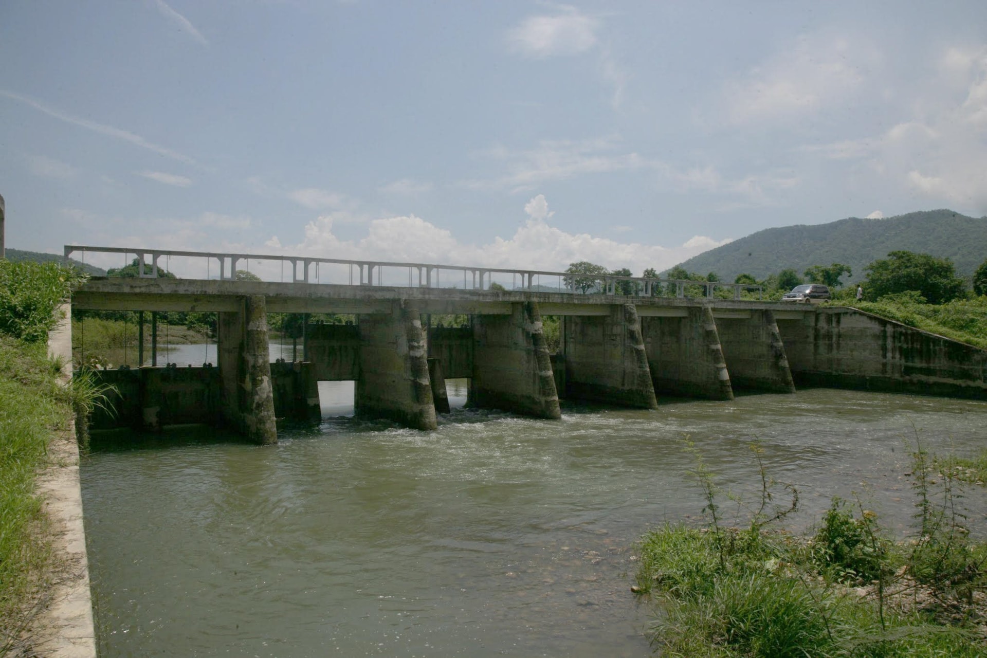
From Da Bac Lake, we stopped at the junction of the project with the main Cay Ca canal of Long Song Lake, then headed straight towards Bac Binh. The car kept running like that for almost the entire morning. At each important construction site, we got off the car to visit and take photos. When our group arrived at Ca Giay Lake, the clock was almost 12 o'clock. Standing on the dam, I silently looked at the rippling surface of the lake and felt that time passed so quickly. I still remember that time clearly. November 20, 2000 was the inauguration day of Ca Giay Lake project in Bac Binh district, and the very next day, November 21, 2000, was also the groundbreaking ceremony of Long Song Lake in Tuy Phong district. Twenty-four years have passed. Time has left its mark on the stele recording the technical parameters of Ca Giay Lake. No matter how hard I tried, I could not read the lines of words and numbers that had faded because of wind, rain, and years.
Crossing Ca Giay Dam, we arrived at Song Luy Lake when the sun was past noon. The Management Station staff welcomed us very warmly. Through discussions with Mr. Le Minh Hung, Head of the Management Station of both Song Luy and Ca Giay Lakes, I learned that the water released from Dai Ninh Hydropower Plant is sometimes very irregular, depending on the specific needs of the electricity industry. Well, we have to accept it! In any case, Binh Thuan has prepared plans to regulate this precious water source to serve the lives of the people in its area.
The car left Song Luy Lake when the sun was setting. Looking back through the car window, the small figures of the brothers and sisters directly managing the project gradually faded into the vast, deserted landscape of the mountains and forests in the late afternoon. People may come and go, but they are still there every day, every hour, to look after and operate the project.
In my mind appeared the image of a map marking the locations of the lakes in blue and the intricate canal system in red. I suddenly thought of the entire system as the circulatory system of a living body. The lakes were like hearts and the intricate canal system was like blood vessels. Every hour and every minute, from those places, water was continuously circulating, like blood to nourish human life.
Song Luy Lake, dry season 2024.
NP
Source: https://baobinhthuan.com.vn/lan-theo-mach-song-123652.html

![[Photo] Prime Minister Pham Minh Chinh receives a bipartisan delegation of US House of Representatives](https://vphoto.vietnam.vn/thumb/1200x675/vietnam/resource/IMAGE/2025/5/28/468e61546b664d3f98dc75f6a3c2c880)
![[Photo] Vietnamese and Hungarian leaders attend the opening of the exhibition by photographer Bozoky Dezso](https://vphoto.vietnam.vn/thumb/1200x675/vietnam/resource/IMAGE/2025/5/28/b478be84f13042aebc74e077c4756e4b)
![[Photo] General Secretary To Lam works with the Central Policy and Strategy Committee](https://vphoto.vietnam.vn/thumb/1200x675/vietnam/resource/IMAGE/2025/5/28/7b31a656d8a148d4b7e7ca66463a6894)
![[Photo] 12th grade students say goodbye at the closing ceremony, preparing to embark on a new journey](https://vphoto.vietnam.vn/thumb/1200x675/vietnam/resource/IMAGE/2025/5/28/42ac3d300d214e7b8db4a03feeed3f6a)


Comment (0)