
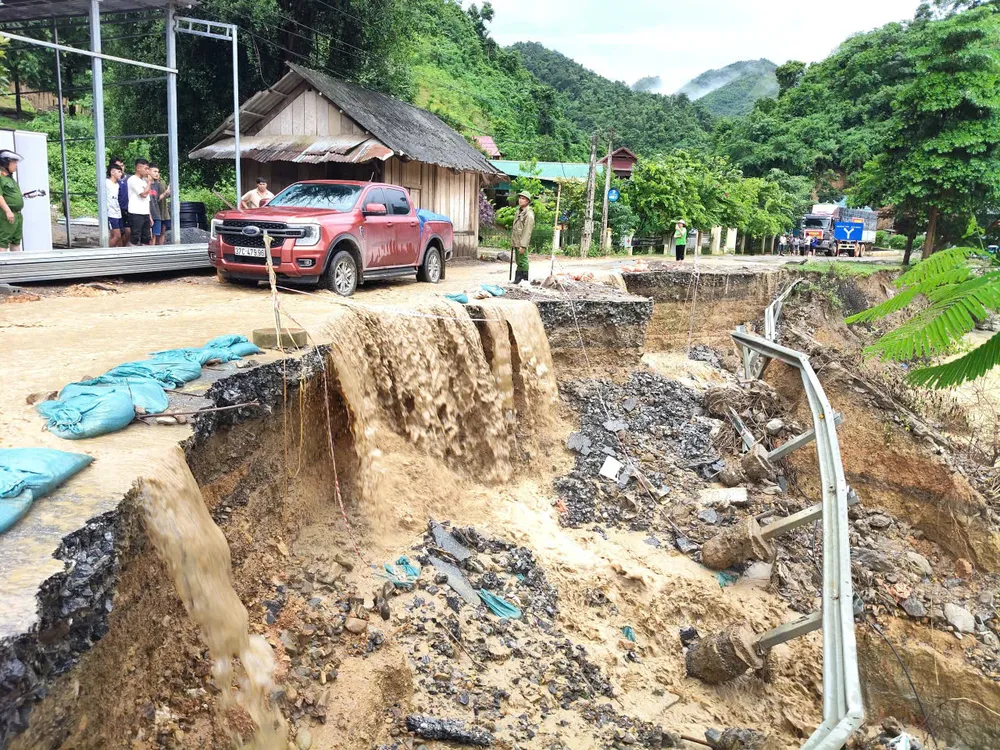
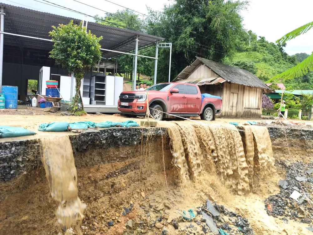
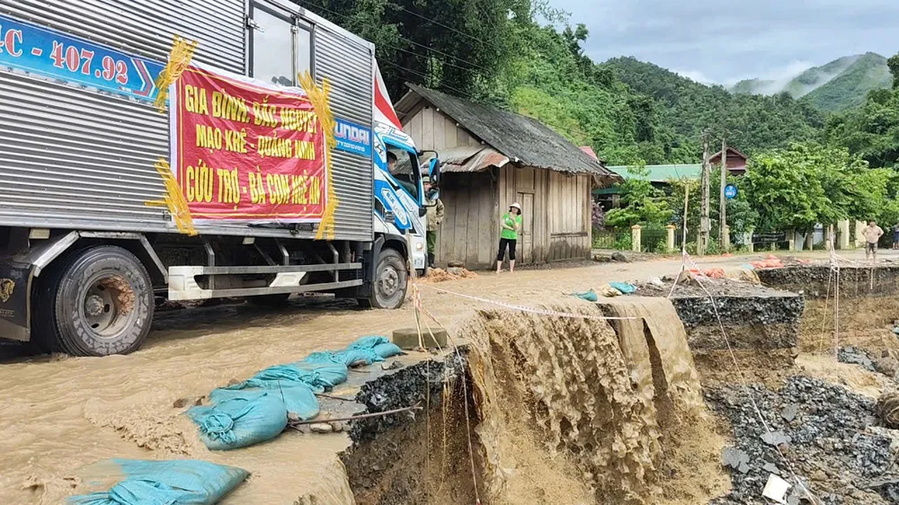
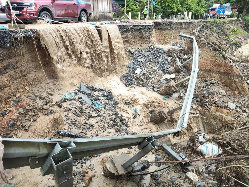
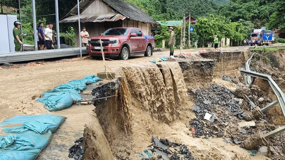
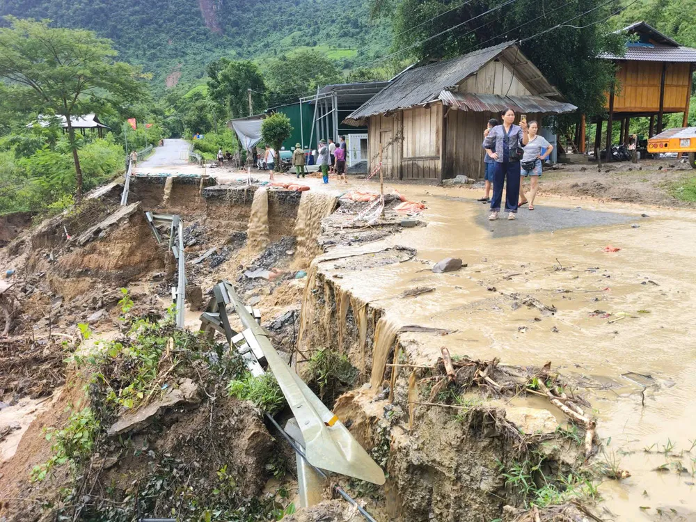
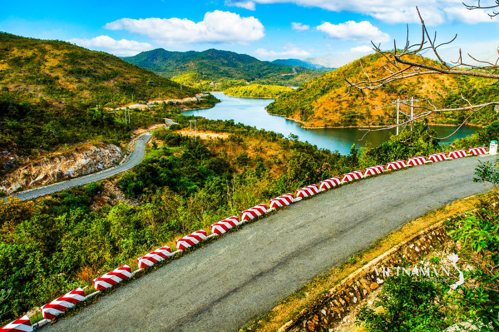
According to the actual scene, the negative slope at KM 364 on National Highway 16 had a landslide of tens of meters long, eating more than half of the roadway. Many sections had serious gaps, water from the ravine continued to flow across the road, making the landslide more serious, posing a danger to passing vehicles. Relief trucks entering My Ly and Nhon Mai communes - where heavy damage was caused by the floods in late July - encountered many difficulties.
According to local residents, the landslide on National Highway 16 at Huoi Cang 1 village occurred on July 23 due to heavy rain. Water flowing from Huoi Nho stream brought with it rocks and soil, blocking the drainage and overflowing onto the road, causing the landslide to become increasingly serious.
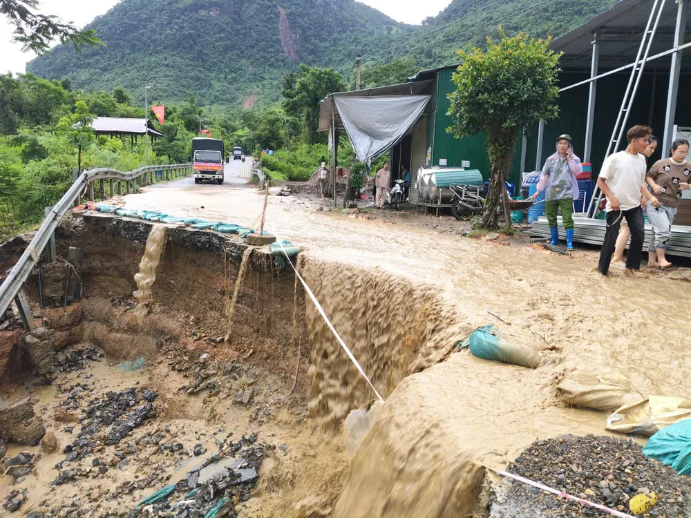
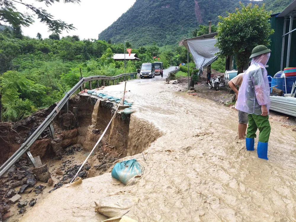
Currently, Bac Ly commune authorities are on duty to regulate traffic, helping people and relief groups to travel safely.
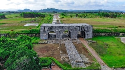
National Highway 16 is a vital security and defense route hundreds of kilometers long through the districts of Que Phong, Tuong Duong and Ky Son of Nghe An province. During the flood at the end of July, many points on National Highway 16 through the communes of Nhon Mai and My Ly were almost completely washed away, hundreds of serious landslides isolated many villages.
>> Images and clips recording the landslide scene on Highway 16:
Source: https://www.sggp.org.vn/nghe-an-quoc-lo-16-tiep-tuc-bi-sat-lo-post806952.html


![[Photo] Nghe An: Provincial Road 543D seriously eroded due to floods](https://vphoto.vietnam.vn/thumb/1200x675/vietnam/resource/IMAGE/2025/8/5/5759d3837c26428799f6d929fa274493)


Comment (0)