
Accordingly, in Ham Thuan commune, from 2 p.m. to 9 p.m. on November 7, there was heavy, prolonged rain. The western area of the commune is a lower mountain basin, so all the rain water flows to the central area when it rains heavily.
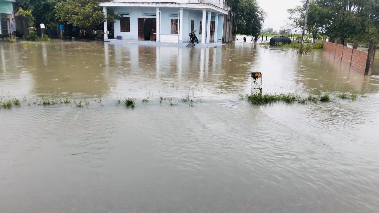
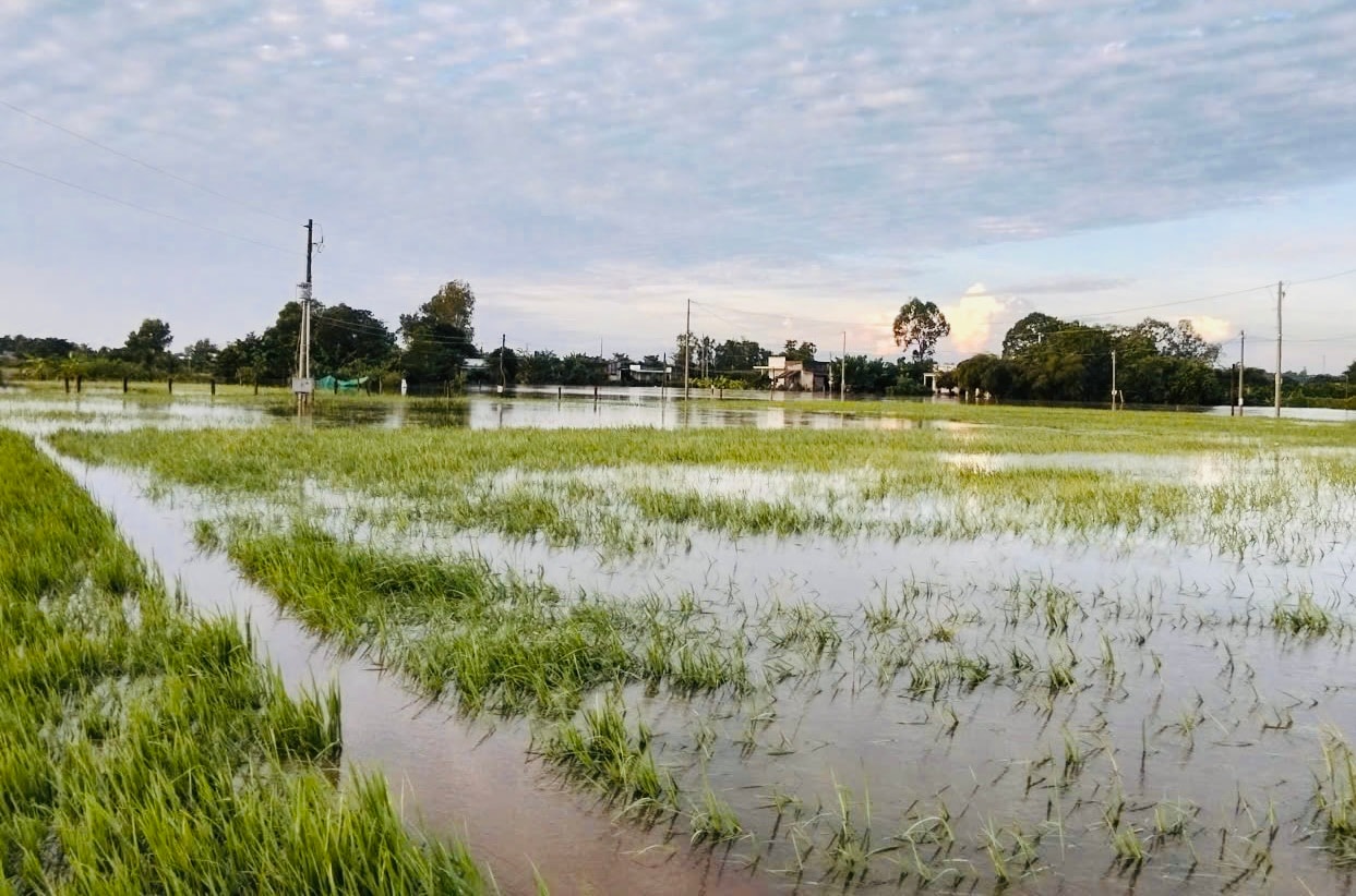
The consequences caused flooding of 518 houses and a cow to float away. Regarding crops, up to now, the flooded area is about 882 hectares, mainly in hamlets 1 and 2 - old Thuan Minh, Doc Lang hamlet, and Ku Ke hamlet. The total estimated damage is about 950 million VND.
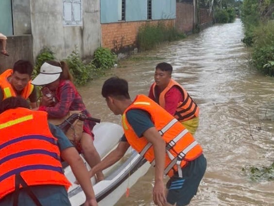
Ham Thuan Commune People's Committee mobilized and organized the evacuation of about 90 households/457 people affected by floods to a safe place.
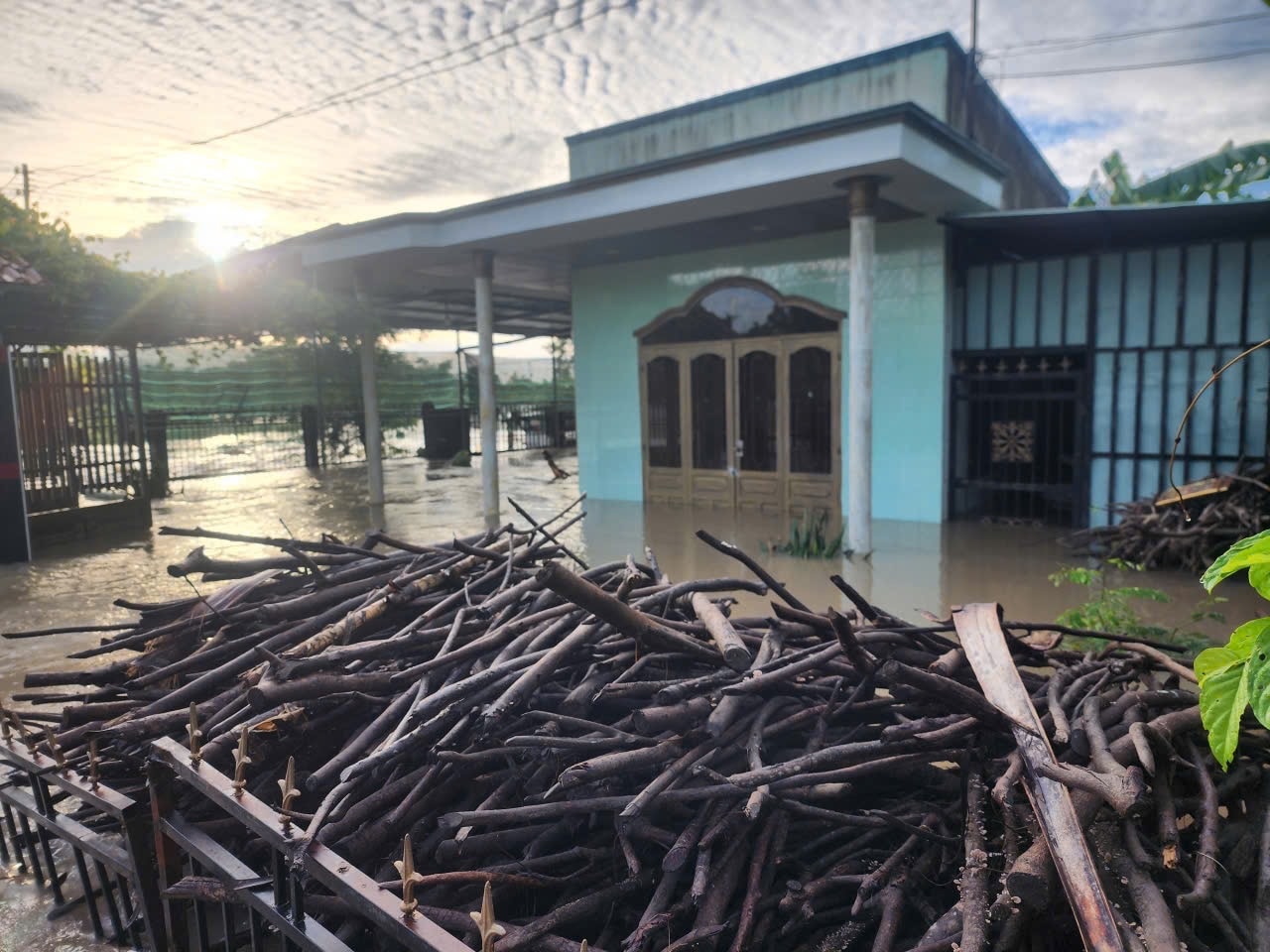
In Luong Son commune, about 170 houses were flooded, in the villages of Luong Bac, Luong Tay, Luong Binh, Tan Son... mostly with light flooding. In Ham Thuan Bac commune, water from the upper reaches of Thang river and Ngang stream is coming in, 5 households in Phu Lap village are slightly flooded.
Ham Thanh commune, in Lo To village, some households along the river were flooded about 0.5 - 0.7m deep, the road to My Thanh village at Bom Bi spillway had river water overflowing onto the road; Ham Kiem commune had Lo Ngoi bridge flooded about 1.3m deep; Binh Thuan ward had some areas slightly flooded.
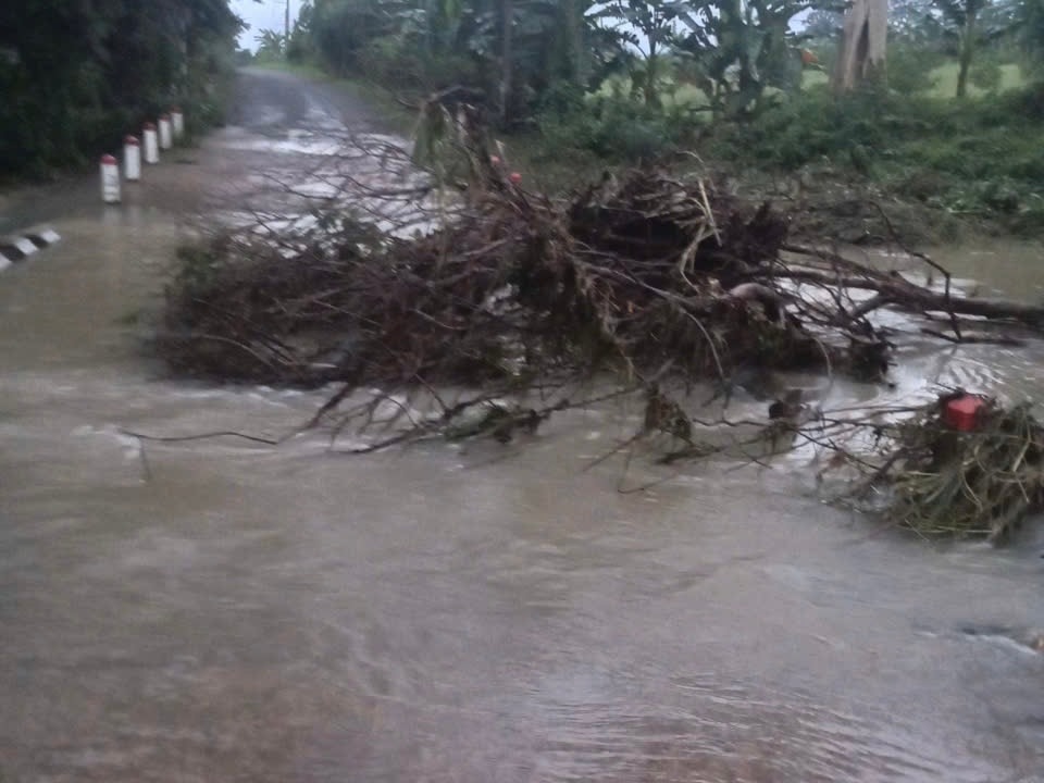
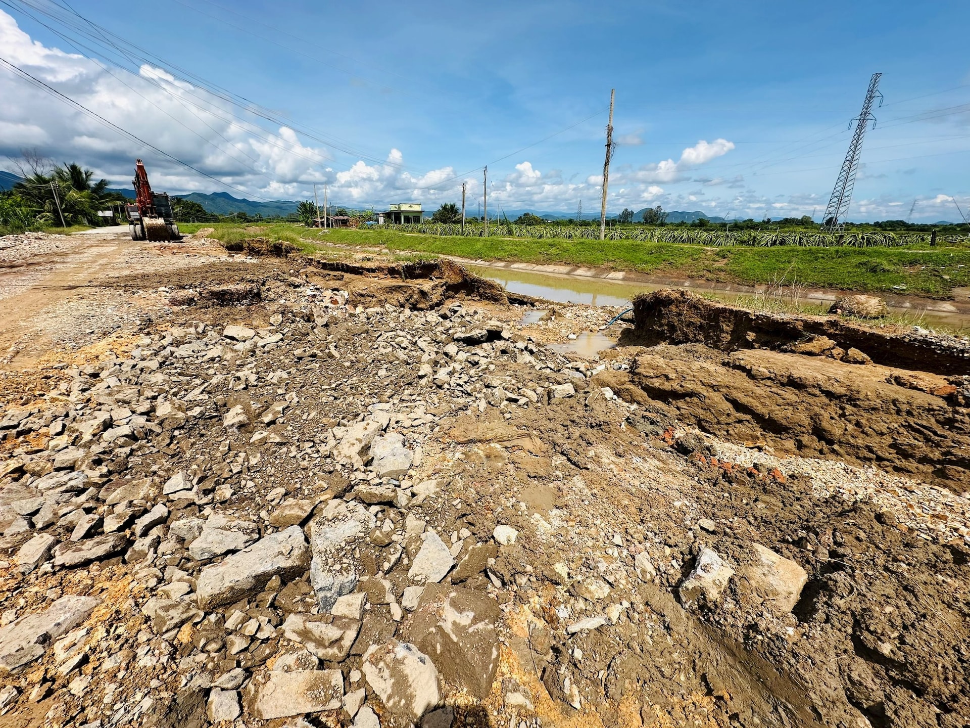
The floods since November 7 have also caused 35 landslides in Luong Son commune (1 point) and Dam Rong commune (4 points) with 34 points, and some inter-village roads have been flooded. In particular, the incident at Cay An reservoir is being urgently resolved. Localities are continuing to count and assess the damage.
Currently, the People's Committees of wards and communes in the province have coordinated with agencies, units and forces to be ready to support people and property when situations arise. At the same time, continue to organize inspections of flood situations in localities, direct the recovery, visit and give gifts to support people facing difficulties in affected and damaged areas. On the other hand, prepare supplies, means and medical equipment to promptly respond when situations arise. Deploy shock forces to inspect and review residential areas along rivers, streams, low-lying areas, at risk of flooding and landslides to deploy response measures and minimize damage.
On the other hand, there are plans to evacuate households from flooded and landslide areas. Put up warning signs and divert traffic at flooded and landslide points on roads. Temporarily ban people and vehicles from traveling through locations where dangerous landslides have been identified...
Previously, due to the impact of storm No. 13, there was rain in many places in the province, the amount of rain measured in communes and wards from November 6 to November 7: Ku Ke 152.6mm; Buon Choah 114.2mm; Quang Thanh 108.0mm; Duc Xuyen 100.2mm, Quang Hoa 95.8mm, Dan Hiep 94.0mm, Nam Dong 89.0mm, Tan Lap 87.4mm.... It is forecasted that from November 8 to November 9, Lam Dong province will continue to have scattered rain, some places will have moderate rain, some places will have heavy rain.
Source: https://baolamdong.vn/nhieu-xa-phuong-o-lam-dong-thiet-hai-do-mua-lu-401359.html


![[Video] Hue Monuments reopen to welcome visitors](https://vphoto.vietnam.vn/thumb/402x226/vietnam/resource/IMAGE/2025/11/05/1762301089171_dung01-05-43-09still013-jpg.webp)


![Dong Nai OCOP transition: [Part 2] Opening new distribution channel](https://vphoto.vietnam.vn/thumb/402x226/vietnam/resource/IMAGE/2025/11/09/1762655780766_4613-anh-1_20240803100041-nongnghiep-154608.jpeg)


Comment (0)