
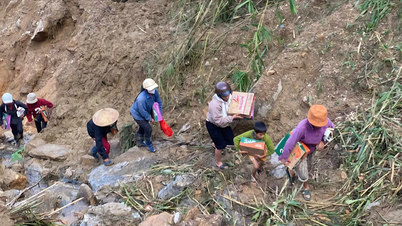
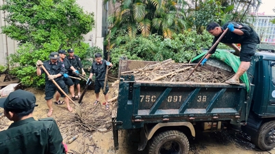
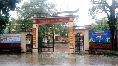
Quang Tri province has urgently directed the evacuation of all 53 households and 1 primary school with a total of 173 children in Dong Lam village (Tuyen Phu commune) to a safe place when there is rain and flood. At the same time, ensure food, food, and necessary necessities for people at the evacuation point; continue to closely monitor the weather, rain, flood, and landslide developments; prepare forces and means to organize response in case of landslide incidents.
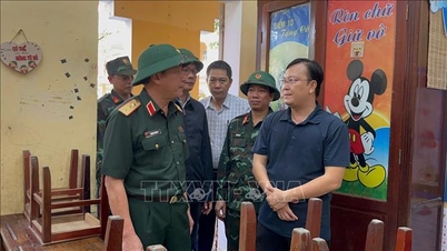
The province directed Tuyen Phu commune to focus on ensuring the safety of people's lives, identifying this as the top priority task at present; strengthen propaganda and mobilize people in dangerous areas to regularly monitor the flood situation, proactively prevent and be ready to move to a safe place when there is a warning of landslides or prolonged heavy rain.
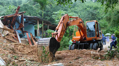
In addition, Tuyen Phu commune closely monitors weather developments, floods and landslides in the Phong Khong hill area and the resettlement area of Dam Thuy village (Tuyen Phu commune); promptly reports and proposes measures to handle any unusual signs; proactively develops and implements plans to relocate and evacuate people when bad situations occur. At the same time, organizes the installation of danger warning signs, delimits landslide areas and landslide risks; arranges permanent forces at the scene, guides people and vehicles to ensure absolute safety. Tuyen Phu commune proactively coordinates with police, military , militia and related units in the work of on-duty, on-duty, and rescue when necessary.
The Department of Agriculture and Environment urgently contacts the Institute of Geological Sciences and Mineral Resources ( Ministry of Agriculture and Environment ) or specialized geological agencies for professional guidance and proposes appropriate solutions to overcome the landslide situation in the Phong Khong hill area, Dong Lam village and the resettlement area of Dam Thuy village, Tuyen Phu commune. Complete before November 15, 2025.
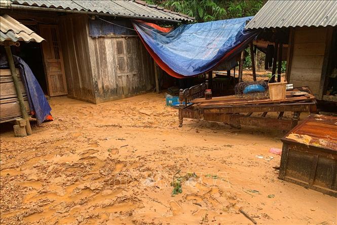
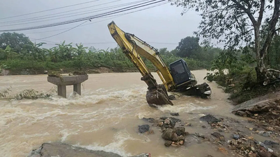
The Phong Khong hill area (Dong Lam village, Tuyen Phu commune) has a high, steep hilly terrain, with a potential risk of serious landslides. The hill is about 171m high, the landslide point is 78m from the residential area, the affected area is about 2.5 hectares. The entire area has 60 residential plots, a total of 53 households and 1 school in the affected area; of which, 13 households are in the very high risk area. The landslide phenomenon is complicated, directly threatening the safety of residential areas, schools and traffic infrastructure, and needs to be monitored, warned and handled urgently to ensure the safety of people's lives and property.
In the Dam Thuy village resettlement area (Tuyen Phu commune), investment has been made to build a place to accommodate displaced households in the landslide area caused by the storm and flood in 2020. The project was carried out under an emergency order. Up to now, the construction site has been completed and land has been allocated to people to basically complete the construction of houses, gradually stabilizing their lives and long-term living, avoiding the risk of damage to people and property. However, during the construction site implementation process, due to the complex mountainous terrain, the project still has the potential risk of landslides on the slope when the rainy season comes.
Specifically, according to the actual status at the site, the slope roof of the excavated ground has a height of 14m, the roof slope coefficient is 1:1, divided into 2 parts: the upper roof is 6m high; the lower roof is 8m high, with the steep and large excavated roof height, there is a high risk of roof erosion during heavy rain, not ensuring safety for the residential area.
Source: https://baotintuc.vn/thoi-su/quang-tri-cong-bo-tinh-huong-khan-cap-ve-thien-tai-doi-voi-hien-tuong-sat-lo-20251030183114199.htm
![[Photo] General Secretary To Lam attends the Vietnam-UK High-Level Economic Conference](https://vphoto.vietnam.vn/thumb/1200x675/vietnam/resource/IMAGE/2025/10/30/1761825773922_anh-1-3371-jpg.webp)


![[Photo] Prime Minister Pham Minh Chinh attends the 5th National Press Awards Ceremony on preventing and combating corruption, waste and negativity](https://vphoto.vietnam.vn/thumb/1200x675/vietnam/resource/IMAGE/2025/10/31/1761881588160_dsc-8359-jpg.webp)

![[Photo] The Third Patriotic Emulation Congress of the Central Internal Affairs Commission](https://vphoto.vietnam.vn/thumb/1200x675/vietnam/resource/IMAGE/2025/10/30/1761831176178_dh-thi-dua-yeu-nuoc-5076-2710-jpg.webp)


Comment (0)