
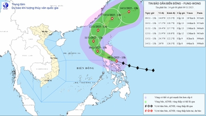
The National Center for Hydro-Meteorological Forecasting said that at 1 p.m. on November 9, storm Fung - Wong (Vietnamese name is Phuong Hoang) had strengthened to level 15-16 (167-201 km/h), gusting to level 17 (super typhoon level) in the sea east of Luzon Island (Philippines).
The storm is moving west-northwest at about 25km per hour. It is forecasted that tomorrow morning, storm Phuong Hoang will enter the East Sea and become storm number 14.
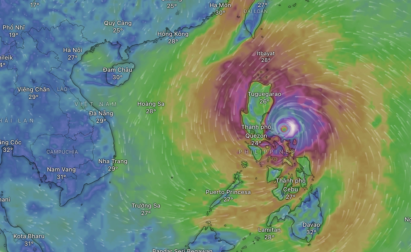
Storm Phoenix has strengthened into a super typhoon (Photo: Windy).
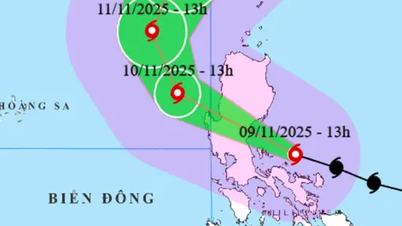
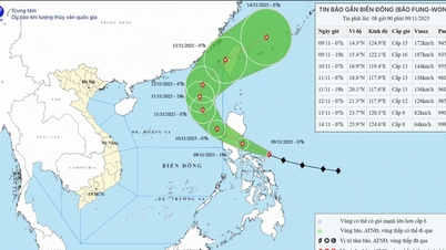
According to the hydrometeorological agency, at around 1 p.m. on November 10, the storm weakened to level 13, gusting to level 16 in the eastern sea area of the North East Sea.
At 1:00 p.m. on November 11, the storm changed direction to the Northwest and maintained its intensity at level 13, gusting to level 16 in the eastern sea area of the North East Sea.
It is forecasted that at around 1:00 p.m. on November 12, the storm will continue to change direction to the North-Northeast, moving slowly at about 10-15 km/h in the northeastern sea area of the North East Sea. At this time, the storm will weaken to level 12, gusting to level 15.
The meteorological agency said that in the next 72 to 120 hours, the storm will move northeast, traveling about 15-20km per hour and continue to weaken.
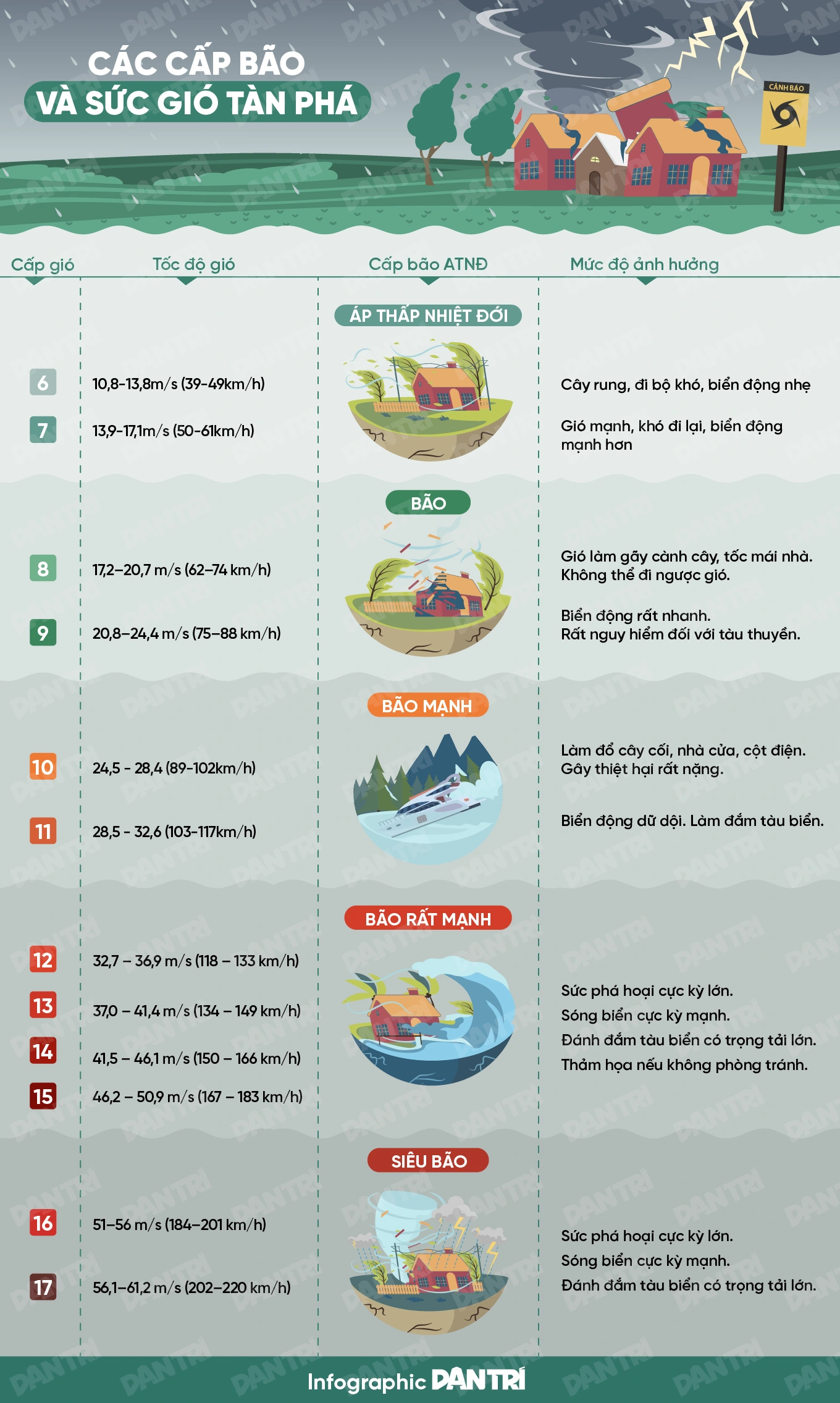
Due to the influence of the storm, the eastern sea area of the North East Sea has strong winds of level 6-7, later increasing to level 8-10, the area near the eye of the storm has strong winds of level 11-13, gusts of level 16, waves 4-6m high, later increasing to 6-8m, the area near the eye of the storm has 8-10m, the sea is very rough.
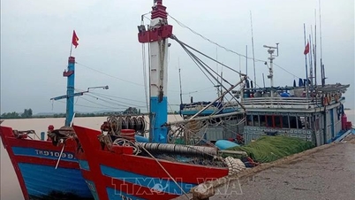
All vessels operating in the above mentioned danger zones are susceptible to the effects of storms, whirlwinds, strong winds and large waves.
Source: https://dantri.com.vn/thoi-su/sieu-bao-phuong-hoang-sap-vao-bien-dong-20251109143356323.htm


![Dong Nai OCOP transition: [Part 2] Opening new distribution channel](https://vphoto.vietnam.vn/thumb/402x226/vietnam/resource/IMAGE/2025/11/09/1762655780766_4613-anh-1_20240803100041-nongnghiep-154608.jpeg)


Comment (0)