
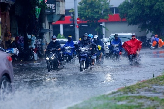
Common rainfall is 50 - 110mm, in some places over 200mm; rainfall intensity is greater than 80mm/3 hours, with high potential risk of flooding and landslides.
In addition, Thanh Hoa, Nghe An , Hue to Quang Ngai, the Central Highlands and the South will have scattered showers and thunderstorms, with rainfall of 15 - 35 mm, in some places over 70 mm; warning of heavy rain intensity over 60 mm/3 hours. During thunderstorms, there is a possibility of tornadoes, lightning, hail and strong gusts of wind.
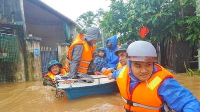
From November 5 to the morning of November 6, heavy rains in Ha Tinh and Quang Tri tend to gradually decrease. However, on November 4-5, rivers in this area are likely to experience new floods, with peak water levels on the Ngan Sau and Ngan Pho rivers (Ha Tinh), Gianh, Kien Giang and Thach Han rivers (Quang Tri) possibly reaching alert levels 2-3, with some places even above alert level 3.
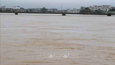
Currently, floods on the Bo River, Huong River (Hue), and Vu Gia - Thu Bon River (Da Nang) are receding; floods downstream of the Ngan Sau River (Ha Tinh) have decreased below alert level 1. On the Kien Giang River (Le Thuy, Quang Binh ), the flood peak recorded at 11 p.m. on November 3 reached 3.47m, exceeding alert level 3 by about 0.77m; the Thach Han River (Quang Tri) reached 5.83m, lower than alert level 3 by about 0.17m.
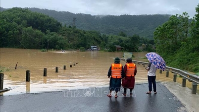
The meteorological agency warns of a high risk of flash floods, landslides on steep slopes, and flooding in low-lying areas, urban areas, and industrial zones from Ha Tinh to Da Nang. The risk of natural disasters due to heavy rain, tornadoes, lightning, and hail is level 1.
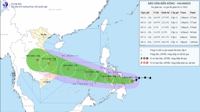
At sea, the tropical convergence zone linked to Typhoon Kalmaegi is active over the central Philippines, causing strong winds and rough seas.
On the day and night of November 4, the North East Sea (including the Hoang Sa sea area) has Northeast wind level 6-7, gusts level 8-9, waves 3-5m high, rough seas. The Gulf of Tonkin has Northeast wind level 6, gusts 7-8, rough seas; the wind gradually decreases at night. The sea area from South Quang Tri to Hue has wind level 5-6, gusts 7-8, waves 2-3m high.
On the afternoon and night of November 4, the sea area east of the central East Sea will have winds gradually increasing to level 8-10, near the storm center level 11-13, gusting to level 15-16, waves 5-7m high, and rough seas.
During the day and night of November 5, the North East Sea (including Hoang Sa sea area) continues to have strong winds of level 6-7, gusts of 8-9, and rough seas; the Central East Sea (including Truong Sa sea area) has strong winds of level 8-10, near the storm center of level 12-14, gusts above level 17, waves 8-10m high, and rough seas.
The meteorological agency recommends that ships operating in the above sea areas should proactively avoid strong winds, large waves and tornadoes during thunderstorms.
Marine disaster risk level: level 2; in the eastern sea area of the central East Sea, level 3.
Weather forecast for some regions as follows:
Hanoi capital is cloudy, with rain in many places during the day; scattered rain at night. Northeast wind level 2-3. Cold. Lowest temperature 17-19 degrees Celsius. Highest temperature 19-21 degrees Celsius.
The Northwestern provinces are cloudy with some rain. Light wind. Cold weather, some places are very cold; especially Dien Bien-Lai Chau. Lowest temperature 17-20 degrees Celsius, some places below 16 degrees Celsius. Highest temperature 19-22 degrees Celsius, especially Lai Chau-Dien Bien, Son La 22-25 degrees Celsius.
The Northeastern region is cloudy, with rain in many places during the day; scattered rain at night. Northeast wind level 2-3, coastal areas level 3-4. Cold weather, some mountainous areas are very cold. Lowest temperature 16-19 degrees Celsius, some mountainous areas below 15 degrees Celsius. Highest temperature 19-22 degrees Celsius.
Provinces from Thanh Hoa to Hue are cloudy with rain, some places have moderate to heavy rain; Ha Tinh and Quang Tri have moderate to heavy rain, some places have very heavy rain. North to northwest wind level 2-3, coastal areas level 3-4. Cold weather, cold in the North. Lowest temperature 18-21 degrees Celsius. Highest temperature in the North 20-23 degrees Celsius, in the South 24-26 degrees Celsius.
The South Central Coast region in the North is cloudy with scattered showers and thunderstorms, some places have heavy rain; the South is cloudy with scattered showers and thunderstorms, in the afternoon and evening there are scattered showers and thunderstorms in some places. In the North, the wind is from the east to northeast at level 2-3, in the South, the wind is from the southwest at level 2-3. During thunderstorms, there is a possibility of tornadoes, lightning and strong gusts of wind. The lowest temperature is 23-26 degrees Celsius. The highest temperature is in the North 26-29 degrees Celsius, in the South 29-32 degrees Celsius.
Source: https://baohaiphong.vn/anh-huong-bao-kalmaegi-nhieu-dia-phuong-co-mua-lon-525532.html
![[Photo] Government holds a special meeting on 8 decrees related to the International Financial Center in Vietnam](https://vphoto.vietnam.vn/thumb/1200x675/vietnam/resource/IMAGE/2025/11/04/1762229370189_dsc-9764-jpg.webp)
![[Photo] Comrade Nguyen Duy Ngoc holds the position of Secretary of the Hanoi Party Committee](https://vphoto.vietnam.vn/thumb/1200x675/vietnam/resource/IMAGE/2025/11/04/1762234472658_a1-bnd-5518-8538-jpg.webp)


![[Photo] Ca Mau "struggling" to cope with the highest tide of the year, forecast to exceed alert level 3](https://vphoto.vietnam.vn/thumb/1200x675/vietnam/resource/IMAGE/2025/11/04/1762235371445_ndo_br_trieu-cuong-2-6486-jpg.webp)
![[Photo] Ho Chi Minh City Youth Take Action for a Cleaner Environment](https://vphoto.vietnam.vn/thumb/1200x675/vietnam/resource/IMAGE/2025/11/04/1762233574890_550816358-1108586934787014-6430522970717297480-n-1-jpg.webp)


Comment (0)