
The strongest wind is level 13-14 (134-166km/h), gusting to level 17. It is forecasted that in the next 3 hours, the storm will move mainly in the West Northwest direction, at a speed of about 30km/h.
Due to the influence of the storm, at Ly Son station (Quang Ngai), there were strong winds of level 8, gusts of level 10; Dung Quat (Quang Ngai) strong winds of level 8, gusts of level 9; Hoa Nhon Dong ( Gia Lai ) strong winds of level 6, gusts of level 9; Phu Cat (Gia Lai) strong winds of level 8, gusts of level 11; Hoi An (Da Nang) strong winds of level 8, gusts of level 10; in the area from Hue city to Khanh Hoa, there was heavy rain in some places over 100mm such as: An Xuan station (Dak Lak) 162mm, Bong Son (Gia Lai) 146mm, Sa Huynh (Quang Ngai) 119mm, ...
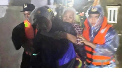
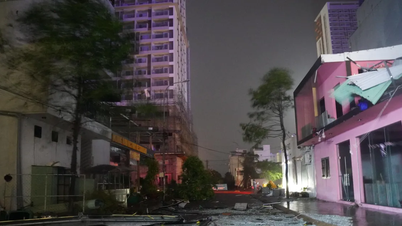
Sharing about this storm, Mr. Nguyen Xuan Hien, Deputy Director of the National Center for Hydro-Meteorological Forecasting, said: “Storm No. 13 will make landfall in Da Nang - Khanh Hoa provinces between 6-10pm on November 6, accompanied by strong winds, waves and rising water. It is assessed that this is a very strong storm. Rising water combined with high tides will cause flooding in low-lying coastal areas. Waves with a height of 4-6m in the provinces from Quang Tri - Lam Dong can cause boats to capsize, rafts to break…”.
"People need to pay special attention to the risk of sea waves during this storm," Mr. Nguyen Xuan Hien, Deputy Director of the National Center for Hydro-Meteorological Forecasting, warned.
Forecast for the coming time:

Due to the influence of storm No. 13, the sea area west of the Central East Sea has strong winds of level 8-10; near the storm center has strong winds of level 11-12, gusts of level 14, waves 5.0-7.0m high, near the storm center have waves of 8.0-10.0m high; the sea is very rough.
The sea area from South Da Nang to Dak Lak (including Ly Son special zone, Cu Lao Cham island) has strong winds of level 8-11, waves 4.0-7.0m high; the area near the storm center has strong winds of level 12-14, gusts of level 16, waves 8.0-10.0m high; the sea is very rough.
The sea area from South Quang Tri to North Da Nang and Khanh Hoa has strong winds of level 6-8, waves 3.0-5.0m high; rough seas.
Coastal areas from South Quang Tri to Dak Lak have storm surges of 0.5-1.0m. The highest sea levels are in Thuan An (1.0m), Son Tra (1.2m), Hoi An (1.3m), Dung Quat (1.5m), Quy Nhon (1.2m), Tuy Hoa (1.1m).
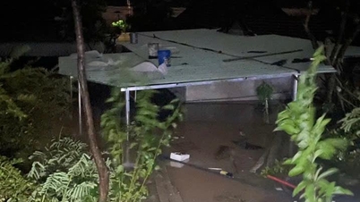
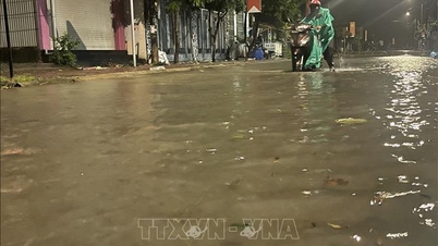
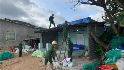
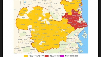
Coastal areas from South Quang Tri to Dak Lak are warned to be on guard against rising sea levels accompanied by large waves causing flooding in low-lying areas, waves overflowing dikes, coastal roads, coastal erosion, slowing down flood drainage in the area. All ships, boats, and aquaculture areas in the above-mentioned dangerous areas are strongly affected by storms, whirlwinds, strong winds, large waves, and rising sea levels.
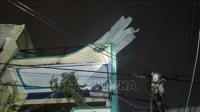
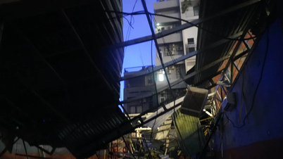
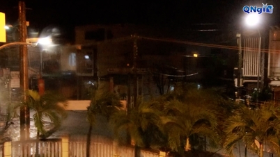
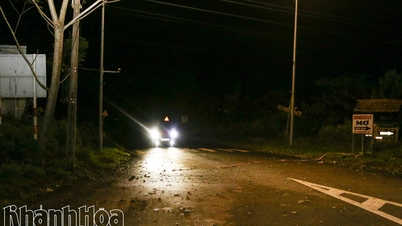
On land from the South of Da Nang City to Dak Lak, strong winds of level 6-9, areas near the storm's eye will be strong winds of level 10-12 (focusing on the East of Quang Ngai-Gia Lai provinces, North of Dak Lak), gusting to level 15; areas from the South of Quang Tri to the North of Da Nang City and the North of Khanh Hoa province, strong winds of level 6-7, gusting to level 8-9. The strongest winds will be from the evening to the night of November 6.
In the West, from Quang Ngai to Gia Lai provinces, there are strong winds of level 6-7, near the storm's eye, there are strong winds of level 8-9, gusting to level 11.
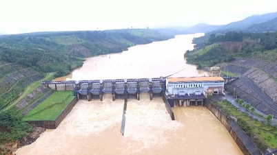
From the evening of November 6-7, the area from Da Nang City to Dak Lak will have very heavy rain with common rainfall of 150-300mm, locally over 500mm; the area from South Quang Tri to Hue City, Khanh Hoa and Lam Dong will have heavy rain with common rainfall of 100-250mm, locally over 400mm. From November 8, heavy rain in the above areas will tend to decrease.
From November 7-8, the area from North Quang Tri to Thanh Hoa will have moderate to heavy rain with common rainfall of 50-150mm, locally very heavy rain over 200mm. Warning of risk of heavy rain (>200mm/3h).
Due to the influence of the wide storm circulation, it is necessary to guard against the risk of thunderstorms, tornadoes and strong gusts of wind both before and during the storm's landfall.
Source: https://baophapluat.vn/bao-so-13-ap-sat-ven-bien-cac-tinh-dak-lak-gia-lai.html
![[Photo] Prime Minister Pham Minh Chinh receives the delegation of the Semiconductor Manufacturing International (SEMI)](https://vphoto.vietnam.vn/thumb/1200x675/vietnam/resource/IMAGE/2025/11/06/1762434628831_dsc-0219-jpg.webp)


![[Photo] Closing of the 14th Conference of the 13th Party Central Committee](https://vphoto.vietnam.vn/thumb/1200x675/vietnam/resource/IMAGE/2025/11/06/1762404919012_a1-bnd-5975-5183-jpg.webp)


![[Video] The third National Press Award "For the cause of developing Vietnamese culture"](https://vphoto.vietnam.vn/thumb/402x226/vietnam/resource/IMAGE/2025/11/06/1762444834490_giai-bao-chi-vh-3937-jpg.webp)


Comment (0)