
 |
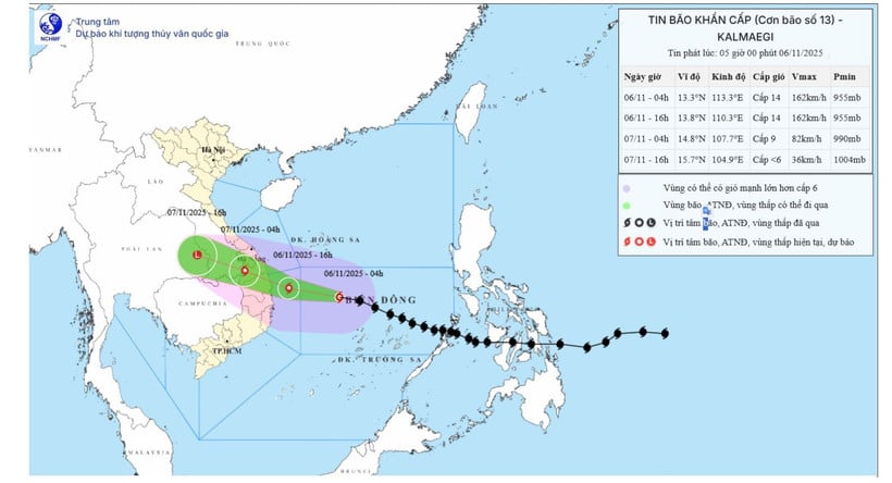
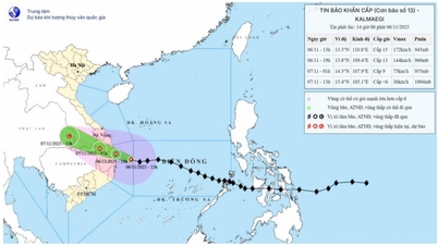
| (Photo: Forecast map of the trajectory and intensity of storm No. 13 (Kalmaegi) released at 5:00 a.m. on November 6, 2025. (Source: National Center for Hydro-Meteorological Forecasting) |
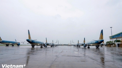
According to the National Center for Hydro-Meteorological Forecasting, at 5:00 a.m. on November 6, the center of the storm was at about 13.3 degrees north latitude; 112.8 degrees east longitude, about 390km east southeast of Quy Nhon ( Gia Lai ). The strongest wind near the center of the storm was level 14 (150-166 km/h), gusting to level 17. In the next 3 hours, the storm will move mainly westward at a speed of about 30km/h.
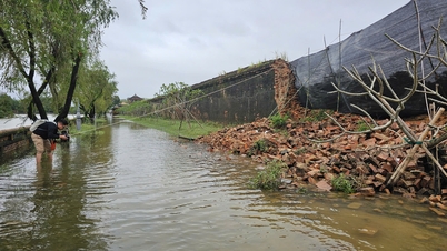
The storm could bring heavy rain to the Central region, including provinces and cities from Ha Tinh to Quang Ngai (localities that have just suffered heavy damage due to floods). Storm No. 13 has a level 4 natural disaster risk level.
By 4:00 p.m. this afternoon (November 6), the storm was moving mainly in the west-northwest direction, 25-30km/hour, the center of the storm was at about 13.8 degrees north latitude; 110.3 degrees east longitude, about 120km east of Quy Nhon (Gia Lai). The strongest wind near the center of the storm was level 14, gusting to level 17. Natural disaster risk: Level 4: The central East Sea area, the sea area from Quang Ngai to Dak Lak (including Ly Son special zone); Level 3: The sea area from southern Quang Tri to Da Nang city (including Cu Lao Cham island) and Khanh Hoa; mainland southern Quang Tri to Da Nang city, the east of the provinces from Quang Ngai to Dak Lak and the north of Khanh Hoa province.
By 4 a.m. tomorrow (November 7), the storm will move mainly in the west-northwest direction, 25km/h, the center of the storm will be at about 14.8 degrees north latitude; 107.7 degrees east longitude, on the western border area of Quang Ngai province - Southern Laos. The strongest wind near the center of the storm is level 9, gusting to level 11. Natural disaster risk: Level 4: Sea area from Quang Ngai to Dak Lak (including Ly Son special zone); mainland east of the area from Quang Ngai to Gia Lai; Level 3: Sea area from south of Quang Tri to Da Nang city (including Cu Lao Cham island) and Khanh Hoa; mainland south of Quang Tri to Da Nang city, west of Quang Ngai and Gia Lai provinces, east of Dak Lak province and north of Khanh Hoa province.
By 4 p.m. tomorrow, the storm will be moving mainly in a west-northwest direction at 25 km/hour, with its center at about 15.7 degrees north latitude and 104.9 degrees east longitude, in the eastern part of Thailand. The storm will move inland and weaken into a tropical depression, then a low pressure area. The strongest wind near the center of the low pressure area is at level 6.
Due to the influence of the storm, at sea, in the central East Sea, the wind is strong at level 8-11; near the eye of the storm, it is strong at level 12-14, gusting at level 17, waves are 5-7m high, near the eye of the storm are 8-10m high; the sea is very rough.
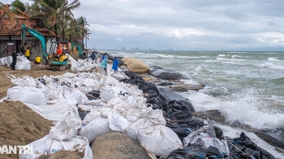
From this morning (November 6), the sea area from southern Quang Tri to Khanh Hoa (including Ly Son special zone, Cu Lao Cham island) will have stronger winds of level 6-7, then increase to level 8-11, waves 3-6m high; the area near the storm center will have strong winds of level 12-14, gusts of level 17, waves 7-9m high; the sea will be rough. Storm surge and flood warning for coastal areas: Coastal areas from Hue city to Dak Lak will have storm surges of 0.4-0.8m high.
Warning, from this afternoon, coastal areas from Hue city to Dak Lak are on guard against rising sea levels accompanied by large waves causing flooding in low-lying areas, waves overflowing dikes, coastal roads, coastal erosion, slowing down flood drainage in the area. All ships, boats, and aquaculture areas in the above-mentioned dangerous areas are strongly affected by storms, whirlwinds, strong winds, large waves, and rising sea levels.
On land, from this evening (November 6), from the area south of Da Nang city to Dak Lak, the wind will gradually increase to level 6-7, then increase to level 8-9, the area near the storm's eye will be strong at level 10-12 (focusing on the east of Quang Ngai-Gia Lai provinces), gusting to level 14-15; the area from south of Quang Tri to the north of Da Nang city and north of Khanh Hoa province, the wind will increase to level 6-7, gusting to level 8-9.
From the evening and night of November 6, in the west of the provinces from Quang Ngai to Gia Lai, the wind will gradually increase to level 6-7, near the storm's eye, it will be level 8-9, gusting to level 11.
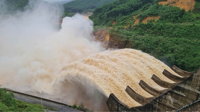
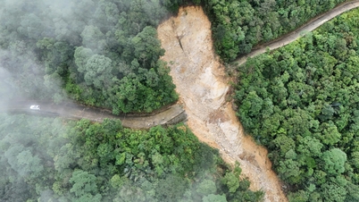
From November 6-7, the area from Da Nang city to Dak Lak will have very heavy rain with common rainfall of 200-400mm/period, locally over 600mm/period; the area from southern Quang Tri to Hue city, Khanh Hoa and Lam Dong will have heavy rain with common rainfall of 150-300mm/period, locally over 450mm/period.
From November 8, heavy rain in the above areas tends to decrease.
From November 7-8, the area from northern Quang Tri to Thanh Hoa will have moderate to heavy rain with common rainfall of 50-150mm/period, locally very heavy rain of over 200mm/period. Warning of risk of heavy rain (>200mm/3 hours).
Vietnam Maritime Administration and Vietnam Waterways direct storm prevention and control work No. 13 for the Star Bueno ship
Due to the influence of the wide storm circulation, it is necessary to guard against the risk of thunderstorms, tornadoes and strong gusts of wind both before and during the storm's landfall.
Yesterday, Deputy Prime Minister Tran Hong Ha signed a telegram to the provinces and cities of Quang Tri, Hue, Da Nang, Quang Ngai, Gia Lai, Dak Lak, and Khanh Hoa, requesting the deployment of forces on standby in all key areas, focusing on implementing the work of preventing, avoiding, and responding to storm No. 13.
Deputy Minister of Agriculture and Environment Nguyen Hoang Hiep said that this is a strong storm with a wide area of influence. The storm will make landfall around 9-10pm tonight, but the storm's impact may come earlier. Around noon today (November 6), heavy rain will start, and from 5-6pm the same day, there may be very heavy rain. People in the storm-affected areas from Quang Tri to Khanh Hoa should absolutely not go out unless necessary.
Source: https://huengaynay.vn/chinh-tri-xa-hoi/theo-dong-thoi-su/bao-so-13-dang-manh-cap-14-di-chuyen-nhanh-huong-truc-tiep-vao-quy-nhon-gia-lai-159650.html


![[Photo] Closing of the 14th Conference of the 13th Party Central Committee](https://vphoto.vietnam.vn/thumb/1200x675/vietnam/resource/IMAGE/2025/11/06/1762404919012_a1-bnd-5975-5183-jpg.webp)


Comment (0)