
Many dikes have been upgraded.
Nine months ago, specifically from September 9 to 18, 2024, the impact of the circulation of super typhoon No. 3 (typhoon Yagi) caused heavy rain, high upstream floods, and hydroelectric reservoirs released floodwaters, causing the water levels in Hai Duong rivers to rise very quickly, in some places far exceeding the alarm level III, lasting for many days. Statistics show that in the past 28 years, the dikes in Hai Duong have not been under such great pressure from such a large flood.
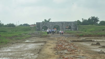
The dike system in the province remained stable after the historic flood but also posed many challenges for flood prevention in the following period when 269 dike incidents occurred, mainly seepage, extrusion, leaks through the dike body, landslides and sluice gate leaks. Many dike routes are weak and do not ensure flood protection elevation...
Determining that the dike system plays a particularly important role in flood and storm prevention, protecting the lives and property of the State and people, since the above flood, Hai Duong has focused on accelerating the implementation of projects to renovate and upgrade local dike works in the period of 2021 - 2025.
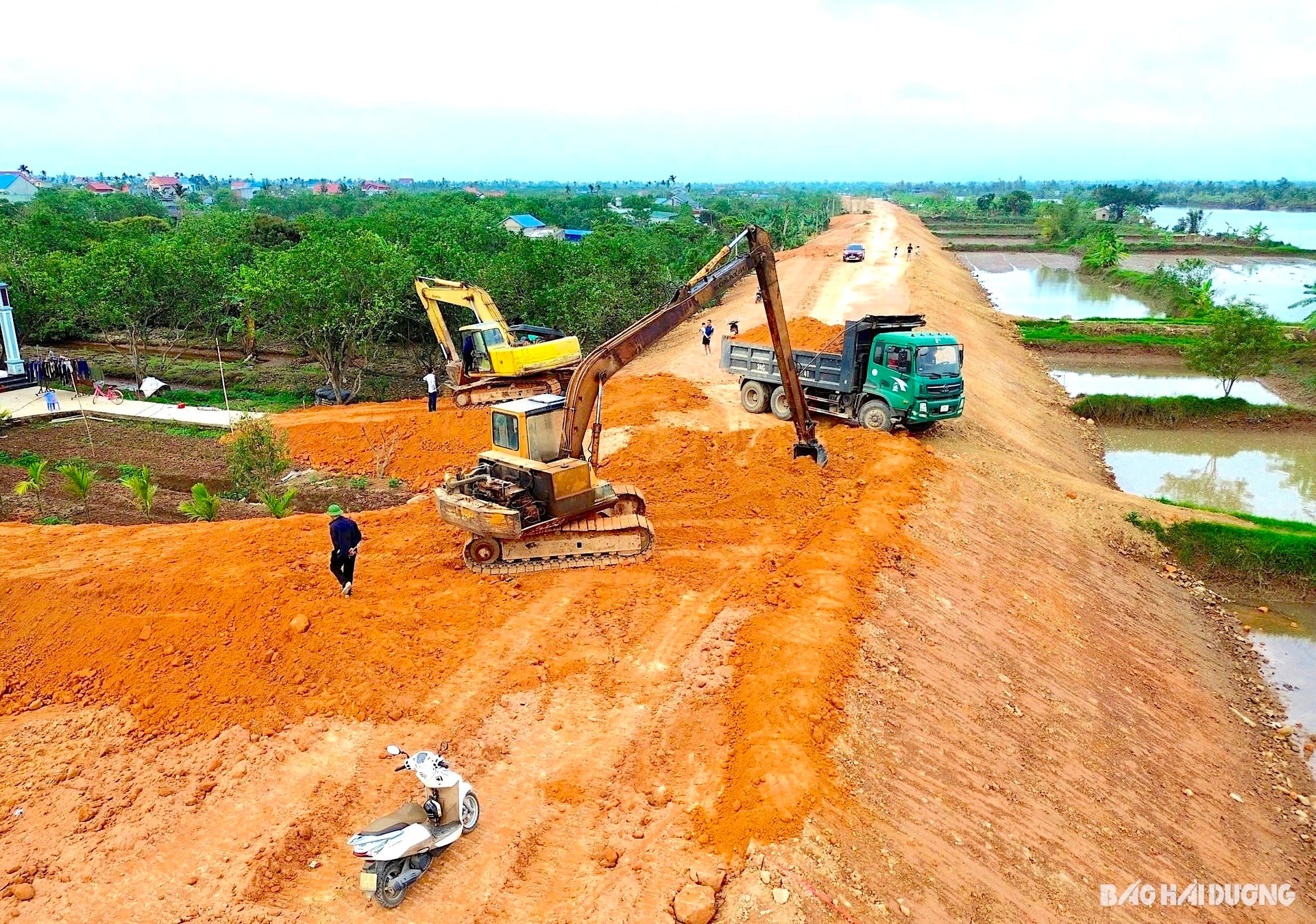
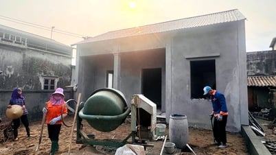
The project to renovate and upgrade the left dike of Thai Binh River from km 53 + 450 - km 56 + 987 through Thanh Hong Commune (Thanh Ha) was started after storm No. 3. After only 9 months, this project has now reached about 80% of the workload. The dike body was built with bamboo, the dike surface was raised, and concrete was poured, ensuring flood protection.
Nguyen Tien Cuong, Deputy Head of the Thanh Ha District Dike Management Department, informed: "Every year, this dike section is included in the list of key areas during the rainy and stormy season because the dike surface is small and has many extrusions and efflorescences. Now the dike surface has been raised and widened from 4 m to 6 m, making it more secure in case of a big flood."
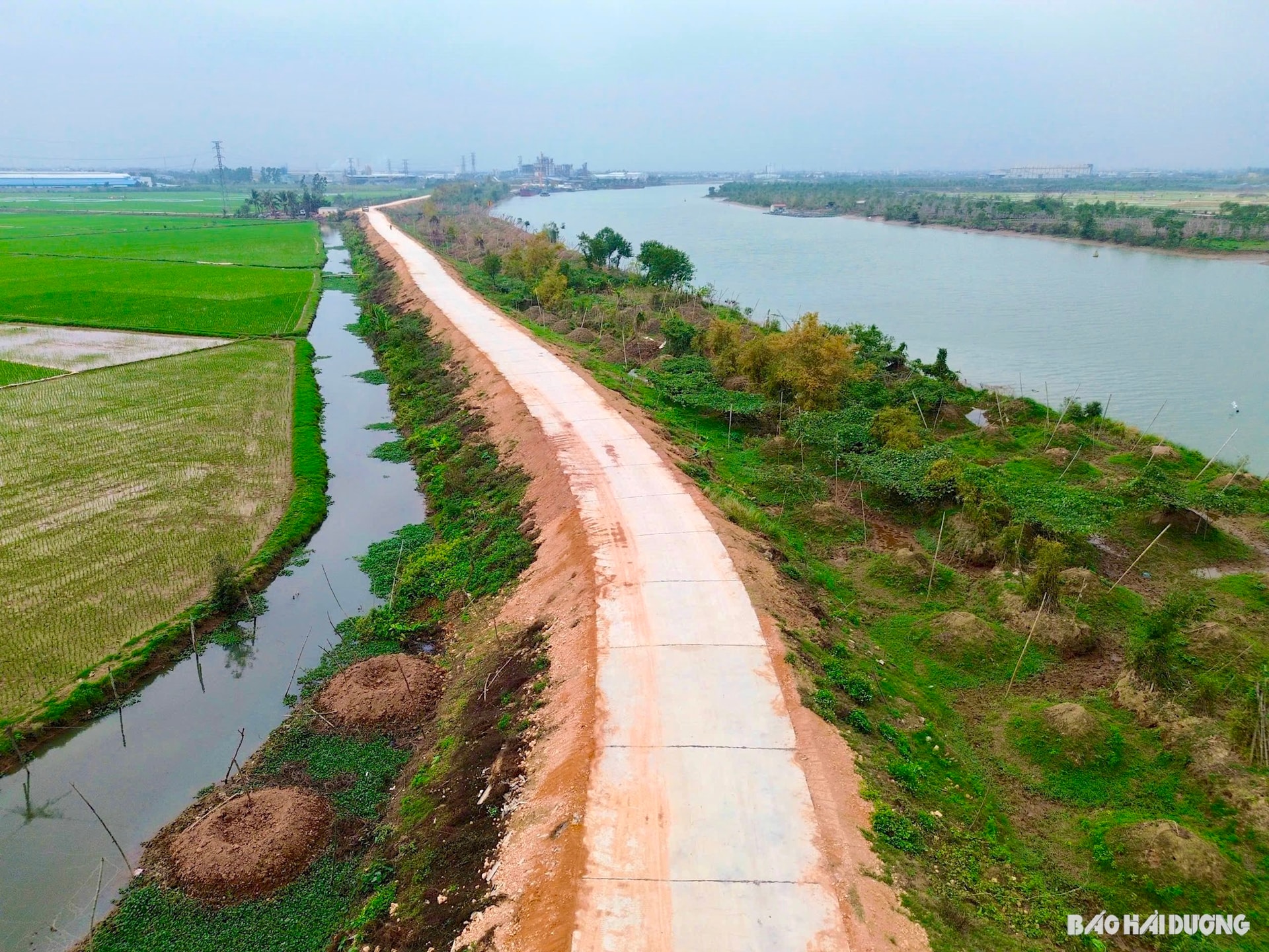
A series of other key dike routes under the Hai Duong province dike system restoration project in the 2021 - 2025 period have also been upgraded by construction units since the historic flood with a construction value of hundreds of billions of VND. These are the right dike route of Rang River from km 0 + 815 - km 8 + 170, from km 9 + 600 - km 13 and from km 15 + 300 - km 20 + 430 through Hong Lac, Cam Viet, Thanh An, Thanh Lang, Thanh Xuan communes (Thanh Ha); the right dike route of Kinh Mon River from km 7 + 500 - km 10 + 204 and from km 10 + 645 - km 13 + 425 from Tuan Viet commune to Phu Thai town; the left dike route of Lach Tray River from km 0 - km 3 + 600 in Dai Duc commune (Kim Thanh district)...
Up to now, the above dikes have basically completed the upgrading, expanded from 4 - 4.5 m to 7 m, with a 6 m wide concrete dike surface, ensuring flood protection.
In addition to the above projects, since the beginning of the year, the Provincial People's Committee has allocated 200 billion VND from the central budget reserve in 2024 to support the district level in investing in 19 projects to overcome the damage caused by storm No. 3 and post-storm floods. The main contents of the projects are repairing and restoring dikes, building new culverts across the dikes to replace old culverts, building dike embankments... Currently, most localities have completed the project dossier, some are selecting contractors, and preparing for construction this May.
Proactively protect key points
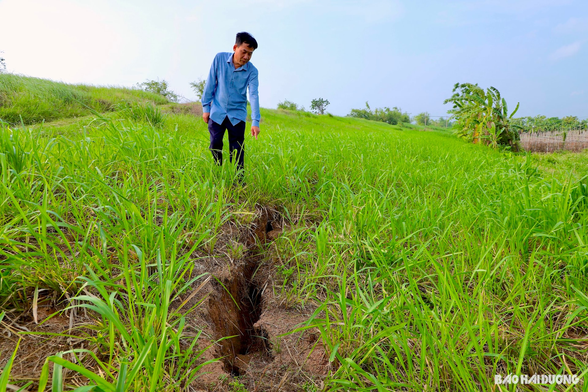
However, the dike system in Hai Duong still has many vulnerable locations. Just counting the dikes of level III and above, the whole province has 17.6 km of dikes that are not as high as designed, 113.6 km of dikes with narrow sides, 20 culverts across the dikes that were built a long time ago, have degraded and need to be rebuilt, 31 culverts are damaged...
Head of the provincial Irrigation Department Do Tien Bac said that during last year's historic flood, many dikes in the province experienced extrusion, seepage, seepage, and landslides. Although they were handled promptly, it is still necessary to closely monitor and deploy key protection plans against unpredictable developments of natural disasters.
In the immediate future, during this year's storm season, Hai Duong has developed plans to protect 34 key dyke areas (1 provincial level, 33 district levels) and 51 vulnerable locations of dykes, embankments, and culverts that require special attention. Localities are continuing to review and develop additional protection plans.
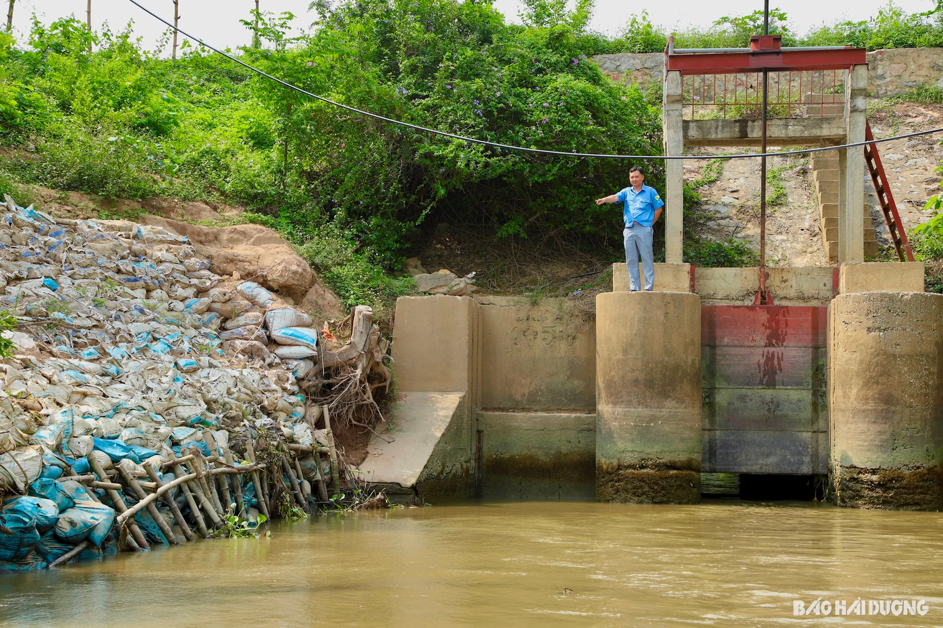
The work of building key plans to protect dikes has been proactively carried out by districts, towns and cities in the province early. Since March, Nam Sach district has completed building key plans to protect Ngo Dong sluice (Nam Hung commune) on Kinh Thay river dike, Hung Thang embankment (Minh Tan commune) on Thai Binh river left dike. Since early May, the district has continued to build additional plans to protect the erosion of the riverside dike on the Thai Binh left dike section through Minh Tan commune and the erosion of the fieldside dike on the same dike section through An Son commune.
According to Mr. Dang Huy Cuong, Head of the Dyke Management Department of Nam Sach district, each plan clearly states the current situation, builds hypothetical situations, arranges forces, materials, and means to participate in handling, and assigns specific responsibilities to each agency, unit, and locality... "Regarding the incident of the dike slope collapse in An Son commune, the district is preparing a project from the province's allocated resources so that it can be constructed immediately in the near future," Mr. Cuong emphasized.
Chi Linh City has also completed the construction of protection plans for Ky Dac culvert (Co Thanh ward), Dap Khe landslide (Nhan Hue commune), Van Thang culvert (Tan Dan ward), Vung Sau culvert (Hung Dao commune) on the left dike of Kinh Thay river and Nhan Hue dyke (Nhan Hue commune). The city has also developed a plan to deal with floods exceeding the design frequency, prevent inundation in fields and inner-city areas with very detailed contents, demonstrating proactiveness, positivity, and readiness to respond to situations that may occur due to natural disasters...
GOING STRONGSource: https://baohaiduong.vn/bao-ve-thanh-tri-phong-chong-lu-411292.html
![[Photo] President Luong Cuong receives Prime Minister of the Kingdom of Thailand Paetongtarn Shinawatra](https://vphoto.vietnam.vn/thumb/1200x675/vietnam/resource/IMAGE/2025/5/16/52c73b27198a4e12bd6a903d1c218846)

![[Photo] Prime Minister Pham Minh Chinh and Prime Minister of the Kingdom of Thailand Paetongtarn Shinawatra attend the Vietnam-Thailand Business Forum 2025](https://vphoto.vietnam.vn/thumb/1200x675/vietnam/resource/IMAGE/2025/5/16/1cdfce54d25c48a68ae6fb9204f2171a)


![[Photo] The Prime Ministers of Vietnam and Thailand witnessed the signing ceremony of cooperation and exchange of documents.](https://vphoto.vietnam.vn/thumb/1200x675/vietnam/resource/IMAGE/2025/5/16/935407e225f640f9ac97b85d3359c1a5)


Comment (0)