
On the afternoon of November 14, the Central Hydrometeorological Station issued a flood warning on rivers in Da Nang City in the coming days.
Currently, the water level of rivers in Da Nang City is still lower than the first alarm level. From November 16 to 20, floods are forecast to rise rapidly.
Notably, the flood peak on the Vu Gia – Thu Bon river system is likely to reach alert level II to alert level III, some places exceeding alert level III. The Han River and Tam Ky River are also forecast to reach alert level II – III, with the potential risk of widespread flooding.

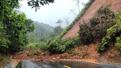
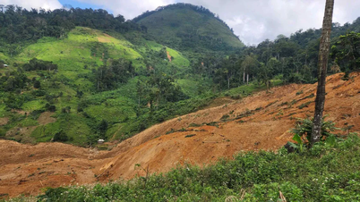
The downstream area of Thu Bon River was heavily flooded during the recent historic flood.
The meteorological agency said this flood could last for many days, causing the risk of flooding in low-lying areas along rivers, urban flooding, and flash floods and landslides in mountainous areas.
According to forecasts, from the night of November 15 to November 18, Da Nang is likely to experience widespread heavy rain due to the impact of increased cold air combined with strong easterly winds.
Rainfall in the plains is generally 200-400 mm; in the Northwestern mountainous region 150-300 mm; in the Southern mountainous region 250-500 mm, in high places it can exceed 700 mm.
Faced with complicated weather developments, the Da Nang City Civil Defense Command has requested localities to activate disaster prevention plans and provide timely information so that people can proactively respond.
Source: https://nld.com.vn/canh-bao-lu-len-nhanh-du-bao-mua-lon-dien-rong-tu-dem-15-11-o-da-nang-196251114180707077.htm
![[Photo] Prime Minister Pham Minh Chinh meets with representatives of outstanding teachers](https://vphoto.vietnam.vn/thumb/1200x675/vietnam/resource/IMAGE/2025/11/15/1763215934276_dsc-0578-jpg.webp)

![[Photo] Panorama of the 2025 Community Action Awards Final Round](https://vphoto.vietnam.vn/thumb/1200x675/vietnam/resource/IMAGE/2025/11/15/1763206932975_chi-7868-jpg.webp)


![[Photo] General Secretary To Lam receives Vice President of Luxshare-ICT Group (China)](https://vphoto.vietnam.vn/thumb/1200x675/vietnam/resource/IMAGE/2025/11/15/1763211137119_a1-bnd-7809-8939-jpg.webp)


Comment (0)