
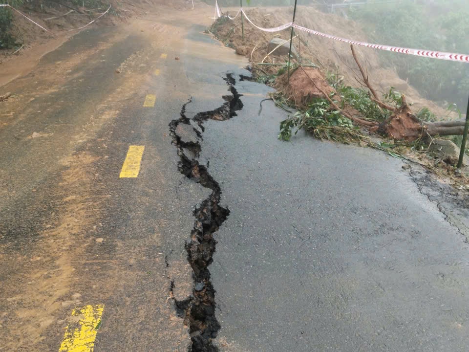
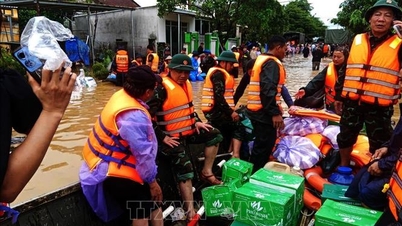
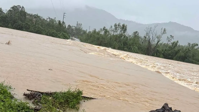
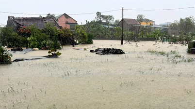
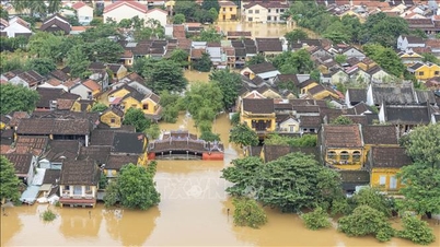
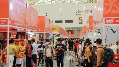
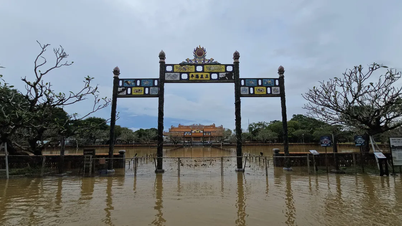
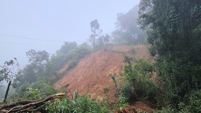
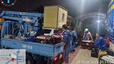
Therefore, under the impact of flash floods, landslides, and land subsidence due to heavy rain or water flow, flash floods and landslides can have very negative impacts on the environment, threaten people's lives; cause local traffic congestion, affect the movement of vehicles; destroy civil and economic works, causing damage to production and socio- economic activities.
.jpg)
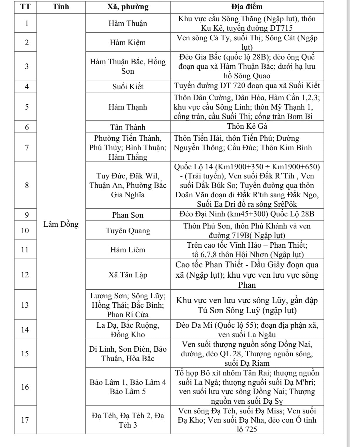
Notably, some areas at risk of flooding, landslides, and rock subsidence in the coming hours include the Song Thang bridge area, Ku Ke village, DT 715 route (Ham Thuan commune); along Ca Ty river, Thi stream, Cat river (Ham Kiem commune); Gia Bac pass (National Highway 28B); Ong Que pass through Ham Thuan Bac commune; downstream of Song Quao lake; DT 720 route through Suoi Kiet commune; Dai Ninh pass; the area along Luy river...
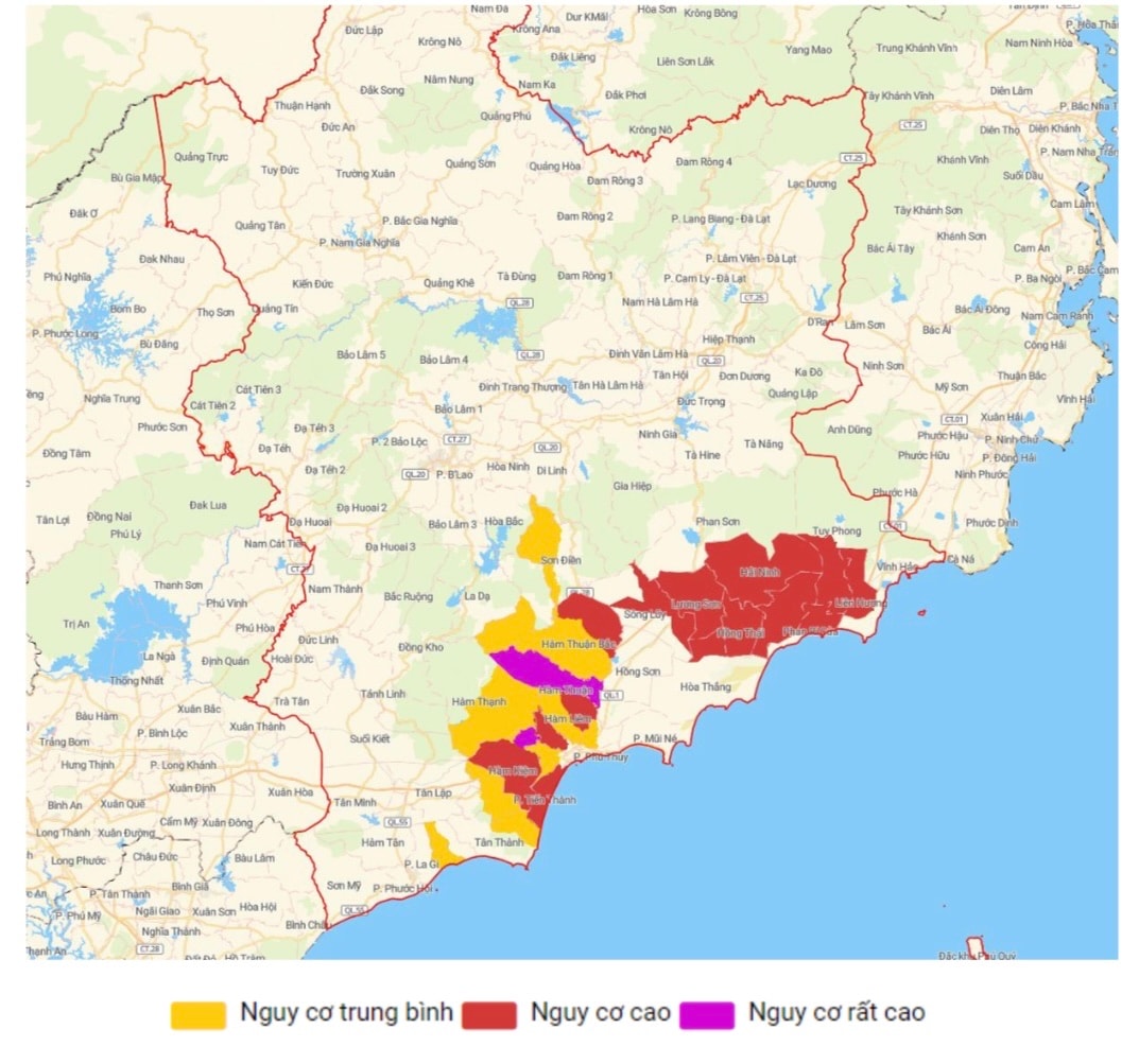
It is known that in the past 24 hours (from 5:00 p.m. on October 29 to 5:00 p.m. on October 30), Lam Dong province has had moderate rain, heavy rain, and very heavy rain. Rainfall at some stations such as Ku Ke 199mm (Ham Thuan); Ma Lam 172mm (Ham Thuan); Muong Man 149.6mm (Ham Kiem); Cau Chay 141.1mm (Ham Kiem); Ham Kiem 136.2mm; Thuan Hoa 118.4mm (Ham Thuan Bac); Tien Thanh 116.8mm (Tien Thanh ward); Dan Hiep 113.8mm (Ham Thuan Bac)... Soil moisture model shows that some areas in Lam Dong province are nearly saturated (over 90%) or have reached a saturated state.
Source: https://baolamdong.vn/canh-bao-nhieu-diem-lu-quet-sat-lo-sut-lun-dat-do-mua-lu-dong-chay-tai-lam-dong-399011.html
![[Photo] General Secretary To Lam meets former British Prime Minister Tony Blair](https://vphoto.vietnam.vn/thumb/1200x675/vietnam/resource/IMAGE/2025/10/30/1761821573624_tbt-tl1-jpg.webp)
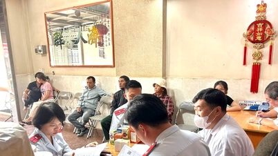
![[Photo] The Third Patriotic Emulation Congress of the Central Internal Affairs Commission](https://vphoto.vietnam.vn/thumb/1200x675/vietnam/resource/IMAGE/2025/10/30/1761831176178_dh-thi-dua-yeu-nuoc-5076-2710-jpg.webp)
![[Photo] General Secretary To Lam attends the Vietnam-UK High-Level Economic Conference](https://vphoto.vietnam.vn/thumb/1200x675/vietnam/resource/IMAGE/2025/10/30/1761825773922_anh-1-3371-jpg.webp)
![[Photo] National Assembly Chairman Tran Thanh Man receives foreign ambassadors who came to say goodbye](https://vphoto.vietnam.vn/thumb/1200x675/vietnam/resource/IMAGE/2025/10/30/1761820977744_ndo_br_1-jpg.webp)
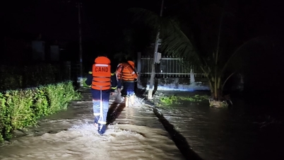
![[Photo] Touching scene of thousands of people saving the embankment from the raging water](https://vphoto.vietnam.vn/thumb/1200x675/vietnam/resource/IMAGE/2025/10/30/1761825173837_ndo_br_ho-de-3-jpg.webp)


Comment (0)