
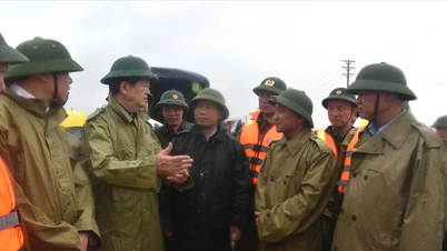
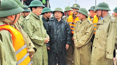
On the evening of October 30, Deputy Minister of Agriculture and Environment Nguyen Hoang Hiep, member of the National Civil Defense Steering Committee, signed an official dispatch dated October 30 requesting the People's Committees of provinces and cities from Nghe An to Hue, along with Da Nang City and Quang Ngai Province, to deploy plans to respond to the risk of floods that could last until November 4.
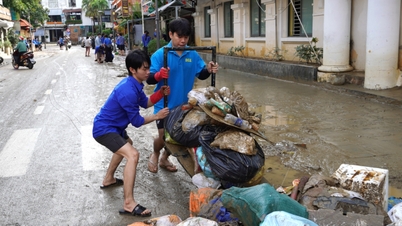
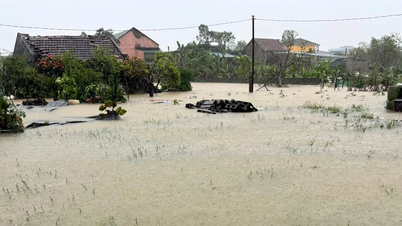
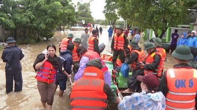
According to the above document, recently, the Central region has had prolonged heavy rains causing widespread flooding, flash floods, and landslides, causing serious damage to people and property.

Currently, according to the meteorological agency, heavy rain in the Central region is likely to last until November 4, in which from tonight, October 30 to November 1, the area from Nghe An to Northern Quang Tri will have heavy to very heavy rain (generally 200-400mm, locally over 700mm); from the night of October 31 to November 1, the area from Southern Quang Tri to Hue will have heavy rain with general rainfall of 70-150mm, locally over 250mm.
To proactively respond to heavy rains, floods, landslides, flash floods, and inundation in low-lying areas, urban areas, and industrial zones, the National Steering Committee for Civil Defense requested 6 localities including Nghe An, Ha Tinh, Quang Tri, Hue, Da Nang, and Quang Ngai to promptly and fully inform local authorities and people to proactively prevent and urgently overcome the consequences of recent natural disasters.
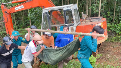
These localities deployed shock forces to inspect and review residential areas along rivers, streams, low-lying areas at risk of floods, flash floods, and landslides.

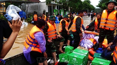
At the same time, localities need to organize forces to guard, control, support, and guide to ensure safe traffic for people and vehicles, especially at culverts, spillways, deep flooded areas, fast-flowing water, and areas where landslides have occurred or are at risk of landslides.
Besides, it is necessary to proactively operate and regulate inter-lakes and single reservoirs for irrigation and hydropower to ensure flood prevention capacity for downstream areas.
Localities also need to prepare forces, means, equipment, and necessities according to the "4 on-the-spot" motto to be ready to respond to all situations, especially in areas at risk of being isolated.
Source: https://www.sggp.org.vn/mua-lu-co-the-keo-dai-den-ngay-4-11-o-khu-vuc-tu-nghe-an-den-hue-post820905.html
![[Photo] Da Nang: Water gradually recedes, local authorities take advantage of the cleanup](https://vphoto.vietnam.vn/thumb/1200x675/vietnam/resource/IMAGE/2025/10/31/1761897188943_ndo_tr_2-jpg.webp)


![[Photo] Prime Minister Pham Minh Chinh attends the 5th National Press Awards Ceremony on preventing and combating corruption, waste and negativity](https://vphoto.vietnam.vn/thumb/1200x675/vietnam/resource/IMAGE/2025/10/31/1761881588160_dsc-8359-jpg.webp)


Comment (0)