
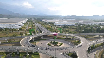
Multi-line connection
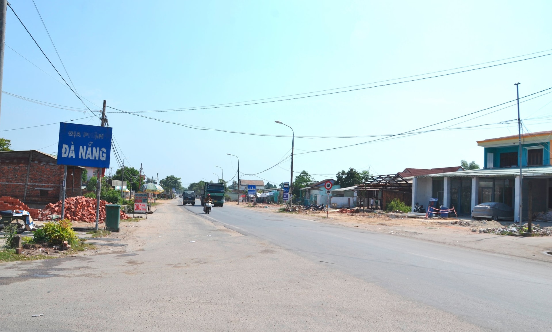
Located in the northern coastal area of Quang Nam , DT603B route through Hoi An city and Dien Ban town connects with Truong Sa coastal road of Da Nang city. The connection of the coastal route through 2 localities (belonging to Vietnam's coastal road) with Vo Chi Cong road extends to near the entrance to Chu Lai airport. Moving to the west, DT607 in Hoi An, Dien Ban has the starting point connecting to Tran Dai Nghia street (Da Nang) with a scale of 6 lanes.
On the journey from North to South, Da Nang and Quang Nam not only share the Hanoi - Ho Chi Minh City railway, but also have National Highway 1 running along the entire route. The border area that this National Highway connects between Hoa Phuoc commune, Hoa Vang district and Dien Thang Bac ward, Dien Ban has been expanded to have 3 lanes on each side.
Intersecting with DT609 at Cam Ly intersection (Dien Hong commune, Dien Ban), DT605 of Quang Nam crosses the Da Nang - Quang Ngai expressway, crosses Bo Bo hill and connects with the road through the center of Hoa Tien commune (Hoa Vang).
.jpg)
A notable point is that many routes that the two localities share the same name include the Da Nang - Quang Ngai Expressway, National Highway 14B, National Highway 14G. In particular, Quang Da Bridge is a symbol of love, solidarity, loyalty, and steadfastness between two brothers who once lived under the same roof.
After the technical opening to celebrate the 50th anniversary of liberation, this bridge is continuing to be completed and put into use, connecting from National Highway 14B (Hoa Khuong and Hoa Vang communes), crossing Yen River to connect to the northern belt road project of Quang Nam (Dien Tien, Dien Hoa and Dien Ban communes).
Need to continue investing
For National Highway 14B, 74km long, located on the East-West Economic Corridor 2; the route starts from Tien Sa port, crosses the National Highway 1 intersection in Hoa Cam, goes up to Dai Loc and Nam Giang districts (the end of the route borders Ho Chi Minh road, in Thanh My town).
Current status through Da Nang, the first section of the route up to the intersection with Da Nang - Quang Ngai Expressway (Hoa Nhon commune, Hoa Vang) has been expanded to 6 lanes.
On November 25, 2023, the city continued to start the project to upgrade and expand National Highway 14B from the expressway intersection to Hoa Khuong commune (end point of route km32 + 185.09), bordering Dai Hiep commune (Dai Loc district) with a scale of 6 lanes.
Through Quang Nam, the section from Dai Hiep commune to Thanh My town is 41.9km long with only 2 lanes (9m wide roadbed). Currently, the traffic volume through National Highway 14B is increasing rapidly; there are also trucks from Laos via National Highway 14D, down to National Highway 14B. National Highway 14B has an average traffic volume of about 4,813 cars/day and night; of which heavy trucks with 3 axles or more account for 1,232 vehicles/day and night.
.jpg)
The traffic volume as above has exceeded the load capacity, National Highway 14B has appeared damaged, cracked, and locally sunken, especially on the left side of the route. Quang Nam has proposed and received approval from the Prime Minister to support investment funding for the project to upgrade and expand National Highway 14B. Therefore, after the merger, the preparation of the investment project needs to be continued and promoted quickly.
A very important traffic route currently connecting Quang Nam and Da Nang to the northwest is National Highway 14G. Head of the Economic, Infrastructure and Urban Department of Dong Giang District - Mr. Nguyen Duc Huy said that National Highway 14G is 66km long, connecting Hoa Vang District (Da Nang City) with Dong Giang District, of which the section through Dong Giang is 41km long. According to the plan, National Highway 14G has a scale of level IV road, 2 lanes, cross-section width of 7.5m.
The section passing through Da Nang has been upgraded and expanded in many places, making traffic more convenient, contributing to effectively exploiting the potential and strengths of the locality. Meanwhile, the current road surface of National Highway 14G in Quang Nam is mainly only 4-5m wide.
Over the years, local voters have repeatedly reported that the road has seriously degraded, causing traffic insecurity, affecting people's travel and the socio-economic development of Dong Giang and Tay Giang. Therefore, voters recommend that relevant authorities pay attention to investing in and upgrading this vital route.
Given the current situation of National Highway 14G, after the merger of Quang Nam and Da Nang (expected to be named Da Nang City), the city needs to continue to propose and research to promote investment resources to expand this vital axis.
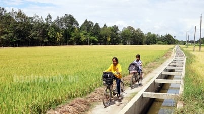
If the National Highway 14G has a bright new look, it will contribute to achieving the goal of expanding new development space, creating a driving force to promote socio-economic development, first of all, to give people in mountainous areas and ethnic minority areas the opportunity to rise up and sustainably reduce poverty.
Source: https://baoquangnam.vn/giao-thong-ket-noi-quang-nam-va-da-nang-3153552.html

![[Photo] Hungarian President begins official visit to Vietnam](https://vphoto.vietnam.vn/thumb/1200x675/vietnam/resource/IMAGE/2025/5/27/ab75a654c6934572a4f1a566ac63ce82)


![[Photo] Hungarian President and his wife take a walk and enjoy the view of Hoan Kiem Lake](https://vphoto.vietnam.vn/thumb/1200x675/vietnam/resource/IMAGE/2025/5/28/b9c83fbe6d5849a4805f986af8d33f39)


Comment (0)