
This morning, October 28, the rain in some places in the central provinces has significantly reduced. However, after that break, dense thunderstorms have continued to appear. According to satellite cloud images and weather radar, the giant thunderstorm cloud mass in the middle of the East Sea is moving towards the central mainland. It is forecasted to continue causing heavy to very heavy rain in the central provinces such as Hue, Da Nang , Quang Ngai...
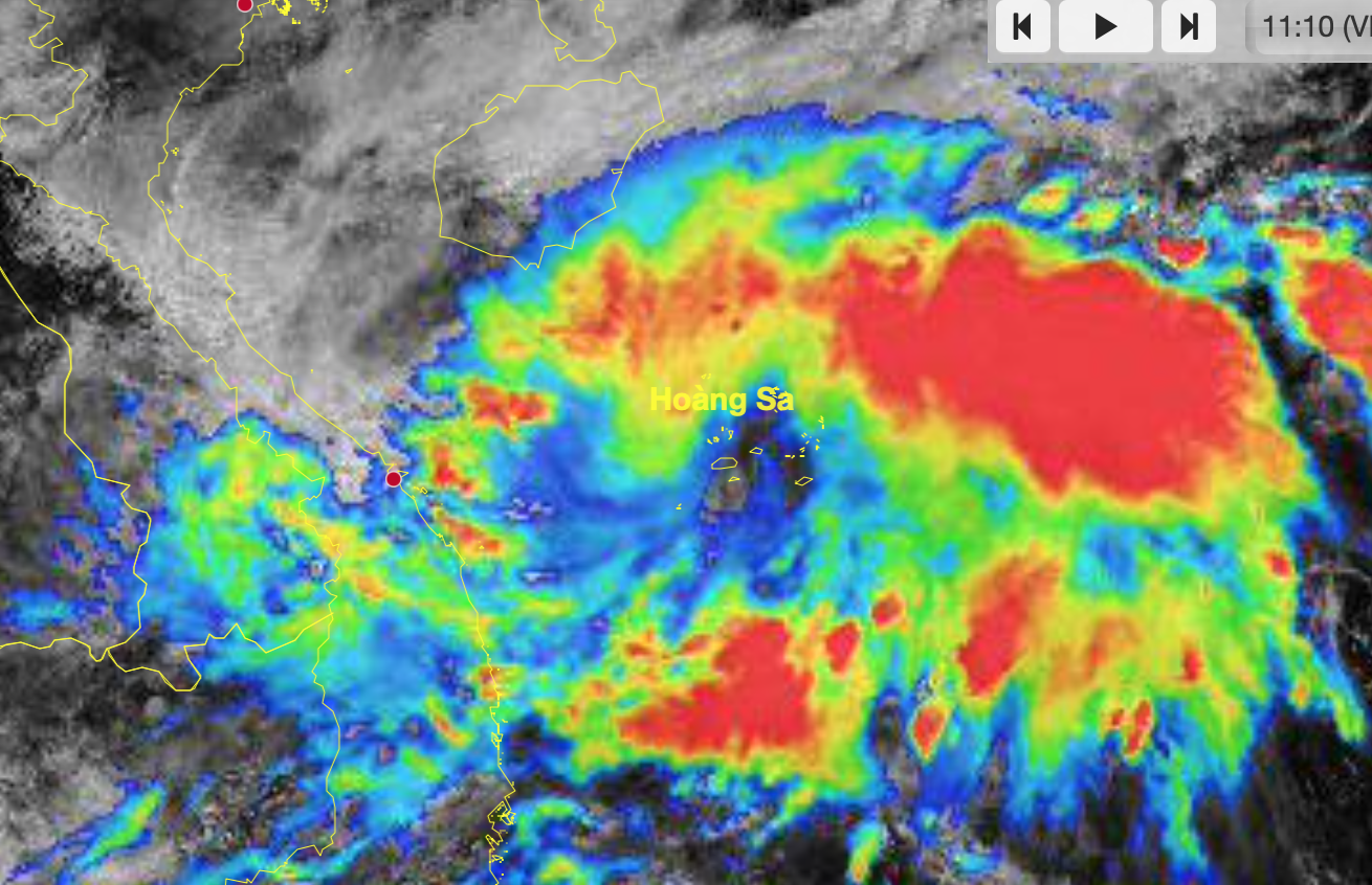
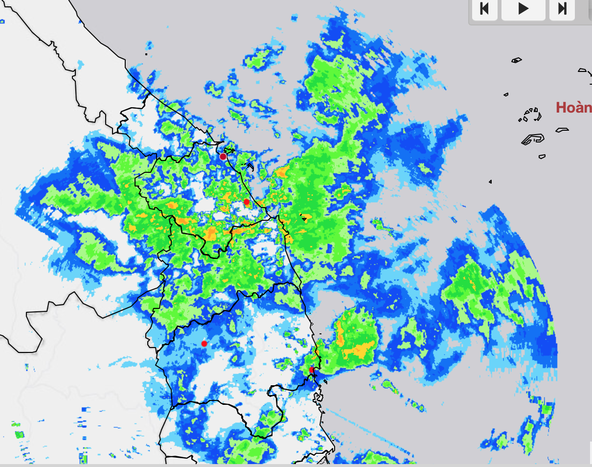
Giant thunderstorms continue to cause heavy rain in the central provinces.
SOURCE: HYMETNET - VNDMS
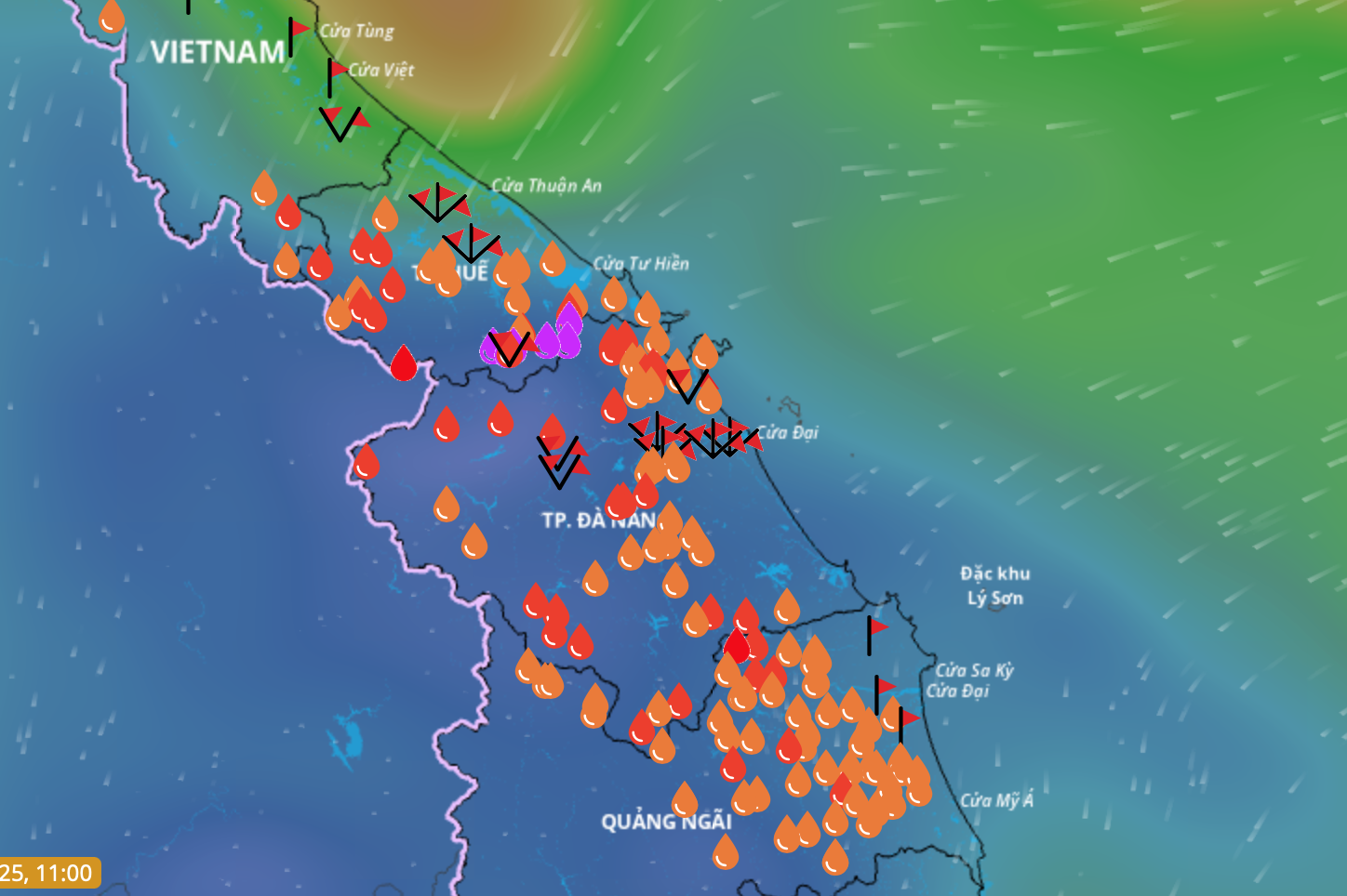
The National Center for Hydro-Meteorological Forecasting (NCHMF) said that from now until the end of the night of October 29, the Hue and Da Nang areas will have very heavy rain with common amounts of 200 - 400 mm, locally over 600 mm in some places.
In the south of Quang Tri and the east of Quang Ngai province, there will be rain from 150 - 300 mm, locally over 500 mm. In the area from Ha Tinh to the north of Quang Tri, there will be widespread rainfall of 80 - 150 mm, locally over 300 mm. Warning: Beware of heavy rain over 200 mm in 3 hours.
At sea, the northern East Sea has strong northeast winds of level 6, sometimes level 7, gusting to level 8-9, rough seas, and waves 3-5 m high. Meanwhile, the sea from Quang Tri to Quang Ngai has strong northeast winds of level 6, gusting to level 7-8, rough seas, and waves 2.5-3.5 m high.
In addition, the sea area from southern Quang Tri to Ca Mau, Ca Mau to An Giang, the Gulf of Thailand, the northern and central areas of the East Sea (including Hoang Sa special zone), and the southern areas of the East Sea (including Truong Sa special zone) will have scattered showers and thunderstorms. During thunderstorms, there is a possibility of tornadoes, strong gusts of wind of level 6-7 and waves over 2 meters high.
All vessels operating in the above mentioned areas are at high risk of being affected by strong winds and large waves. Coastal areas from southern Quang Tri to Quang Ngai are likely to be flooded in low-lying areas due to the influence of high tides.
Thanhnien.vn
Source: https://thanhnien.vn/khoi-may-giong-khong-lo-ap-sat-cac-tinh-mien-trung-tiep-tuc-gay-mua-rat-to-185251028121050279.htm


![[Photo] President Luong Cuong attends the 80th Anniversary of the Traditional Day of the Armed Forces of Military Region 3](https://vphoto.vietnam.vn/thumb/1200x675/vietnam/resource/IMAGE/2025/10/28/1761635584312_ndo_br_1-jpg.webp)
![[Photo] Draft documents of the 14th Party Congress reach people at the Commune Cultural Post Offices](https://vphoto.vietnam.vn/thumb/1200x675/vietnam/resource/IMAGE/2025/10/28/1761642182616_du-thao-tai-tinh-hung-yen-4070-5235-jpg.webp)


![[Photo] The 5th Patriotic Emulation Congress of the Central Inspection Commission](https://vphoto.vietnam.vn/thumb/1200x675/vietnam/resource/IMAGE/2025/10/27/1761566862838_ndo_br_1-1858-jpg.webp)


Comment (0)