
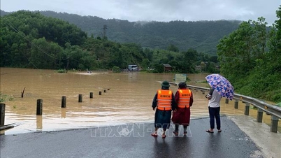
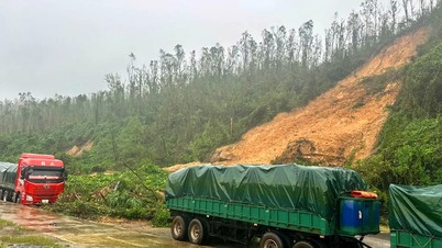
Specifically, the natural disaster emergency situation for the National Highway 20 section from Km 262+400 to Km 262+530 (D'ran suspension bridge area in Xuan Truong ward - Da Lat). On National Highway 28, the natural disaster emergency situation is at the section from Km 47+252 to Km 54+000.

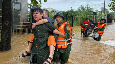
According to Lam Dong Provincial People's Committee, urgent measures that need to be applied immediately to respond and ensure people's safety include: posting warning signs, strictly prohibiting organizations and individuals without authority from entering dangerous warning areas. Organizing 24/7 on-duty at construction sites, monitoring, tracking and assessing the development of natural disasters. At the same time, organizing traffic flow and lanes to ensure traffic circulation and safety when participating in traffic.

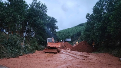
In the long term, it is necessary to determine the cause and propose a plan to repair and restore the route with long-term stability to ensure traffic safety and the property and lives of people...

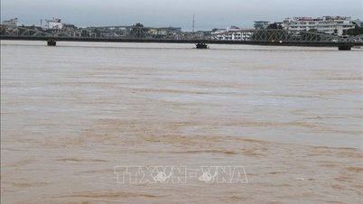
As reported by SGGP Newspaper, from October 26 to 30, due to the impact of heavy and prolonged rains, National Highway 20 (Xuan Truong Ward - Da Lat) and National Highway 28 (Son Dien Commune) experienced landslides and cracks in the roadbed and surface, causing traffic congestion and not ensuring safety for people and vehicles.
Source: https://www.sggp.org.vn/lam-dong-cong-bo-tinh-huong-khan-cap-ve-thien-tai-tai-hai-khu-vuc-sat-lo-quoc-lo-20-va-28-post821373.html
![[Photo] Ho Chi Minh City Youth Take Action for a Cleaner Environment](https://vphoto.vietnam.vn/thumb/1200x675/vietnam/resource/IMAGE/2025/11/04/1762233574890_550816358-1108586934787014-6430522970717297480-n-1-jpg.webp)
![[Photo] Ca Mau "struggling" to cope with the highest tide of the year, forecast to exceed alert level 3](https://vphoto.vietnam.vn/thumb/1200x675/vietnam/resource/IMAGE/2025/11/04/1762235371445_ndo_br_trieu-cuong-2-6486-jpg.webp)
![[Photo] Government holds a special meeting on 8 decrees related to the International Financial Center in Vietnam](https://vphoto.vietnam.vn/thumb/1200x675/vietnam/resource/IMAGE/2025/11/04/1762229370189_dsc-9764-jpg.webp)


![[Photo] Comrade Nguyen Duy Ngoc holds the position of Secretary of the Hanoi Party Committee](https://vphoto.vietnam.vn/thumb/1200x675/vietnam/resource/IMAGE/2025/11/04/1762234472658_a1-bnd-5518-8538-jpg.webp)


Comment (0)