
According to the Governor Cao Huu Duc who came to Tay Ninh (1841-1845) to contribute to the demarcation of administrative units of cantons and villages; there was certainly no branch called Archaeology. Yet, whether by accident or on purpose, the newly established My Ninh canton land, which was incorporated into Quang Hoa district, is dense with archaeological relics. That is what today's archaeologists say. In reality, these are the remaining traces of ancient cultures that were buried by the storms of both nature and time.

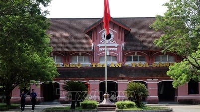
An Thanh Temple.
Triem Hoa commune has a typical archaeological site called Cao Son. Just like the typical site of Giai Hoa commune is Ben Dinh mound… Nowhere else has a density of archaeological sites as high as in My Ninh commune.
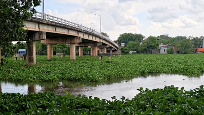
This commune has only one Thanh Phuoc village on the left bank of Quang Hoa river (now Vam Co Dong). This is one of the first villages established in Tay Ninh, with a very large area including Phuoc Thanh commune, Phuoc Dong and Go Dau town today.
The typical archaeological site of Thanh Phuoc village is the Dua River - Hao Thanh relic and Phuoc Thanh tower mound. The book Tay Ninh Xua by Huynh Minh (1973) wrote: “In the 17th century, King Mien Nac Ong Chan invaded our country, occupied Tay Ninh, and built a king's temple in Don Thuan village...
On a deserted mound, temples and palaces suddenly emerged. Around the temple area, ramparts and moats were built to prevent thieves and rebels…”. Huynh Minh was probably wrong when he wrote that it was in Don Thuan village. The truth is that this moat area is located to the west of DT 784 road (ancient imperial road), so it belongs to Thanh Phuoc area, now Phuoc Dong. Accordingly, the ramparts and moats of this garrison area date back to the 17th century.
But according to a recent study by Le Hoang Quoc in the book Tay Ninh Land and People (Thanh Nien Publishing House, 2020), this citadel could have appeared from the 8th century onwards. Also with the enameled ceramic samples discovered at the site and by comparison method, the author wrote: "Therefore, it is possible to predict that this citadel was built in the same period from the 8th to the 16th century...".
Also on the land of Thanh Phuoc village, which in 1877 was separated to establish a new village called Phuoc Thanh, there is an archaeological site called Go Thap. This mound, now belongs to Phuoc Binh B village, not far from the National Monument - Lom Base in the Go Dau area.
Studying the area as a whole, Le Hoang Quoc said it was only about 1.5 km away from Song Dua - Hao Thanh as the crow flies. This site was discovered by French archaeologist H. Parmentier in 1909.
At that time, he wrote: “The traces of a relic in Phuoc Thanh village, Bau Thanh hamlet, My Ninh commune. These traces are located half a mile east of milestone number 66 of Colonial Road No. 1” (he must have been wrong, because it should have been written to the west - NV). Colonial Road No. 1 is the current DT 782 and 784 roads.
Description by H.Parmentier in the journal of the French School of Far Eastern Studies, No. 9, 1909: “A small mound of earth covering the place of a brick shrine, in the middle of a square frame, 50m on a side, limited by a 10m wide pond now turned into a rice field. The whole complex is located on the highest peak of a rather barren plain, oriented East to South 20 degrees…”.
Until the 2010 survey by the Provincial Museum, the above status had been somewhat distorted. That is: “The East and North sides have a large lake surrounding the foot of the mound, the lake is on average 41m wide…”.
This proves that there has been an impact from the people, to make low-lying fields or ponds to raise ducks, fish, etc. However, the most basic part - the mound of earth - is still kept intact with a luxuriant old tree providing shade. There are also newly planted trees, which are acacia trees. And a few more tombs were built on the mound.
Researching the entire area, Song Dua - Hao Thanh and Bau Thap mound (the author's name), Le Hoang Quoc said: "Go Bau Thap is the closest trace proving the existence of an ancient community in the "Song Dua" citadel area.
If that is true, then that “ancient community” existed during the Oc-eo and post-Oc-eo cultural periods, because the brick and stone architecture that the Provincial Museum surveyed in 2010 was determined to be: “belonging to the Oc-eo and post-Oc-eo cultural periods, dating back over 1,000 years ago…”.
If on the left bank of the river, including Triem Hoa commune and Thanh Phuoc village of My Ninh commune, there are only a few places of residence of ancient people (Cao Son mound, residence of prehistoric people and Thanh Phuoc, residence of residents from the Oc-eo culture period and later).
The right bank of the river is truly the center of the ancient cultural residents. In all 3 remaining villages of My Ninh commune. According to the scientific report of the Provincial Museum in 2011, the village (now a commune) of Long Thuan in the past had 7 archaeological sites, of which 6 had traces of ancient bricks and stones of the temples and towers of the Oc-eo and post-Oc-eo cultures.
These are Mound Tower 1 and Mound Tower 2 in Long Hung hamlet; Mound Thap, Mound Da, Mound Mieu, Mound Chua in Nga Tac hamlet. Phuoc Luu village, now in Phuoc Binh commune, Trang Bang town, is also a special case. It can be said that this is the place with the highest density of archaeological sites in the entire right bank of the Vam Co Dong river.
The whole Phuoc Luu commune (old) has up to 12 archaeological sites. All of them have ancient brick and ceramic relics of the post-Oc-eo culture from over 1,000 years ago. Especially at the Can Thang mound site (Phuoc Tan hamlet) and Ba Chanh mound in Phuoc Loi hamlet.
Relics of ancient bricks, pottery, stone mortars, etc. indicate that these two sites could have been “a place of residence or pottery production in the early years of the Common Era, belonging to the Oc-eo culture…”. Early Common Era, meaning right from the time the Kingdom of Funan (1st-7th century) was first formed.

Worship at Ong An Thanh Palace.
However, if we consider the scale, era, density of the sites in the archaeological layers... the most important ancient residential relics belong to An Thanh commune - the predecessor of which is An Thanh village, established by Tay Ninh Governor Cao Huu Duc in 1845.
Dinh Ong in Voi hamlet has long been known to the residents of Southern Tay Ninh as a scenic and spiritual spot for the people in the area. Archaeological results in 1990 discovered: “150 stone tools of various types: quadrilateral stone axes, shouldered axes, grinding table chisels... with tens of thousands of ceramic pieces of various types, more than 80 can-rangs, a collection of wild animal bones and many types of shells, snail shells, mollusks from the river region...”.
Dinh Ong belongs to Voi hamlet; in Chanh hamlet, there is also a similar archaeological site at Ba Dao mound. Here, "many ancient pottery and stone axes such as quadrangular axes and shoulder axes were discovered scattered over an area of 2 hectares of land to the East and Southeast of the mound and it was determined that this was a residential area of a group of prehistoric residents... estimated to be around 2,500 to 2,700 years ago". At Dinh Ong, archaeologists also came to a similar conclusion.
So we could not have imagined that the most bustling foreign trade route in Tay Ninh today - the Trans-Asia route passing through An Thanh - Moc Bai - was actually the oldest residence of prehistoric residents.
Please recall the early period of the establishment of My Ninh commune (1836) or An Thanh village (1841); there was absolutely no such road. It was not until 1916 that a road named Colonial Road No. 1 passed through here as a continuation of the Nguyen Dynasty's river crossing sketch. History has had interesting breaks and twists on the route through My Ninh commune.
Tran Vu
Source


![[Photo] Top players gather at the 2025 Nhan Dan Newspaper National Table Tennis Championship](https://vphoto.vietnam.vn/thumb/1200x675/vietnam/resource/IMAGE/2025/5/23/9ad5f6f4faf146b08335e5c446edb107)
![[Photo] Anh Hoang - Dinh Duc successfully defended the men's doubles championship of the National Table Tennis Championship of Nhan Dan Newspaper](https://vphoto.vietnam.vn/thumb/1200x675/vietnam/resource/IMAGE/2025/5/23/d6ab3bcac02c49928b38c729d795cac6)


![[Photo] The Central Party Executive Committee delegation visits former President Tran Duc Luong](https://vphoto.vietnam.vn/thumb/402x226/vietnam/resource/IMAGE/2025/5/24/32f67673454445aab0f1f2af331cb170)


Comment (0)