

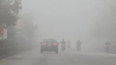
According to the National Center for Meteorological and Hydrological Forecasting, today (October 25), a (new) cold front is moving southward across the Asian continent and will affect Vietnam's weather in the next 24-48 hours.
Accordingly, from around early tomorrow morning (October 26), this cold air mass will directly affect the Northeast region, then spread successively to the North Central region, and to some areas in the Northwest and Central Central regions.
Previously, starting on October 19th, the first cold front of the season began to sweep across Northern and Central Vietnam. Around October 22nd, a stronger cold air mass intensified, causing temperatures in Hanoi and many other areas in the North to drop to freezing levels (Hanoi only reached 18 degrees Celsius). The additional cold air mass arriving from tomorrow morning, October 26th, is an intensified cold front.
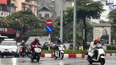
Inland, the northeast wind will be strong, reaching levels 2-3, and levels 3-4 in coastal areas. The provinces in Northern Vietnam, Thanh Hoa, and Nghe An will continue to experience cold weather, with mountainous areas experiencing freezing temperatures at night and in the morning.
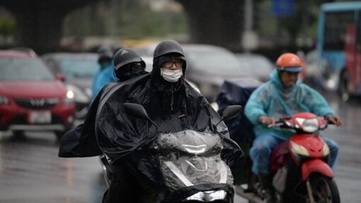
The National Center for Meteorological and Hydrological Forecasting predicts that the lowest temperatures during this period will generally be around 19-22 degrees Celsius, and in mountainous areas, it could drop below 17 degrees Celsius.
Hanoi is cold at night and in the early morning, with the lowest temperatures generally ranging from 19-21 degrees Celsius.
The meteorological agency warns that, due to the influence of a strengthening cold front combined with an upper-level easterly wind disturbance, the area from southern Quang Tri to Lam Dong will continue to experience moderate to heavy rain and thunderstorms, with some areas experiencing very heavy rain.
Currently, the National Center for Meteorological and Hydrological Forecasting has not made a specific prediction on when this cold spell will end.
Source: https://www.sggp.org.vn/ngay-mai-26-10-mien-bac-hung-them-dot-khong-khi-lanh-post819906.html


![[Image] Close-up of the newly discovered "sacred road" at My Son Sanctuary](/_next/image?url=https%3A%2F%2Fvphoto.vietnam.vn%2Fthumb%2F1200x675%2Fvietnam%2Fresource%2FIMAGE%2F2025%2F12%2F13%2F1765587881240_ndo_br_ms5-jpg.webp&w=3840&q=75)


Comment (0)