
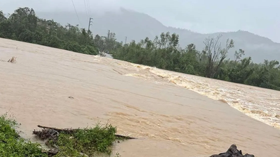
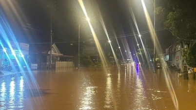
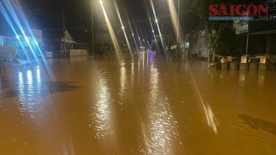
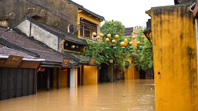
As of 8:00 a.m. on November 1, the water level on the Ngan Sau River at Chu Le station was 1,329 cm, 71 cm below alert level 3; the rainfall measured from 11:00 p.m. on October 29 to 7:00 a.m. on November 1 at Huong Khe Meteorological Station was 329.3 mm. Heavy rains in recent days have caused many roads, bridges and houses in the old Huong Khe district to be partially flooded.

In Huong Pho commune, 20 households were flooded, 6 cultural houses were flooded; DH 56 road, commune 01 axis and some roads through village 10, Bac Son village, Khoai Vac, Thach Thuong, Yen Thang, Pho Thinh, Pho Cuong, Thuong Hai, Chu Le... were flooded, causing local isolation.
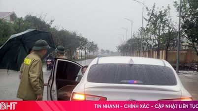
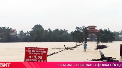
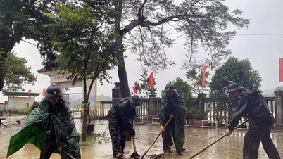
The flood avoidance route from Ho Chi Minh road (section through Huong Binh commune) to Tan Son village has sunk and cracked along a length of 46m, affecting people's travel.
 is flooded. Currently, the authorities and functional forces have put up signs prohibiting people and vehicles from passing.")
 on the morning of November 1.")
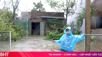
In Ha Linh commune, there is currently 1 household and 1 cultural house flooded. The whole commune has 22 roads partially flooded in villages 2, 4, 5, 7, 10, 12, Trung Thanh, Tan Ha, Thuong Son...

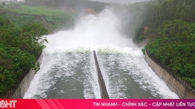
At Ho Ho Hydropower Plant, as of 7:00 a.m. on November 1, the upstream water level was 65.96 m; the downstream water level was 23.80 m. Water flow into the lake was 415 m 3 / s; water flow through the spillway: 383 m 3 / s; water flow through the machine: 32 m 3 / s. Currently, the upstream area is experiencing very heavy rain, and it is forecasted that water flow into the lake will increase rapidly in the coming hours.
Source: https://baohatinh.vn/nhieu-khu-vuc-mien-nui-ha-tinh-bi-ngap-cuc-bo-sat-lo-dat-post298542.html


![[Photo] Prime Minister Pham Minh Chinh chairs the second meeting of the Steering Committee on private economic development.](https://vphoto.vietnam.vn/thumb/1200x675/vietnam/resource/IMAGE/2025/11/01/1762006716873_dsc-9145-jpg.webp)


Comment (0)