
Put people's safety first
Faced with prolonged heavy rain, Chairman of the Provincial People's Committee Vo Trong Hai issued an urgent dispatch requesting relevant departments, branches, localities and businesses to focus on responding to floods.
The provincial chairman emphasized that the entire political system must get involved, be on duty 24/7, and not be subjective or negligent. Chairmen of the People's Committees of communes, wards, and towns must closely monitor the area, promptly direct the evacuation of people from dangerous areas, and take responsibility if human losses occur due to subjectivity.

The telegram requires localities along rivers, streams, low-lying areas and areas with high risk of landslides such as Son Kim 1, Son Kim 2, Ky Thuong, Vu Quang... to prepare emergency evacuation plans; arrange rescue forces and vehicles, ensure traffic safety, and strictly prohibit people and vehicles from passing through dangerous areas. Dam and dyke management units are assigned to closely monitor the development of rain and floods, operate flood discharge according to procedures, and absolutely not let it affect downstream areas. The health sector is fully prepared with medicines, equipment, and chemicals to treat the environment after floods and prevent disease outbreaks.
Chairman Vo Trong Hai requested to put people's safety first, mobilize maximum forces and means, and proactively take all measures to minimize damage caused by floods.
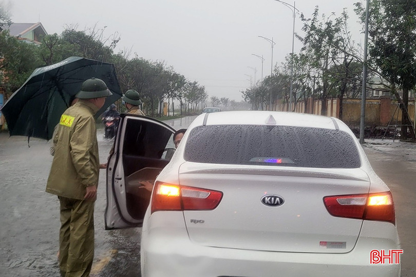
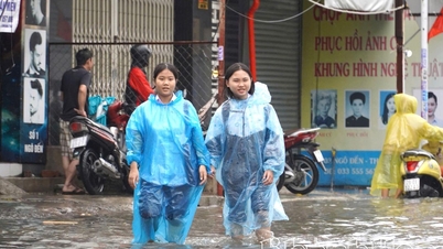
This morning, due to prolonged heavy rain, many roads in Thach Ha commune were deeply flooded, causing traffic jams. The commune police force quickly put up warning signs, organized traffic flow and guided vehicles, ensuring safety for people when passing through flooded areas.
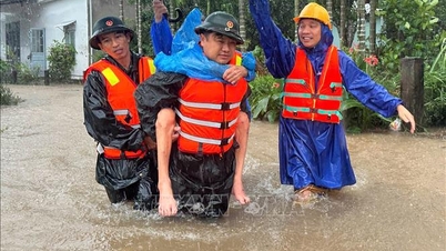
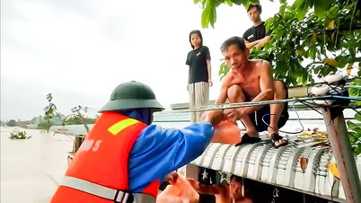
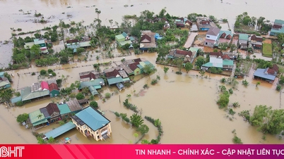
Cam Due proactively responded and evacuated more than 1,300 people from deep flooded areas.
By 8:00 a.m. on November 1, 2025, the entire Cam Due commune had evacuated 780 households with 1,375 people from flooded areas and areas at risk of landslides and flash floods. The commune mobilized 15 trucks, 3 excavators, 3 large motorboats, 67 village boats and hundreds of local boats, along with 500 life jackets, 100 raincoats, 100 flashlights, 3 generators, 28 chainsaws, 2,600 sacks, and 5,200 meters of rope to serve the rescue work.
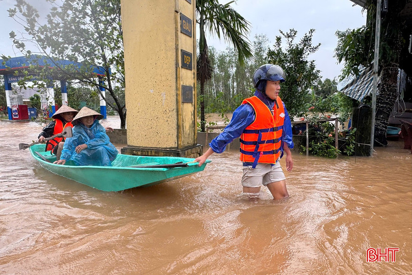
The military , police and shock troops with 450 people supported the people to raise their property and move to the cultural house and school safely. The logistics were also carefully prepared with 1,200 boxes of instant noodles, 1,200 boxes of mineral water, 600 boxes of dry food, and 3 food distribution points at the K6 gas station, the Commune Police Headquarters and the main canal slope of My Yen village.
Mr. Nguyen Van Nguyen, a resident of Cam Due commune, said: “The water rose very quickly, in just about 20 minutes it was nearly 50 cm deep. My family was assisted in moving to a higher house, and is temporarily safe.”
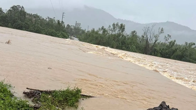
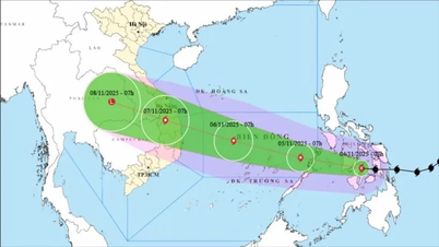
River water is rising, warning of widespread flooding
According to data recorded at 7:00 a.m. on November 1, the water level on Ngan Sau River at Chu Le station reached 13.28m (0.72m below alarm level 3), at Hoa Duyet station it was 7.51m (approximately alarm level 1). On Ngan Pho River at Son Diem station, the water level reached 8.21m (1.79m below alarm level 1). On La River at Linh Cam station, the water level was recorded at 1.92m (2.58m below alarm level 1).
 is flooded. Currently, the authorities and functional forces have put up signs prohibiting people and vehicles from passing.")
In the next 12 hours, floods on the upper reaches of the Ngan Sau River will continue to rise and are likely to reach alert level 3. In the next 12 to 24 hours, water levels may exceed alert level 3, while floods on the Ngan Pho and La rivers will also maintain an upward trend.
It is forecasted that by November 5, the flood peak on Ngan Pho River and the upper reaches of Ngan Sau River may be at alert level 3 and above, the lower reaches of Ngan Sau River at alert level 2, and La River at alert level 1 - alert level 2.
The provincial Hydrometeorological Station warned that prolonged heavy rains increase the risk of flash floods and landslides in mountainous areas, and deep flooding in low-lying areas and urban areas. People need to closely monitor warning bulletins and proactively respond. The level of natural disaster risk due to floods is determined at level 2.
Areas at high risk of flooding include:
Huong Do, Huong Pho, Ha Linh, Phuc Trach (Rao Tre village), Huong Khe, Huong Xuan, Huong Binh, Mai Hoa, Thuong Duc (Lien Hoa village); Vung Ang (Truong Yen, Truong Phu, Canh Truong, Tay Yen residential areas); Song Tri (residential area 3, Tan Ha residential area, area along Tri River embankment); Hoanh Son (Thang Loi, Lien Phu, Le Loi, Nhan Thang residential areas); Ky Anh, Ky Xuan, Ky Thuong, Ky Van (Sa Sa village), Hai Ninh (Bac Ha, Tan Thang residential areas), Ky Khang, Cam Trung (Dong Phong village), Cam Due, Cam Lac, Tran Phu ward, Ha Huy Tap, Cam Binh, Thach Xuan.
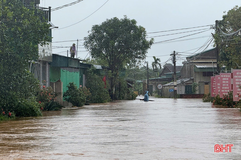
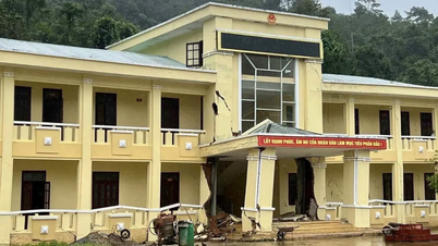
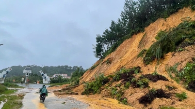
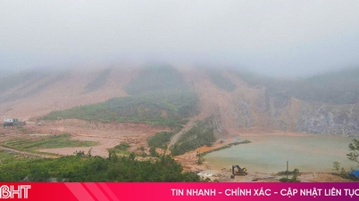
Many mountainous communes began to be deeply flooded.
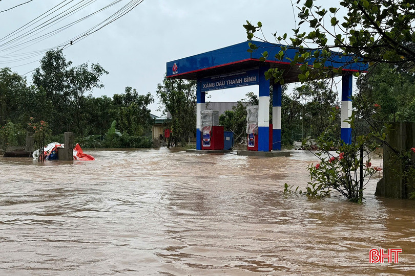
As of 8:00 a.m. on November 1, the water level on the Ngan Sau River at Chu Le station was 1,329 cm, 71 cm below alert level 3; the rainfall measured from 11:00 p.m. on October 29 to 7:00 a.m. on November 1 at Huong Khe Meteorological Station was 329.3 mm. Heavy rains in recent days have caused many roads, bridges and houses in the old Huong Khe district to be partially flooded.

In Huong Pho commune, 20 households were flooded, 6 cultural houses were flooded; DH 56 road, commune 01 axis and some roads through village 10, Bac Son village, Khoai Vac, Thach Thuong, Yen Thang, Pho Thinh, Pho Cuong, Thuong Hai, Chu Le... were flooded, causing local isolation.
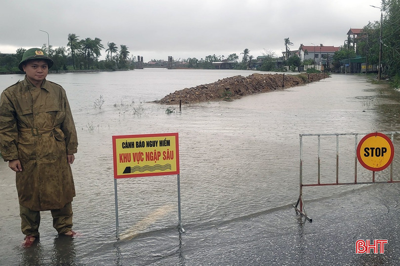
The flood avoidance route from Ho Chi Minh road (section through Huong Binh commune) to Tan Son village has sunk and cracked along a length of 46m, affecting people's travel.
 on the morning of November 1.")
In Ha Linh commune, there is currently 1 household and 1 cultural house flooded. The whole commune has 22 roads partially flooded in villages 2, 4, 5, 7, 10, 12, Trung Thanh, Tan Ha, Thuong Son...

At Ho Ho Hydropower Plant, as of 7:00 a.m. on November 1, the upstream water level was 65.96 m; the downstream water level was 23.80 m. Water flow into the lake was 415 m 3 / s; water flow through the spillway: 383 m 3 / s; water flow through the machine: 32 m 3 / s. Currently, the upstream area is experiencing very heavy rain, and it is forecasted that water flow into the lake will increase rapidly in the coming hours.
Source: https://baohatinh.vn/toan-canh-mua-lu-o-ha-tinh-nuoc-song-len-cao-canh-bao-ngap-lut-dien-rong-post298542.html

![[Photo] The road connecting Dong Nai with Ho Chi Minh City is still unfinished after 5 years of construction.](https://vphoto.vietnam.vn/thumb/1200x675/vietnam/resource/IMAGE/2025/11/04/1762241675985_ndo_br_dji-20251104104418-0635-d-resize-1295-jpg.webp)

![[Photo] Comrade Nguyen Duy Ngoc holds the position of Secretary of the Hanoi Party Committee](https://vphoto.vietnam.vn/thumb/1200x675/vietnam/resource/IMAGE/2025/11/04/1762234472658_a1-bnd-5518-8538-jpg.webp)
![[Photo] Ca Mau "struggling" to cope with the highest tide of the year, forecast to exceed alert level 3](https://vphoto.vietnam.vn/thumb/1200x675/vietnam/resource/IMAGE/2025/11/04/1762235371445_ndo_br_trieu-cuong-2-6486-jpg.webp)
![[Photo] Ho Chi Minh City Youth Take Action for a Cleaner Environment](https://vphoto.vietnam.vn/thumb/1200x675/vietnam/resource/IMAGE/2025/11/04/1762233574890_550816358-1108586934787014-6430522970717297480-n-1-jpg.webp)


Comment (0)