
The General Staff of the Vietnam People's Army; the general departments: Logistics - Engineering, Defense Industry, General Department II; military regions: 1, 2, 3, 4; Army Corps 12; military branches: Air Defense - Air Force, Navy; Border Guard; Vietnam Coast Guard; commands: Hanoi Capital, Artillery - Missile; military branches: Armored, Special Forces, Engineering, Chemical, Communications; army corps: 11, 12, 18, 19; Military Industry and Telecommunications Group ( Viettel ).
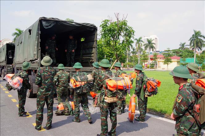
Implementing the Prime Minister 's Official Dispatch No. 171/CD-TTg dated September 23 on focusing on implementing storm response work for storm No. 9 (super storm Ragasa), to focus on responding to storm No. 9, ensuring safety of people's lives, minimizing damage to people's and State's property, the General Staff requests agencies and units to continue to thoroughly grasp and strictly implement the Prime Minister's Official Dispatch No. 170/CD-TTg dated September 22 on proactively responding to storm Ragasa; Official Dispatches: No. 5436/CD-TM, No. 5442/CD-TM dated September 22 of the General Staff on proactively responding to storm No. 9, not to be passive or surprised in any situation.
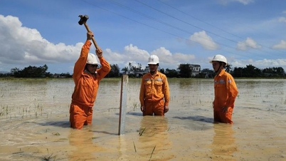
Agencies and units strictly maintain on-duty regime at all levels, grasp the weather, meteorological and hydrological situation, closely monitor the storm's developments; continue to organize vessel counting, promptly notify owners of vehicles and captains of vessels and boats operating at sea of the location, direction of movement and developments of the storm so that they can move to avoid, take shelter or not enter dangerous areas.
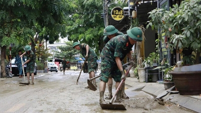
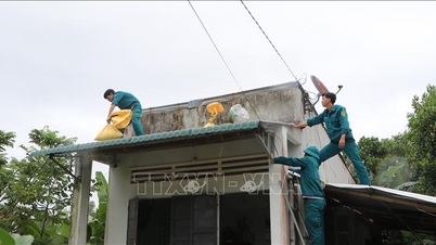
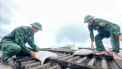
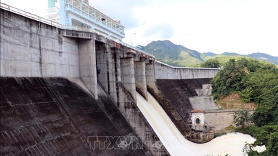
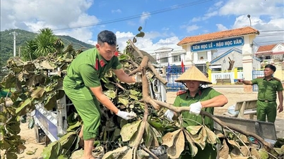
The General Staff reminded agencies and units to inspect and review key areas at risk of flash floods, landslides, riverbank and stream bank erosion, low-lying areas, and flooding; support people in reinforcing their houses, evacuating and moving people out of dangerous areas with the most determined spirit, proactively taking the highest level of response measures, anticipating the worst-case scenario, and prioritizing the goal of ensuring people's safety above all else.
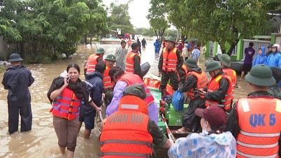
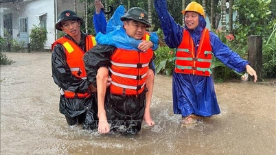
Military agencies and units mobilize forces and means to respond promptly and effectively to situations that arise and take the initiative in search and rescue work. The process of performing tasks must ensure the safety of people and vehicles. Units organize implementation and report to the General Staff through the Ministry's Command and the Department of Search and Rescue for monitoring and direction.
* According to the forecast of the National Center for Hydro-Meteorological Forecasting, at 4:00 p.m. on September 23, the center of the super storm was at about 20.6 degrees North latitude; 116.7 degrees East longitude, in the northeastern sea of the North East Sea area, the strongest wind near the center of the super storm was level 16 (184-201 km/h), gusting above level 17, moving in the West Northwest direction at a speed of about 20 km/h.
It is forecasted that by the morning of September 24, the storm will continue to maintain the intensity of a super typhoon (level 16-17), gusting above level 17, before gradually weakening. Early in the morning of September 25, the storm will move into the Gulf of Tonkin, the storm intensity in the Gulf of Tonkin will remain strong at level 11-12, gusting at level 14-15; on September 25, the storm will make landfall directly on the mainland of the Northern region of our country with strong winds of level 10-11, gusting above level 12-13 along the coast, level 8-9, gusting at level 10-11 on land.
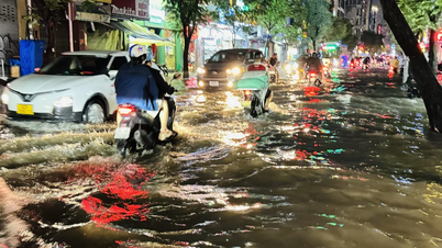
Super typhoon No. 9 has a very strong intensity at sea, a very wide range of strong winds, waves over 10m high, rough seas, especially dangerous for ships operating in the North East Sea area. The storm can cause heavy rain in the Northern provinces, Thanh Hoa, Nghe An with rainfall of about 150-250mm, locally over 400mm, risk of flash floods, landslides, affecting the safety of dams, flooding in urban areas and low-lying areas. Immediately after typhoon No. 9, there is a risk that typhoon No. 10 will continue to move into the East Sea, potentially directly impacting the sea and mainland of our country, affecting production activities at sea.
Source: https://baotintuc.vn/thoi-su/quan-doi-chu-dong-bien-phap-ung-pho-bao-so-9-o-muc-cao-nhat-20250923222634438.htm


![[Photo] Cutting hills to make way for people to travel on route 14E that suffered landslides](https://vphoto.vietnam.vn/thumb/1200x675/vietnam/resource/IMAGE/2025/11/08/1762599969318_ndo_br_thiet-ke-chua-co-ten-2025-11-08t154639923-png.webp)


![[Video] Hue Monuments reopen to welcome visitors](https://vphoto.vietnam.vn/thumb/402x226/vietnam/resource/IMAGE/2025/11/05/1762301089171_dung01-05-43-09still013-jpg.webp)


Comment (0)