
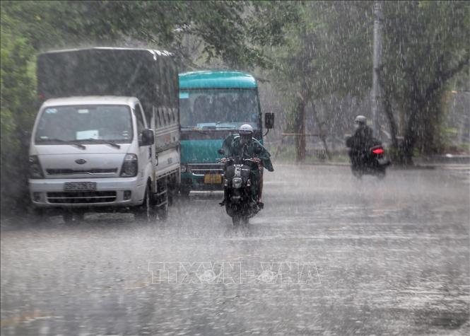
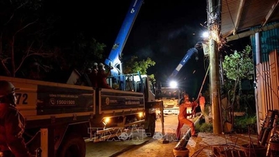
In Hanoi , the National Center for Hydro-Meteorological Forecasting forecasts that, through monitoring satellite images, thunderstorm positioning data and weather radar, convective clouds are developing and causing rain in Vinh Hung ward, Dinh Cong ward, Hoang Liet ward, Yen So ward, Kim Anh ward, Dai Mo ward, Thanh Tri, Dai Thanh, Ngoc Hoi ward, Kien Hung ward, Yen Nghia ward, Phu Luong ward, Son Dong, An Khanh, Duong Noi ward, Chuong My ward, Phu Nghia, Quang Bi, Tran Phu, Hoa Phu, Thanh Oai, Binh Minh, Tam Hung, Dan Hoa, Thuong Tin, Hong Van, Thuong Phuc, Chuong Duong, Phu Xuyen, Phuong Duc, Ung Thien, Phuc Son, the cloud area is moving and expanding to the inner city of Hanoi.
Warning, from now until about 6:30 p.m. on November 9, this cloud area will cause rain in the following wards/communes: Vinh Hung ward, Dinh Cong ward, Hoang Liet ward, Yen So ward, Kim Anh ward, Dai Mo ward, Thanh Tri ward, Dai Thanh ward, Ngoc Hoi ward, Kien Hung ward, Yen Nghia ward, Phu Luong ward, Son Dong ward, An Khanh ward, Duong Noi ward, Chuong My ward, Phu Nghia ward, Quang Bi ward, Tran Phu ward, Hoa Phu ward, Thanh Oai ward, Binh Minh ward, Tam Hung ward, Dan Hoa ward, Thuong Tin ward, Hong Van ward, Thuong Phuc ward, Chuong Duong ward, Phu Xuyen ward, Phuong Duc ward, Ung Thien ward, Phuc Son ward, etc., then it will spread to other wards/communes in Hanoi city center. During thunderstorms, there is a possibility of tornadoes, lightning and strong gusts of wind. Natural disaster risk level due to tornadoes, lightning and hail is level 1.
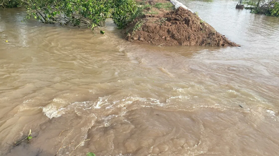
Risk of flash floods and landslides in Lam Dong
The National Center for Hydro-Meteorological Forecasting said that from 4:30 p.m. to 9:30 p.m. on November 9, Lam Dong province will continue to have rain with accumulated rainfall ranging from 10-30 mm, in some places over 60 mm. Warning of the risk of flash floods on small rivers and streams, landslides on steep slopes in the above province, especially in the following communes/wards: Bac Ruong, Bao Lam 1, Bao Lam 2, Bao Lam 3, Bao Lam 5, Da Huoai 2, Da Huoai 3, Dam Rong 1, Dinh Trang Thuong, Dinh Van Lam Ha, Hoa Bac, Kien Duc, Lac Duong, Nam Thanh, Nghi Duc, Ward 1 Bao Loc, Ward 2 Bao Loc, Ward 3 Bao Loc, B'Lao Ward, Xuan Truong Ward, Da Lat, Phuc Tho Lam Ha, Quang Tan, Quang Tin, Quang Truc, Ta Dung, Tan, Ha Lam Ha, Tuy Duc.
Level of natural disaster risk due to flash floods, landslides, land subsidence due to heavy rain or level 1 flow.
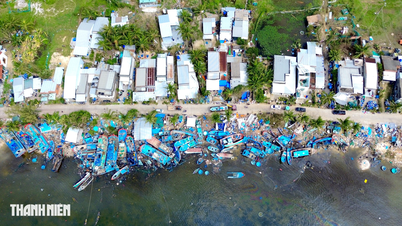
Flash floods and landslides can have very negative impacts on the environment, threaten people's lives; cause local traffic congestion, affect the movement of vehicles; destroy civil and economic works, causing damage to production and socio-economic activities.
The hydrometeorological agency recommends that local authorities pay attention to reviewing bottlenecks and vulnerable locations in the area to have prevention and response measures.
Beware of high tides in coastal areas of the North and Southeast
According to the National Center for Hydro-Meteorological Forecasting, as of 3:30 p.m. on November 9, the tide level in the Northern coastal area is at a high level. The highest tide peak at Hon Dau station (Hai Phong city) reached 4.05 m at 6:30 a.m. on November 9.
In the next 24-72 hours, water levels along the Northern coast tend to decrease slowly. The highest water level at Hon Dau is forecasted to reach 4.05m.
For the Southeast coastal area, it is forecasted that from November 10-11, the highest daily water level in the Eastern coast of the South will tend to decrease slowly, the highest daily tide peak at Vung Tau station is likely to reach 3.95 - 4m.
This is a high tide period, low-lying areas along the coast, along rivers, and areas outside the dike are likely to be flooded for 5-7 hours every day. High tides will slow down the flood drainage process on the river system in the area. People should pay attention in the evening and at night, be on guard against strong offshore currents when the tide recedes, which is dangerous for maritime activities and sea tourism, especially at ports and beaches. At the same time, high tides affect traffic, agricultural production, aquaculture, water pollution and people's lives in the eastern coastal area of the South.
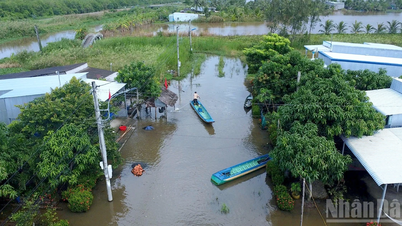
Flood on Krong Ana River peaks below alert level 2
The National Center for Hydro-Meteorological Forecasting warned that from 3:30 p.m. on November 9 to 3:30 a.m. on November 10, flood levels on the Krong Ana River will continue to rise slowly and are likely to peak below alert level 2.
In the next 24 hours, flood on Krong Ana River will slowly recede and stay below alert level 2.
Risk of flooding in low-lying areas along rivers and risk of landslides on slopes in Dak Lak province. Floods on rivers and in low-lying areas affect activities such as waterway transport, aquaculture, agricultural production, people's lives and socio-economic activities.
Weather in different regions on the night of November 9 and November 10
In the Northwest, there will be scattered showers and thunderstorms. Light wind. Lowest temperature 19-22 degrees Celsius, some places below 19 degrees Celsius. Highest temperature 24-27 degrees Celsius, some places above 27 degrees Celsius.
In the Northeast, there will be scattered showers and thunderstorms. Northeast to East wind level 2-3. Lowest temperature 21-24 degrees Celsius, in mountainous areas below 20 degrees Celsius. Highest temperature 25-28 degrees Celsius.
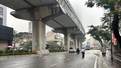
Hanoi has scattered showers and rain. Northeast to East wind level 2-3. Lowest temperature 21-23 degrees Celsius. Highest temperature 26-28 degrees Celsius.
From Thanh Hoa to Hue provinces and cities, the North will have scattered showers and thunderstorms; the South will have scattered showers and thunderstorms, with the possibility of tornadoes, lightning and strong gusts of wind. North to Northwest wind level 2-3. Lowest temperature 22-25 degrees Celsius. Highest temperature in the North 26-29 degrees Celsius, in the South 30-32 degrees Celsius.
The South Central Coast has scattered showers and thunderstorms at night, with the possibility of tornadoes, lightning, and strong gusts of wind during thunderstorms; sunny during the day. Lowest temperature 23-26 degrees Celsius, below 23 degrees Celsius in some places. Highest temperature 30-33 degrees Celsius.
In the late afternoon and at night, there will be showers and thunderstorms in some places in the Central Highlands, with the possibility of tornadoes, lightning and strong gusts of wind; sunny during the day. Lowest temperature 19-22 degrees Celsius. Highest temperature 27-30 degrees Celsius, some places above 30 degrees Celsius.
In the South, in the late afternoon and at night, there will be showers and thunderstorms in some places. During thunderstorms, there is a possibility of tornadoes, lightning and strong gusts of wind. Sunny day. Lowest temperature 23-26 degrees Celsius. Highest temperature 30-33 degrees Celsius.
Ho Chi Minh City in the late afternoon and night has showers and thunderstorms in some places, in thunderstorms there is a possibility of tornadoes, lightning and strong gusts of wind. Sunny day. Lowest temperature 24-26 degrees. Highest temperature 31-33 degrees.
Source: https://baotintuc.vn/xa-hoi/thoi-tiet-dem-911-nhieu-khu-vuc-co-mua-dong-de-phong-loc-set-va-gio-giat-manh-20251109180746321.htm


Comment (0)