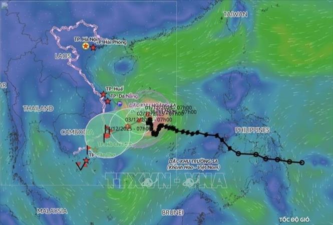
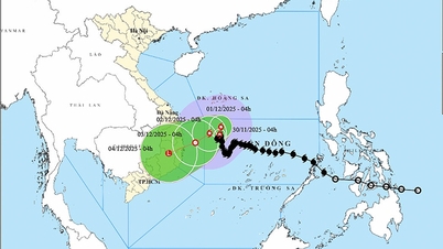
According to the National Center for Hydro-Meteorological Forecasting, at 10:00 a.m. on November 30, the center of the storm was located at about 14.1 degrees North latitude; 112.3 degrees East longitude, in the northwest sea area of the central East Sea. The strongest wind near the center of the storm was level 9 (75-88 km/h), gusting to level 11. Moving slowly in a northerly direction (at 7:00 a.m., north-northeast direction).
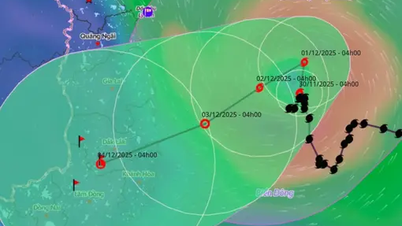
Forecast until 10:00 on December 1, the storm is in the northwest sea area of the central East Sea, about 300km east of the east coast of Gia Lai - Dak Lak province, moving north at a speed of about 3km/h. Wind strength gradually weakens, level 8-9, gusting to level 11. The affected area is the northwest sea area of the central East Sea; disaster risk level 3.
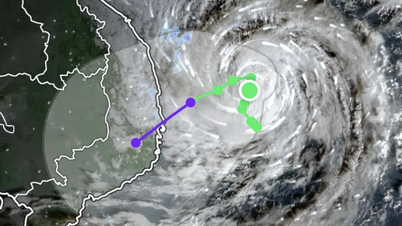
At 10:00 a.m. on December 2, the storm was in the northwest sea area of the central East Sea, about 200km east of the eastern coast of Gia Lai - Dak Lak provinces, moving southwest at a speed of about 5km/h and gradually weakening. The strongest wind was level 8, gusting to level 10. The affected area was the northwest sea area of the central East Sea; disaster risk level 3.
By 10:00 a.m. on December 3, the storm was moving west-southwest at a speed of about 5-7 km/h and continued to weaken. The strongest wind was level 6, gusting to level 8. The affected area was the northwest sea area in the central part of the East Sea, the sea off the coast of the provinces from Gia Lai to Khanh Hoa; disaster risk level 3.
From the next 72 to 96 hours, the tropical depression will move in the West Southwest direction at a speed of about 10km/h and continue to weaken.
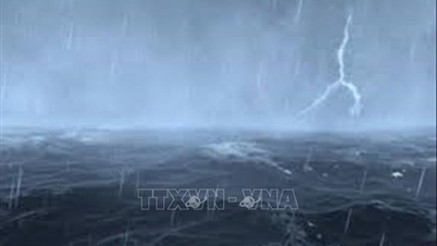
Due to the influence of the storm, the northwest sea area of the Central East Sea has strong winds of level 7; the area near the storm's eye has strong winds of level 8-9, gusting to level 11; waves 3-5m high, the area near the storm's eye 5-7m; very rough seas.
In addition, on the day and night of November 30, the Central East Sea area, the southern sea area of the Northern East Sea area (including Hoang Sa special zone), the sea area from Gia Lai to Khanh Hoa will have scattered showers and thunderstorms; in particular, the northwestern sea area of the Central East Sea area will have storms. During thunderstorms, there is a possibility of tornadoes and strong gusts of wind.
All vessels operating in the above areas are at high risk of being affected by strong winds and large waves. Coastal areas from Da Nang to Khanh Hoa should be on guard against high tides combined with large waves causing dikes, coastal roads and coastal landslides to overflow.
Source: https://baotintuc.vn/xa-hoi/bao-so-15-lai-doi-huong-di-chuyen-du-bao-suy-yeu-dan-20251130112313424.htm


![[Photo] Dan Mountain Ginseng, a precious gift from nature to Kinh Bac land](/_next/image?url=https%3A%2F%2Fvphoto.vietnam.vn%2Fthumb%2F1200x675%2Fvietnam%2Fresource%2FIMAGE%2F2025%2F11%2F30%2F1764493588163_ndo_br_anh-longform-jpg.webp&w=3840&q=75)










Comment (0)