
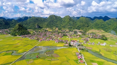
Along the Krong No River is the area of cultivated land of the people, mainly rice, coffee and vegetable fields. For many years, many agricultural areas have been seriously eroded. From 2013 to now, in Nam Ka and Ea R'bin communes (old Lak district), about 20 landslides have been recorded with an area of about 80 hectares, of which 7 are severe landslides, with some sections being over 500 meters long, causing many areas of people's productive land to be wiped out.
It was noted that along the riverbanks through the Krai, Buoc and Plao Sieng villages, many locations were deeply eroded, sweeping away not only the land but also the perennial crops. Ms. LTM (Krai village) said that her family has 2 hectares of coffee plantation along the Krong No riverbank. Every year, her family's production land area gradually narrows, up to now losing about 2,000 m2 due to landslides. Ms. M. and many other households have repeatedly petitioned the local authorities for solutions to support and prevent landslides. However, this situation has not been completely resolved, causing people here to live in constant anxiety when the rainy season comes.
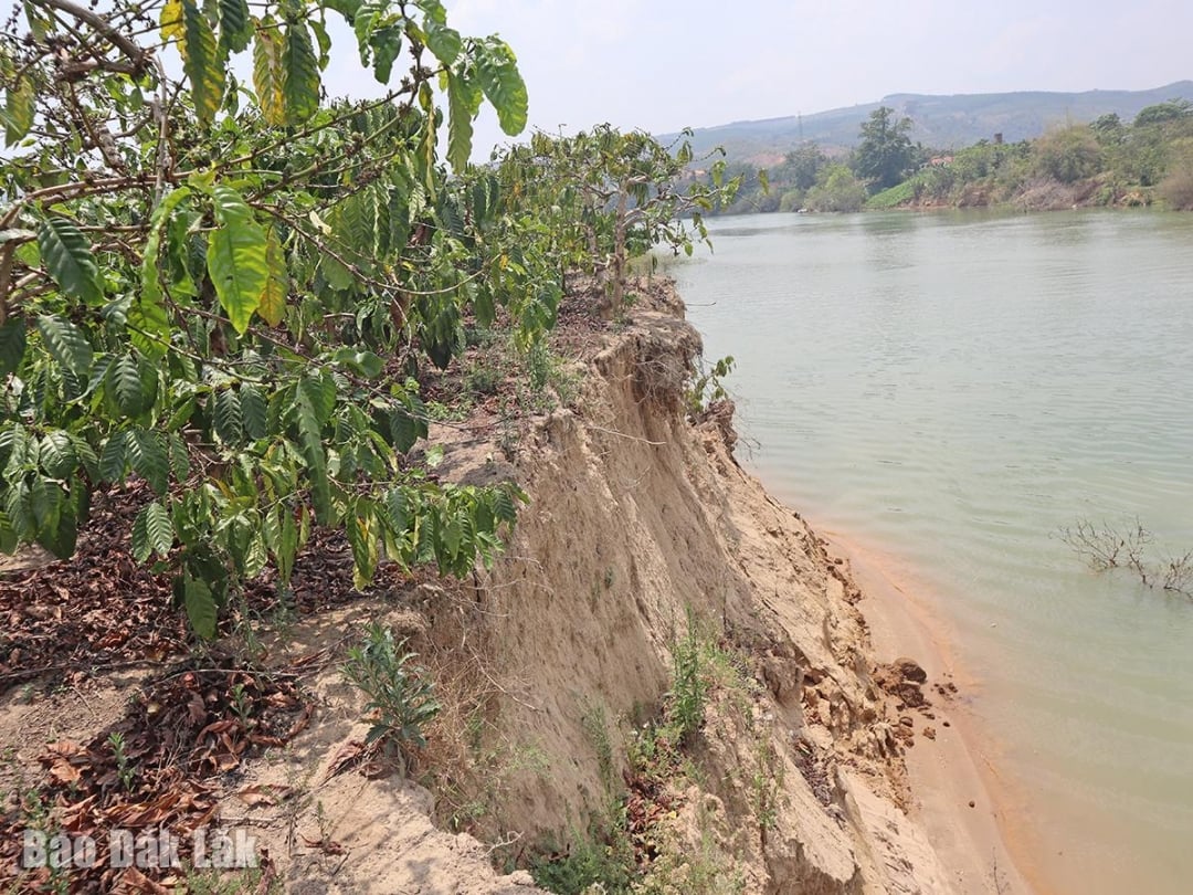 |
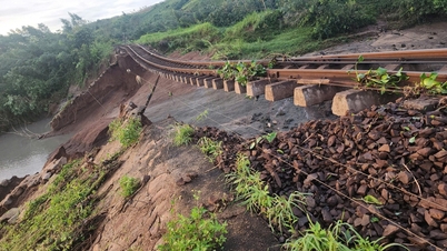
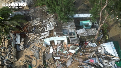
| Many areas of crops in Nam Ka commune were swept away by landslides. |
It is known that along the Krong No River, passing through Lam Dong and Dak Lak provinces, there are 11 licensed enterprises to explore and exploit sand. In addition to the impact of natural disasters, floods, geological structures, water discharge from hydropower plants and the impact of people in irrigation and production, there is also the cause of sand mining activities that have been going on for a long time.
According to the authorities, excessive sand mining, especially without strict compliance with the location and depth of mining according to the license, has seriously changed the hydrodynamics of the river, broken the natural structure of the riverbed and banks, leading to increasingly widespread and difficult-to-control erosion. Management and supervision of sand mining activities in this border area is becoming a big challenge for both localities.
Faced with the increasingly severe erosion of river banks, from 2022 to present, local authorities (Nam Ka commune and Ea R'bin commune of the old Lak district) have organized many inspections to propose solutions to prevent this situation.
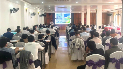
After merging and operating under the two-level local government model, Nam Ka commune has coordinated with the commune police to organize many patrols along the Krong No river through the Krai and Plao Sieng villages to continue to record the current situation and propose appropriate solutions. In early September, the local government also had a dialogue with households with landslides in the Krong No river basin (through the old Ea R'bin commune) to grasp the damage situation.
Recently, a working delegation of the Provincial People's Committee led by Vice Chairman Nguyen Thien Van also conducted a field inspection of the landslide situation along the banks of the Krong No River in Nam Ka Commune. After the inspection, the Dak Lak Provincial People's Committee sent a document to the Lam Dong Provincial People's Committee on coordination in handling the landslide situation along the banks of the Krong No River, the border section between the two provinces.
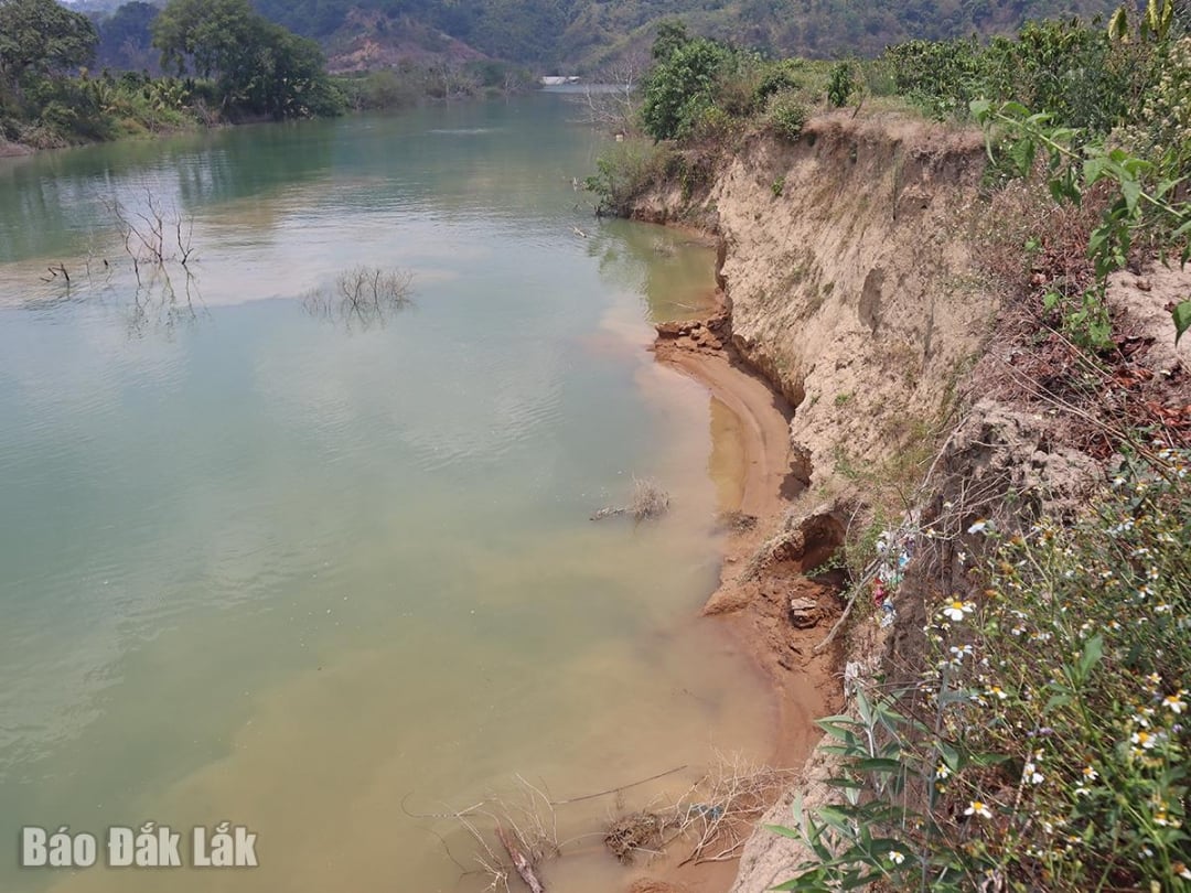 |
| The bank of the Krong No River through Nam Ka commune was deeply eroded due to landslides. |
Accordingly, Dak Lak province requested Lam Dong province to direct specialized agencies, local authorities and related units to organize inspections and determine the cause of landslides on the left bank of Krong No river, after Buon Tua Srah hydropower dam to the end of the main road of Nam Ka commune with a length of about 16 km (in Lam Dong province) for handling according to authority. At the same time, provide information on handling results so that Dak Lak Provincial People's Committee can know to serve the coordination of state management of land, minerals, water resources and environmental protection in the border area.
Regarding sand mining activities affecting river banks, the Department of Agriculture and Environment also issued Official Dispatch No. 01960/SNNMT-ĐCKS dated September 5, 2025 requesting Phu Binh Company Limited - Dak Lak Branch to stop mineral mining activities at the mine; close the mine, rehabilitate the environment and perform other related obligations according to regulations.
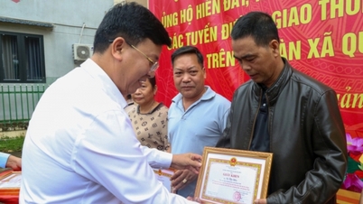
On the local government side, Mr. Nguyen Chi Luan, Chairman of Nam Ka Commune People's Committee, said that the commune has submitted a document to the superiors proposing a plan to build 3 embankment projects to prevent landslides along the Krong No River with a length of 3,620 m. Specifically, the urgent project to handle embankment projects to prevent landslides along the Krong No River bank through Krai village, the project to build embankment projects to prevent landslides from Nam Ka bridge to the middle of Krai village and the project to build embankment projects to prevent landslides from Ea R'bin 1 pumping station to Nam Ka commune suspension bridge through Plao Sieng village.
Source: https://baodaklak.vn/kinh-te/202511/can-giai-phap-cap-bach-ngan-chan-sat-lo-song-krong-no-ee200dd/


![[Photo] Da Nang: Hundreds of people join hands to clean up a vital tourist route after storm No. 13](https://vphoto.vietnam.vn/thumb/1200x675/vietnam/resource/IMAGE/2025/11/07/1762491638903_image-3-1353-jpg.webp)


Comment (0)