
Where are the fertile, bountiful fields now?
In October, as the heavy rains considered the end of the season subsided, the Krông Nô riverbanks were nearing the end of their major erosion season compared to last year. At the 100-hectare Đắk Rền field along the river in Nâm Nung commune, which locals consider the rice pot that has sustained generations, the river continues to swallow up the land.
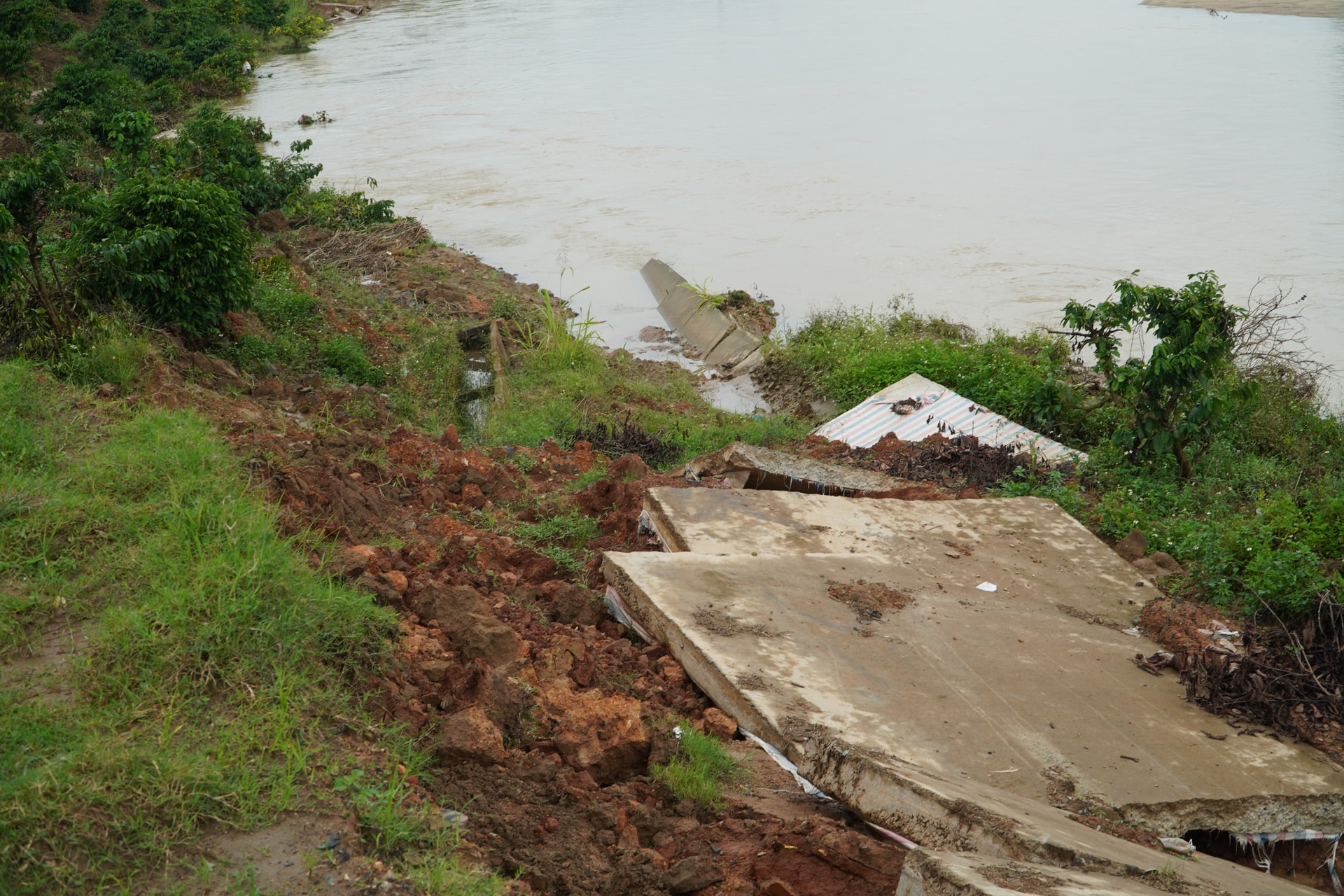
The traces of the landslide are still fresh. Lush green coffee plants have been dragged down into the river, some clinging to the edge of the cliff, others gradually disappearing beneath the muddy water of the rainy season. This image reminds me of 2023, at this same time, when the villagers' farmland was still far away, now covered by the river. Currently, this once peaceful riverbank has an inverted arc shape. That shape, those jagged edges along the bank, seem to denounce how the Krông Nô River has eroded the fertile land of the villagers.
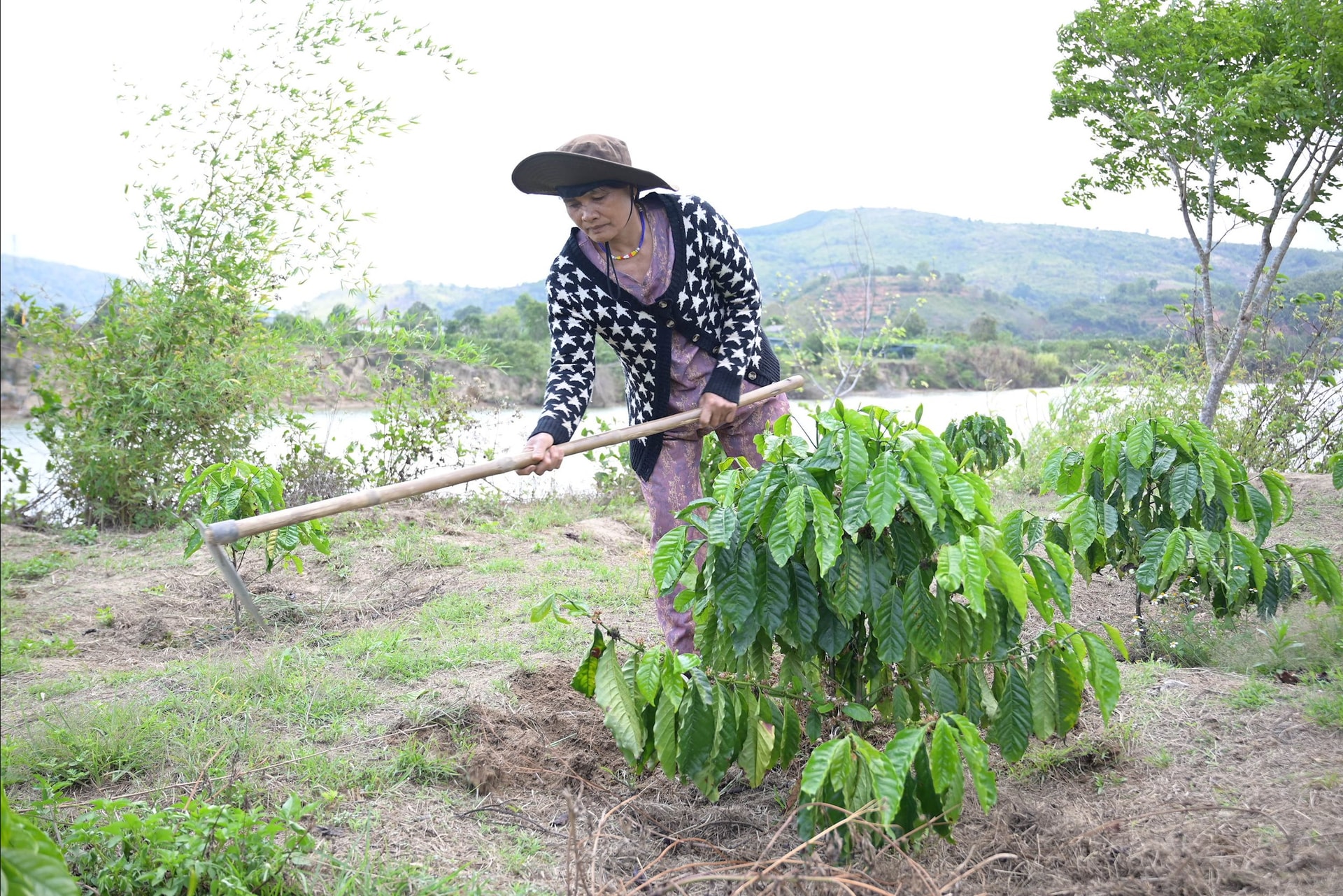
Mr. Ban Van Phan, from Quang Ha village, has lived and worked on this land for decades. At over 50 years old, he vividly remembers the alluvial land along the riverbank, a gift from Mother Nature, that has sustained his family and generations. From an initial 3 sao (1 sao = 1,000 m²) of land planted with coffee trees along the river, his family now owns only about 1 sao. He feels heartbroken at the sight of the once peaceful river becoming increasingly turbulent.
He recalled events that occurred nearly 10 years ago. From losing a small amount of land, the riverbank erosion has become increasingly severe in recent years. This year, even the road leading to his and many other families' production areas has been damaged by landslides, preventing large vehicles from reaching the area. Meanwhile, the coffee plants are now bearing ripe fruit. Therefore, for the past few days, he and other families with ripe coffee have had to carry sacks of their harvest across the landslide-affected sections to load them onto trucks. The hardship ahead, coupled with the worry about the expanding and worsening landslides, and the uncertainty of how to remedy them, has left his already weathered face even more gaunt.
Mr. Ban lamented, "The land is eroding about 2-3 meters from the water's surface, and the sand is weak, so we can't use manual methods like fences or barriers to protect our land. We're helpless and can only watch as the river gradually swallows our land."
Leaving Nâm Nung commune with a feeling of helplessness, and following the villagers' reports, we went to Quảng Phú commune. In Phú Lợi village, where serious riverbank erosion has been recorded, we met Mrs. H'Trong, one of the 20 households whose agricultural land was lost due to the erosion. Mrs. H'Trong belongs to an ethnic minority group, has lived in the area since 1982, and cultivated 5 sao (approximately 0.5 hectares) of land for various crops. However, from 2020 to the present, the land bordering the river has been continuously eroded, sweeping away hundreds of crops and more than 1 sao of her land into the river. Mrs. H'Trong choked up: "For farmers, land is their biggest asset, and when it's gradually lost, I don't know where to turn to survive. I'm in so much pain; losing my land is like losing a close relative."
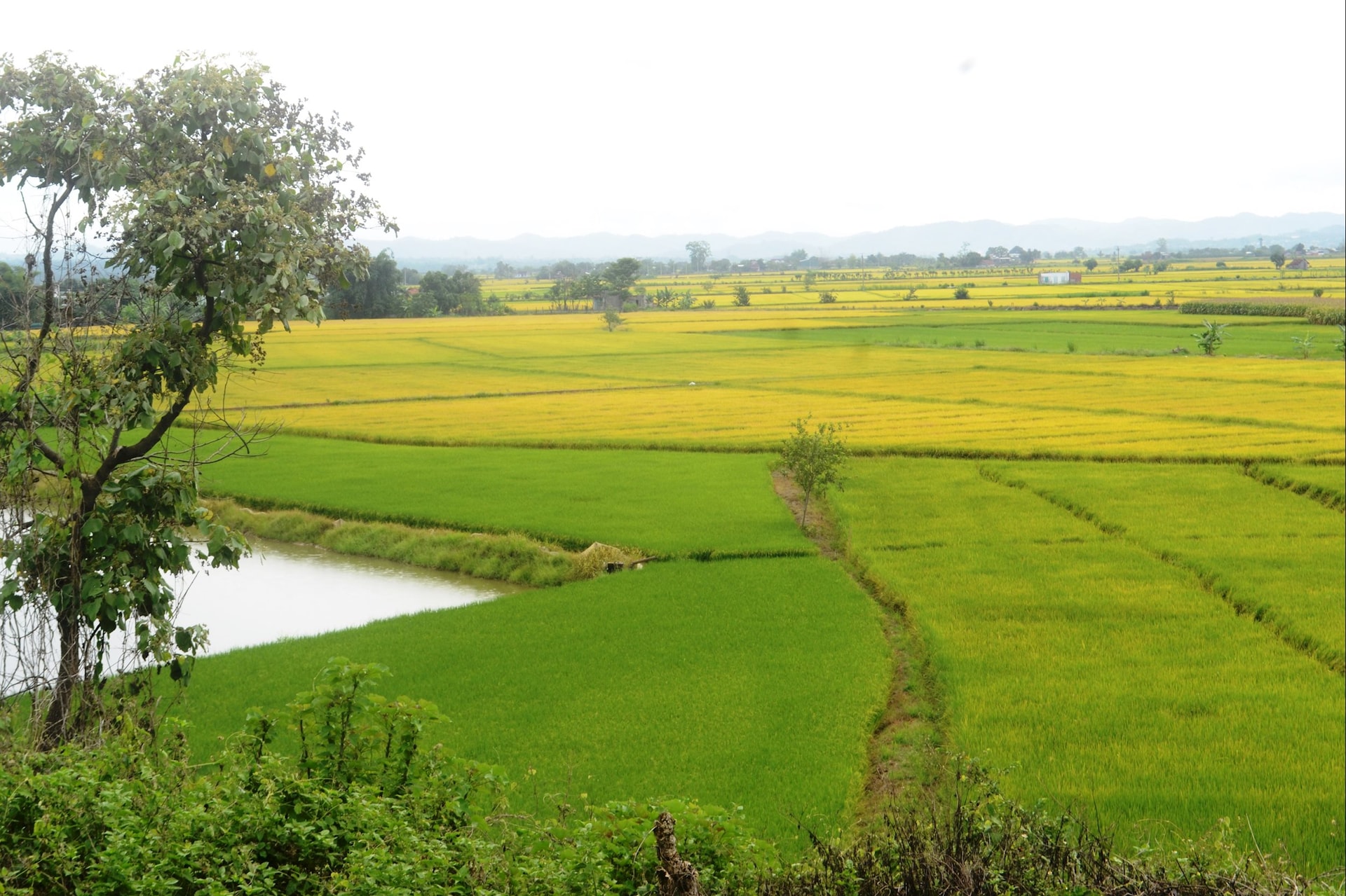
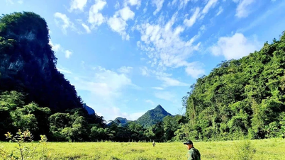
The sorrow intensifies as all the people with land along the riverbanks are increasingly fearful, asking themselves: why? The Krông Nô River was once considered a gentle river, annually depositing alluvial soil on the fields on both banks. Many fields, such as Đắk Rền and Buôn Choáh, could be described as fertile land, providing a stable livelihood for thousands of households. Moreover, thanks to the fertile land, people along the river have been able to prosper by growing some of the world's finest corn, potatoes, and rice, such as in Buôn Choáh commune with its VietGAP-certified rice fields producing ST24 and ST25 varieties. However, for the past 10 years, the river has silently changed, and in recent years has become ferocious, threatening the lives and livelihoods of the people.
The fundamental solution is a pressing issue.
The Krông Nô River originates from the Chư Yang Sin mountain range (Đắk Lắk province), at an altitude of over 2,000 meters. It flows westward through valleys before turning northward and merging with the Krông Ana River. The river is 189 km long and crosses the border of two provinces: Lâm Đồng and Đắk Lắk . Approximately 53.3 km of the river flows through the communes of Quảng Phú, Nâm Nung, and Nam Đà (bordering Đắk Lắk province).
Now, all three communes are facing the wrath of the Krông Nô River. According to Mr. Nguyễn Văn Cường, head of the Economic Department of Nâm Nung commune, who accompanied us, the section of the Krông Nô River flowing through Nâm Nung commune is approximately 14 km long and currently has 11 landslide points, including 3 severely affected ones. Since 2023 alone, nearly 1,000 meters of concrete road along the riverbank have been washed away. “In early 2025 alone, more than 300 meters of road in the Dak Ren rice fields collapsed into the river, paralyzing transportation and agricultural product delivery. Nearly 500 meters of irrigation canals were also damaged, with many sections completely disappearing, making irrigation difficult. Several pumping stations along the river were also affected, potentially resulting in losses of billions of dong. Dozens of hectares of agricultural land and crops were completely lost to the floodwaters. The local authorities are very worried about the increasingly serious riverbank erosion,” Mr. Nguyen Van Cuong said as if he knew the story by heart.
Understandably, this is a constant concern for the communes located along the river. For example, during the 2025 rainy season, due to several prolonged heavy rains, erosion continued to encroach further, directly threatening water pumping stations (serving irrigation during the dry season) and power lines along the river, posing a potential risk to infrastructure and people's land. There are no specific statistics on the damage from riverbank erosion along the Krông Nô River in various localities during the 2025 rainy season. To date, we have preliminarily recorded 21 different erosion points, with a total length of over 9 km.
During a recent working visit to the Standing Committee of the Party Committee of Nâm Nung and Quảng Phú communes, Comrade Lưu Văn Trung - Deputy Secretary of the Provincial Party Committee - personally inspected the landslide sites. The causes of riverbank erosion were identified by relevant departments as weak geological conditions, changes in water flow due to the operation of hydropower plants upstream, and excessive sand mining that lowered the riverbed. Furthermore, climate change also played a role…
It wasn't until now, when riverbank erosion reached alarming levels, that the departments, agencies, and the Provincial People's Committee, along with relevant units including upstream hydropower management units and the Dak Lak Provincial People's Committee, implemented several measures such as constructing some sections of embankment and strictly managing illegal exploitation. However, reality shows that these measures are like a drop in the ocean, failing to address the core issue. Evidence shows that riverbank erosion continues and is becoming increasingly serious.
I remember the pensive faces of the commune officials who led us on the field trip that day, when someone wondered: couldn't this river be managed like other rivers in the province? The La Nga River and the Luy River in the southeastern part of the province also have hydroelectric power plants at their headwaters, and after management, the water resources have brought many benefits to agricultural production and other economic sectors.
On the way home, I kept thinking about the solution that the commune officials and people suggested: the province needs to hold in-depth workshops, mobilizing the participation of agencies, units, and leading experts to find the root causes and develop comprehensive, effective solutions.
Source: https://baolamdong.vn/su-gian-du-cua-song-krong-no-397778.html


![[Photo] The General Secretary, President and his wife begin their state visit to the Philippines.](https://vphoto.vietnam.vn/thumb/1200x675/vietnam/resource/IMAGE/2026/05/31/1780230559452_anh-man-hinh-2026-05-31-luc-19-28-11.png)
![[Image] Hanoi Police officially crowned champions of V-League 2025/2026](https://vphoto.vietnam.vn/thumb/1200x675/vietnam/resource/IMAGE/2026/05/31/1780244769054_ndo_br_039d561b692be875b13a-jpg.webp)


![[Video] Sunset at Lap An Lagoon – Where the sun sets over the fishing nets](https://vphoto.vietnam.vn/thumb/340x192/vietnam/resource/IMAGE/2026/05/31/1780192137701_beach-landscape-sea-water-nature-grass-745871-pxhere-com.jpeg)


![[Photo] Admire the coral "masterpiece" amidst the million-year-old heritage of Dak Lak province.](https://vphoto.vietnam.vn/thumb/1200x675/vietnam/resource/IMAGE/2026/05/31/1780221235105_anh-man-hinh-2026-05-31-luc-16-53-27.png)

![[Photo] Solemn bathing ceremony and Buddha procession in Hue](https://vphoto.vietnam.vn/thumb/1200x675/vietnam/resource/IMAGE/2026/05/31/1780228263543_1-jpg.webp)


Comment (0)