
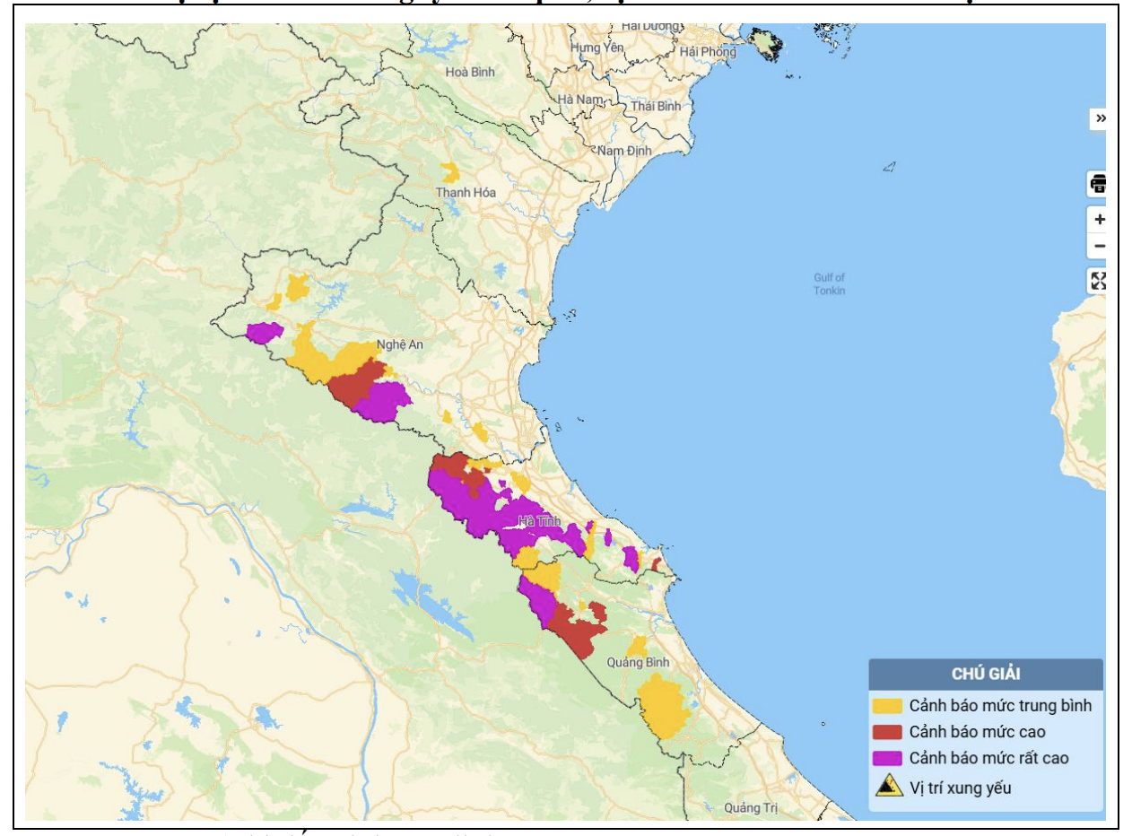
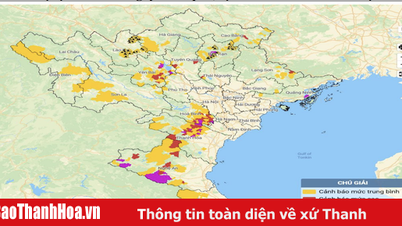
Map of flash flood and landslide risk in the areas.
In 24 hours (from 7:00 a.m. on May 24 to 7:00 a.m. on May 25), the provinces from Thanh Hoa to Quang Binh had moderate rain, heavy rain, and some places had very heavy rain such as: Thuong Song Tri Lake 599mm, Ke Go Lake 506mm ( Ha Tinh ); Mon Son 151.6mm (Nghe An); Giao An 55.6mm (Thanh Hoa); Trong Hoa 144.6mm (Quang Binh)...
Soil moisture models show that some areas in the above provinces are close to saturation (over 85%) or have reached saturation.
Warning: In the next 3-6 hours, the above provinces will continue to have rain with the following common rainfall: from Nghe An to Quang Binh from 10-25mm, some places over 50mm; Thanh Hoa from 5-10mm, some places over 20mm.
In the next 6 hours, there is a risk of flash floods on small rivers and streams, landslides on steep slopes in the districts of Lang Chanh (Thanh Hoa); Con Cuong, Ky Son, Thanh Chuong, Tuong Duong (Nghe An); Cam Xuyen, Can Loc, Duc Tho, Huong Khe, Huong Son, Ky Anh, Ky Anh Town, Vu Quang (Ha Tinh); Bo Trach, Minh Hoa, Quang Ninh, Tuyen Hoa ( Quang Binh ).
Warning level of natural disaster risk due to flash floods, landslides, land subsidence due to heavy rain or water flow: Level 1, Ha Tinh level 2.
TS
Source: https://baothanhhoa.vn/canh-bao-lu-quet-sat-lo-dat-khu-vuc-huyen-lang-chanh-249844.htm
![[Photo] Prime Minister Pham Minh Chinh meets the Vietnamese community in Malaysia](https://vphoto.vietnam.vn/thumb/1200x675/vietnam/resource/IMAGE/2025/5/25/1f11d1256d7745a2a22cc65781f53fdc)
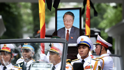
![[Photo] Memorial service for former President Tran Duc Luong in Ho Chi Minh City](https://vphoto.vietnam.vn/thumb/1200x675/vietnam/resource/IMAGE/2025/5/25/c3eb4210a5f24b6493780548c00e59a1)


![[Photo] President Luong Cuong receives Lao Vice President Pany Yathotou](https://vphoto.vietnam.vn/thumb/1200x675/vietnam/resource/IMAGE/2025/5/25/958c0c66375f48269e277c8e1e7f1545)
![[Photo] President Luong Cuong receives Vice President of the Cambodian People's Party Men Sam An](https://vphoto.vietnam.vn/thumb/1200x675/vietnam/resource/IMAGE/2025/5/25/6f327406164b403a8e36e8ce9d3b2ad2)


Comment (0)