
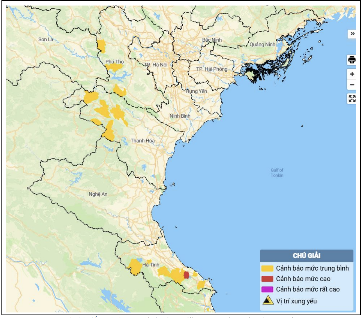
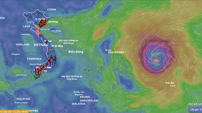
Map of flash flood and landslide risks in the areas (Details at the link: http://luquetsatlo.nchmf.gov.vn)
Accordingly, in 2 hours (from 12:00 to 14:00) on July 26, the areas of Phu Tho, Thanh Hoa and Ha Tinh provinces had moderate to heavy rain. The soil moisture model showed that some areas were nearly saturated (over 85%) or reached a saturated state.
It is forecasted that in the next 3-6 hours, the above provinces will continue to have rain with accumulated rainfall ranging from 20-40mm, in some places over 70mm.
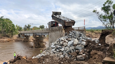
In the next 6 hours, there is a risk of flash floods on small rivers and streams, landslides on steep slopes in many communes and wards; including Thanh Hoa province including 14 communes: Ba Thuoc, Bat Mot, Dong Luong, Hoi Xuan, Muong Ly, Nam Xuan, Quan Son, Tam Thanh, Thien Phu, Thiet Ong, Trung Ha, Trung Ly, Van Nho, Yen Khuong.
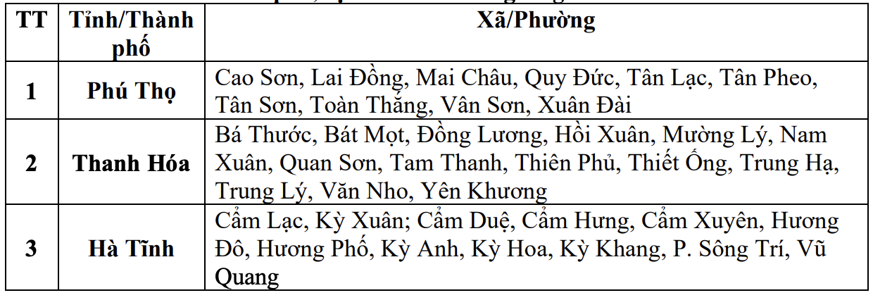
List of areas at risk of flash floods and landslides in the next 6 hours.
Level of natural disaster risk due to flash floods, landslides, land subsidence due to rain, floods or water flow: Level 1.
The Center for Hydro-Meteorological Forecasting warns that flash floods and landslides can have a very negative impact on the environment, threaten people's lives; destroy structures, and cause damage to production activities. Therefore, this agency recommends that local authorities pay attention to reviewing bottlenecks and vulnerable locations in the area to take preventive and response measures.
NDS
Source: https://baothanhhoa.vn/canh-bao-lu-quet-sat-lo-dat-tai-14-xa-trong-6-gio-toi-256089.htm
![[Photo] Heavy damage after storm No. 13 in Song Cau ward, Dak Lak province](https://vphoto.vietnam.vn/thumb/1200x675/vietnam/resource/IMAGE/2025/11/08/1762574759594_img-0541-7441-jpg.webp)


![[E-Magazine]: Winter comes, calling love back](https://vphoto.vietnam.vn/thumb/402x226/vietnam/resource/IMAGE/2025/11/07/1762519247877_e-magazine-dong-w1200t0-di2544d199d5163001t11920l1-v-128.webp)


![[Video] Hue Monuments reopen to welcome visitors](https://vphoto.vietnam.vn/thumb/402x226/vietnam/resource/IMAGE/2025/11/05/1762301089171_dung01-05-43-09still013-jpg.webp)


Comment (0)