
According to the Southern Institute of Water Resources Science , the average total rainfall in the Ca Mau peninsula area in May 2025 was 50-110mm, mainly concentrated in the western coastal areas. Some areas experienced rainfall exceeding 200mm, such as An Bien - Kien Giang (315mm), U Minh (257mm), and Thoi Binh - Ca Mau (237mm).
In June 2025, two periods of high tides are predicted to be 13-38cm higher than the multi-year average. Specifically:
Phase 1 (June 12-14): On the West Sea side, the highest tide peaks were at Song Doc station (0.80m) and Xeo Ro station (0.60m); on the East Sea side, the highest tide peaks were at Ganh Hao station (1.87m) and at Tran De station (1.60m).
Phase 2 (June 24-26): On the West Sea side, the highest tide peaks at Song Doc station were 0.92m and at Xeo Ro station were 0.86m; on the East Sea side, the highest tide peaks at Ganh Hao station were 1.98m and at Tran De station were 1.69m… Notably, in the Cai Lon river mouth area, the tide peaks during this phase were equivalent to the highest tide peaks in May. However, the lower tides were higher, making drainage difficult. If combined with strong southwest monsoon winds, the water level could rise higher than predicted, potentially causing localized flooding in some areas along the Cai Lon river that are not yet sufficiently protected by embankments.
According to the Department of Agriculture and Environment of Bac Lieu province, during the rainy season (from June to November), combined with high tides, flooding often occurs, especially in rice-growing areas. Statistics from the past 10 years (2015-2025) show that flooding has damaged 20,494 hectares of rice fields.
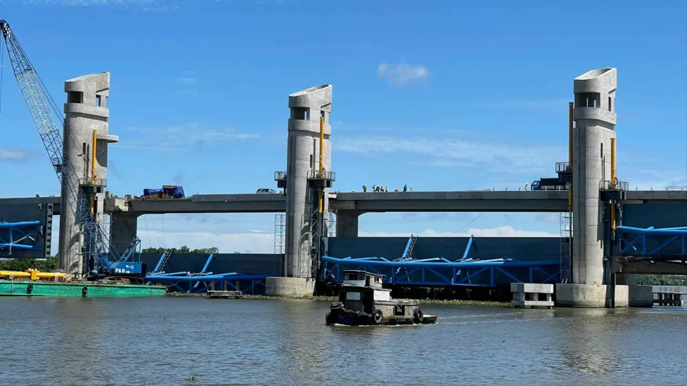
 plays a crucial role in regulating salinity levels in the Ca Mau peninsula region.")
The Southern Institute of Water Resources Science recommends that the Cai Lon - Cai Be and Xeo Ro sluice gates (Kien Giang province) need close coordination with management and operation units and local authorities in the region for operation. It is requested that the Southern Water Resources Exploitation Company Limited - Mekong Delta branch continue to closely monitor tidal surges, water levels, and the actual operation of the cluster of structures belonging to the Quan Lo Phung Hiep system to coordinate water control and drainage support within the system.
Source: https://www.sggp.org.vn/dbscl-canh-bao-ngap-ung-do-trieu-cuong-dang-cao-post797580.html


Comment (0)