

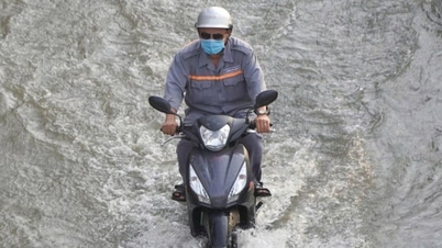
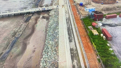
More than 300 sluices and dams in the system are operated synchronously to control water levels, protect production and people's lives. Photo: Trong Linh.
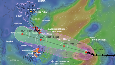
According to the Ca Mau Province Hydrometeorological Station, from November 3 to 12, 2025, a new high tide will appear in the East Sea, the full moon of the 9th lunar month with very strong intensity, tidal amplitude from 3.0 - 4.3 m, the peak tide can exceed alarm level 3 by 20 - 35 cm. The highest water level was recorded at the Ganh Hao hydrological station, with high tide times around 1:30, 9:30, 11:30, 14:30 and 17:00 every day. The Hydrometeorological Station warned that this is one of the highest high tides of the year, possibly higher than the late August and early September of the previous lunar month, with the risk level of natural disasters due to flooding at level 2.
In response to the above developments, Mr. Nguyen Thanh Tung, Head of the Irrigation Department of Ca Mau province, said: The unit has directed the closure of the entire sluice system along the East Sea, along Highway 1 and the dividing sluices to prevent the tide from rising deep into the fields and the central suburbs of Ca Mau. At the same time, more than 300 sluices and dams in the system are operated synchronously to control water levels, protect production and people's lives.
“In addition to operating the sluice, we also directed our affiliated units to increase pumping and drainage 24/7 for areas with closed dikes, ensuring quick drainage when the tide recedes, minimizing damage to people,” informed Mr. Nguyen Thanh Tung.

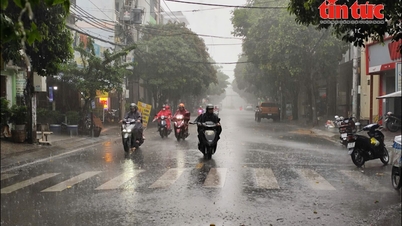
Some sections of National Highway 1A in Ca Mau province were flooded on a large scale. Photo: Trong Linh.
According to Mr. Tung, the Center for Management and Exploitation of Irrigation Works is assigned to be on duty 24/7, closely coordinating with local authorities to monitor tidal developments, and be ready to open sluices when the water recedes to regulate and balance the water level in the fields.
In addition to specialized solutions, the Department of Irrigation of Ca Mau province recommends that people, especially in coastal areas, riverside areas, and low-lying areas, should proactively reinforce embankments, dykes, and residential culverts and raise them high, moving easily damaged assets to safe places. People should not travel or exploit aquatic products along rivers and coastal areas when the water level is high and the current is strong, to avoid risks from landslides, flooding, and rapids.
For the central inner city area of Ca Mau, where there are many low-lying areas, the drainage system is being operated at maximum capacity to limit deep flooding. Authorities recommend that people turn off electricity in low-lying areas and check the civil electrical system to prevent leakage and short circuit when water floods into the house.
In particular, during November 6-8, 2025 (ie September 17-19 of the lunar calendar), which is forecast to be the time of the highest tide peak, people need to limit movement in the early morning and late afternoon, regularly update warning bulletins of the Hydrometeorological Station and local authorities to promptly respond.

Farmers proactively pump water to protect the autumn-winter rice crop. Photo: Trong Linh.
Along with the initiative of the professional sector, the authorities of the East-West coastal localities, the downstream areas of Ganh Hao, Phung Hiep, Ong Doc, Cai Tau rivers... have deployed forces on duty at sluices and pumping stations, ensuring the safe operation of the entire irrigation system, serving the work of responding to high tides and protecting year-end crop production.
According to forecasts, localized flooding may occur in wards and communes in the East of Ca Mau, some riverside residential areas in Cai Nuoc, Dam Doi, Nam Can, Ngoc Hien... which are directly affected by the East Sea tide. These localities are actively implementing the "four on-site" plan, mobilizing local forces, vehicles, materials and being ready to support people in case of incidents.
Ca Mau is one of the provinces with the densest network of rivers and canals and the longest coastline in the country (more than 300km), so the impact of high tides, waves and climate change is increasingly severe. Disaster prevention, especially responding to high tides combined with heavy rain in the region, is always identified by the Irrigation sector as a key task to ensure people's safety, stabilize production and minimize damage.
Source: https://nongnghiepmoitruong.vn/dong-toan-bo-he-thong-cong-dap-ngan-trieu-cuong-ram-thang-9-d781987.html
![[Photo] Ho Chi Minh City Youth Take Action for a Cleaner Environment](https://vphoto.vietnam.vn/thumb/1200x675/vietnam/resource/IMAGE/2025/11/04/1762233574890_550816358-1108586934787014-6430522970717297480-n-1-jpg.webp)
![[Photo] The road connecting Dong Nai with Ho Chi Minh City is still unfinished after 5 years of construction.](https://vphoto.vietnam.vn/thumb/1200x675/vietnam/resource/IMAGE/2025/11/04/1762241675985_ndo_br_dji-20251104104418-0635-d-resize-1295-jpg.webp)

![[Photo] Panorama of the Patriotic Emulation Congress of Nhan Dan Newspaper for the period 2025-2030](https://vphoto.vietnam.vn/thumb/1200x675/vietnam/resource/IMAGE/2025/11/04/1762252775462_ndo_br_dhthiduayeuncbaond-6125-jpg.webp)

![[Photo] Ca Mau "struggling" to cope with the highest tide of the year, forecast to exceed alert level 3](https://vphoto.vietnam.vn/thumb/1200x675/vietnam/resource/IMAGE/2025/11/04/1762235371445_ndo_br_trieu-cuong-2-6486-jpg.webp)


![From working for hire to becoming a boss: [Lesson 5] Sending - learning - returning - creating](https://vphoto.vietnam.vn/thumb/402x226/vietnam/resource/IMAGE/2025/11/05/1762297489528_1546-anh-3-072934_320.jpeg)


Comment (0)