
At 4:00 a.m. on November 5, the storm center was expected to be at about 11.4 degrees North latitude; 119.4 degrees East longitude, about 560 km east of Song Tu Tay Island. The strongest wind near the storm center was level 13 (134 - 149 km/h), gusting to level 16. The storm is forecast to move in a West Northwest direction at a speed of 20 - 25 km/h and is likely to strengthen.
At 4:00 a.m. on November 6, the storm center is expected to be at about 12.8 degrees North latitude; 113.9 degrees East longitude, about 550 km East Southeast of the coast of Gia Lai province, with the strongest wind at level 14, gusting to level 17. By the morning of November 7, the storm center will be in the mainland area from Quang Ngai to Dak Lak , with the intensity decreasing to level 9 - 10, gusting to level 12.

In the East Sea, the wind is strong at level 8 - 11, near the storm center at level 12 - 14, gusting at level 17; waves are 8 - 10m high, and the sea is rough. From early morning on November 6, the sea area from Da Nang to Khanh Hoa (including Ly Son special zone) will gradually increase to level 8 - 11, near the storm center at level 12 - 14, gusting at level 17; storm surge is 0.3 - 0.6m high, large waves are 6 - 8m.
On land, from the evening of November 6, the coast from South Quang Tri to Dak Lak will have strong winds of level 8 - 9, near the storm center level 10 - 12, gusting to level 14 - 15. Very heavy rain is expected on November 6 - 7: From Da Nang to Dak Lak, rainfall is generally 200 - 400mm, in some places over 600mm; from South Quang Tri to Hue, Khanh Hoa and Lam Dong 150 - 300mm, in some places over 450mm. From November 8, the rain will gradually decrease.
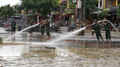
The meteorological agency warned that the circulation of storm Kalmaegi is wide, which can cause thunderstorms, tornadoes, and strong gusts of wind before and during the storm's landfall. Localities from Quang Tri to Dak Lak need to urgently review and evacuate people from coastal and low-lying areas, be ready to respond to the risk of flooding, landslides, flash floods, and ensure the safety of ships operating at sea.
Weather forecast for regions across the country:
Hanoi capital is cloudy with scattered rain and light rain. North to northeast wind level 2 - 3. Cold morning and night. Lowest temperature 18 - 20 degrees Celsius. Highest temperature 21 - 23 degrees Celsius.
The Northwestern provinces are cloudy with some rain. Light wind. Cold in the morning and at night. Lowest temperature 16 - 19 degrees Celsius, some places below 16 degrees Celsius. Highest temperature 23 - 26 degrees Celsius.
The Northeast region is cloudy with scattered rain and light rain. North to northeast wind level 2 - 3. Cold in the morning and at night. Lowest temperature 17 - 20 degrees Celsius, in mountainous areas below 17 degrees Celsius. Highest temperature 21 - 24 degrees Celsius.
Provinces from Thanh Hoa to Hue are cloudy with scattered showers and thunderstorms. North to northwest winds at level 2-3. Cold in the morning and at night. During thunderstorms, there is a possibility of tornadoes, lightning and strong gusts of wind. Lowest temperature 19-22 degrees Celsius. Highest temperature in the North 22-25 degrees Celsius.
The North Central Coast region is cloudy with scattered showers and thunderstorms, with some heavy rain in some places; the South is cloudy with scattered showers and thunderstorms, with scattered showers and thunderstorms in the afternoon and evening. The north to northwest wind is level 3 - 4. There is a possibility of tornadoes, lightning and strong gusts of wind in thunderstorms. The lowest temperature is 23 - 26 degrees Celsius. The highest temperature is 29 - 32 degrees Celsius.
The Central Highlands is cloudy with scattered showers and thunderstorms; in the afternoon and evening there will be scattered showers and thunderstorms, with some heavy rain in some places. Light wind. During thunderstorms there is a possibility of tornadoes, lightning, hail and strong gusts of wind. Lowest temperature 20 - 23 degrees Celsius. Highest temperature 28 - 31 degrees Celsius.
The South is cloudy with scattered showers and thunderstorms; in the afternoon and at night there will be scattered showers and thunderstorms, with some heavy rain in some places. Light wind. During thunderstorms there is a possibility of tornadoes, lightning, hail and strong gusts of wind. Lowest temperature 23 - 26 degrees Celsius. Highest temperature 30 - 33 degrees Celsius.
Ho Chi Minh City is cloudy with scattered showers and thunderstorms; in the afternoon and at night there will be scattered showers and thunderstorms, with some heavy rain in some places. Light wind. During thunderstorms there is a possibility of tornadoes, lightning, hail and strong gusts of wind. Lowest temperature 24 - 26 degrees Celsius. Highest temperature 30 - 32 degrees Celsius.
Source: https://baotintuc.vn/xa-hoi/thoi-tiet-ngay-511-bao-kalmaegi-di-vao-bien-dong-co-kha-nang-manh-them-20251105060856004.htm


![[Photo] Opening of the 14th Conference of the 13th Party Central Committee](https://vphoto.vietnam.vn/thumb/1200x675/vietnam/resource/IMAGE/2025/11/05/1762310995216_a5-bnd-5742-5255-jpg.webp)


![[Photo] Panorama of the Patriotic Emulation Congress of Nhan Dan Newspaper for the period 2025-2030](https://vphoto.vietnam.vn/thumb/1200x675/vietnam/resource/IMAGE/2025/11/04/1762252775462_ndo_br_dhthiduayeuncbaond-6125-jpg.webp)


Comment (0)