
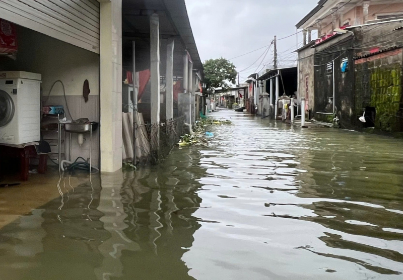
According to the CAND Newspaper reporter's records on National Highway 49B, the section passing through Phong Dinh Ward ( Hue City), from Km4+500 to Km10+350, many points are flooded, some sections are flooded deeper than 0.5m; the section from Km15+600 to Km18+100 in Phong Phu Ward is flooded in many sections from 0.2 to 0.3m.
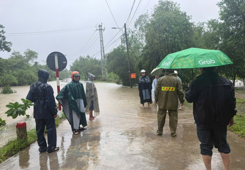
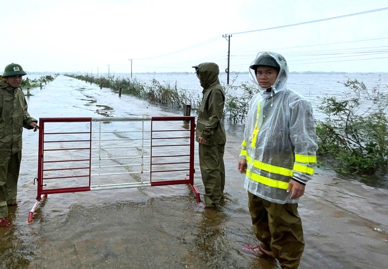
On provincial road 1 and provincial road 3 through Thanh Thuy ward, many points are flooded from 0.2m or more, many sections are flooded over 0.6m deep; provincial road 2 through Duong No ward, the section from Km6+100 to Km6+400 is flooded from 0.2-0.3m; Km7+100 to Km7+800 is flooded from 0.4 to 0.6m; Km9+750 the road surface is flooded from 0.3-0.5m. Duong No ward police have assigned officers to be on duty, coordinating with local authorities to set up barriers and prohibit vehicles from passing through flooded areas.
Provincial Road 6 through Phong Dien Ward was flooded from 0.4 to 0.5m in many sections; Provincial Road 8A through Quang Dien Commune, Km6+650, was flooded from 0.8 to 0.9m in depth. Routes 8B through Kim Tra Ward, Route 10A through Vy Da Ward, and Provincial Road 10C through Phu Vang Commune were also flooded in many places, cutting off traffic. Some low-lying roads in Hue City such as Nguyen Huu Canh, Le Van Huu, Nguyen Dang De... were partially flooded in many places.
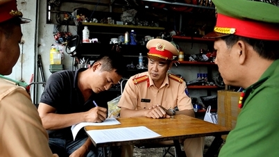
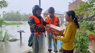
On deeply flooded roads, the police of communes and wards have mobilized forces and vehicles to set up barricades and place warning signs prohibiting vehicles from circulating to ensure safety.
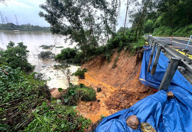
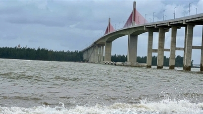
This morning, due to heavy rain, at Km23+800 of National Highway 49, from Cham residential group to Tuan bridge (Kim Long ward, Hue city), the negative slope collapsed. A large amount of rock and soil was swept to the bank of the Huong river, water penetrated deep into the road foundation and there is a risk of further landslides. The authorities have temporarily reinforced it with sandbags and ropes, placed warning signs of narrow roads to allow traffic in one lane and assigned guards to monitor.
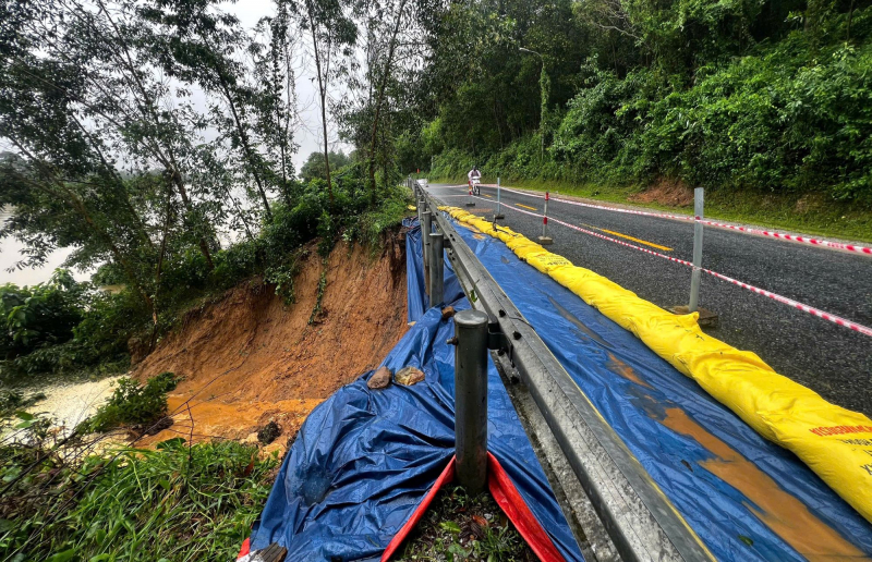
National Highway 49 is the main route connecting the central area of Hue City with the mountainous communes of A Luoi, the Hue bypass and the Cam Lo - La Son expressway, so every day there are many vehicles passing through here, including many large trucks. Heavy rains causing landslides on the negative slope in the above-mentioned area on this route pose a potential risk to traffic safety.
Due to the impact of storm No. 12 and heavy rain, landslides along rivers, coastlines and on traffic routes in Hue city continue to be complicated. In particular, the coastline at Hoa Duan residential group, Thuan An ward suffered heavy landslides with a length of 1 km; the asphalt road to Tan An Hai village, Phu Loc commune was eroded by sea waves, causing landslides from 0.5 to 2m, nearly 500m long...
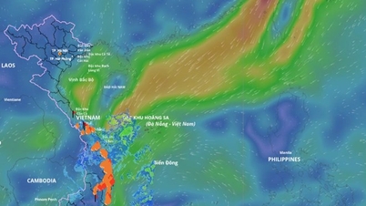
The Hue City Hydrometeorological Station warns that in the next 24 hours, the Hue City area will continue to have moderate to heavy rain, with some places experiencing very heavy rain. Therefore, people are advised to limit travel in low-lying areas with fast-flowing water, proactively move assets to higher ground and follow the instructions of the authorities to avoid risks.
Source: https://cand.com.vn/Xa-hoi/hang-loat-tuyen-duong-giao-thong-o-hue-chim-ngap-trong-lu-ql49-sat-lo-nang-i785704/

![[Photo] Prime Minister Pham Minh Chinh and United Nations Secretary-General Antonio Guterres attend the Press Conference of the Hanoi Convention Signing Ceremony](https://vphoto.vietnam.vn/thumb/1200x675/vietnam/resource/IMAGE/2025/10/25/1761391413866_conguoctt-jpg.webp)
![[Photo] National Assembly Chairman Tran Thanh Man receives United Nations Secretary-General Antonio Guterres](https://vphoto.vietnam.vn/thumb/1200x675/vietnam/resource/IMAGE/2025/10/25/1761390815792_ctqh-jpg.webp)


![[Photo] Prime Minister Pham Minh Chinh receives United Nations Secretary-General Antonio Guterres](https://vphoto.vietnam.vn/thumb/1200x675/vietnam/resource/IMAGE/2025/10/25/1761390212729_dsc-1484-jpg.webp)


![[Photo] General Secretary To Lam meets with General Secretary and President of Laos Thongloun Sisoulith](https://vphoto.vietnam.vn/thumb/1200x675/vietnam/resource/IMAGE/2025/10/25/1761380913135_a1-bnd-4751-1374-7632-jpg.webp)


Comment (0)