

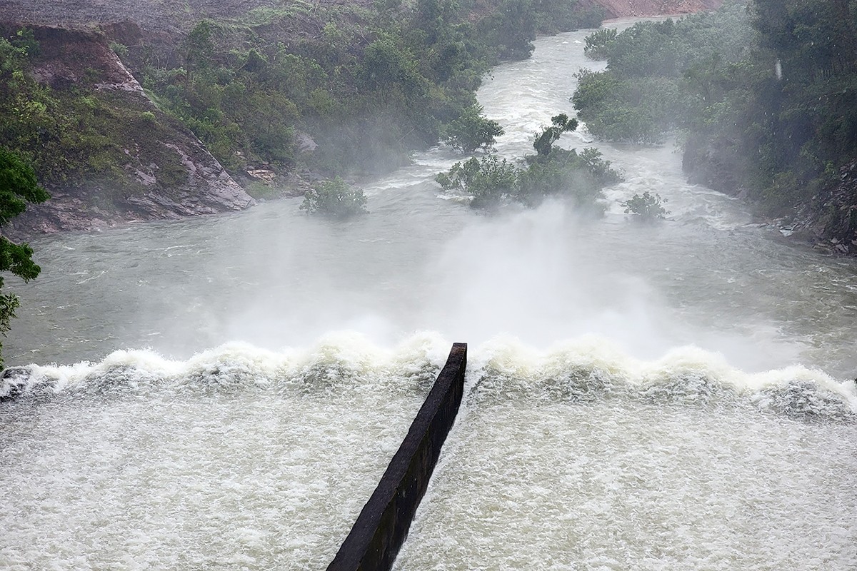
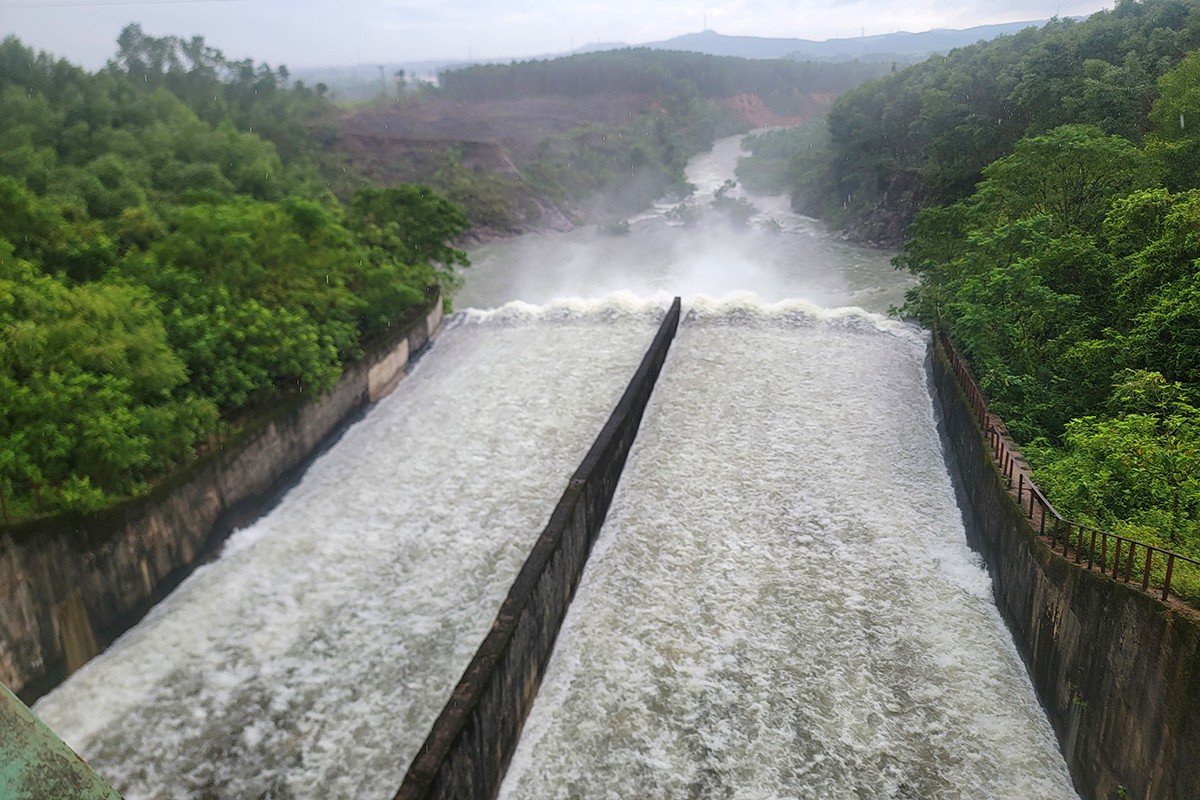
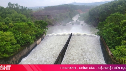
At 10:00 a.m. on August 29, Nam Ha Tinh Irrigation Company Limited was regulating water from Ke Go Lake (Cam Due Commune, Ha Tinh Province) through Doc Mieu spillway with a flow rate of 90 m3 /second. The water level of Ke Go Lake at this time was at 27.94/32 m, equivalent to a capacity of 223.65/345 million m3 of water.
The management and operation unit has been regulating the water level of Ke Go Lake since 7am on August 27 when the lake's water level increased rapidly due to the impact of heavy rain after the storm.
Right after storm number 5, at this time, in the Hoang Sa special zone, there is a tropical depression active, forecast to have the potential to strengthen into a storm and Ha Tinh is in the area directly affected when the storm makes landfall.
Due to the influence of a tropical depression that is about to strengthen into a storm, Ha Tinh will have a period of heavy rain with rainfall forecast to reach up to 500 mm.
Director of Nam Ha Tinh Irrigation Company, Tran Manh Cuong, said: Before the forecast of heavy rain in Ha Tinh, the unit maintained the regulation of water through Doc Mieu spillway to lower the water level in the lake first, reducing the pressure somewhat before continuing to "receive" a large amount of water flowing into the lake.
In the coming days, the unit will continue to closely monitor weather developments and forecasts from hydrometeorological agencies to be able to adjust the increase/decrease of spillway discharge, ensuring safety for the project and downstream areas.
In addition to Ke Go Lake, at this time, Nam Ha Tinh Irrigation Company Limited is also regulating water through the spillway for many other large reservoirs, such as Boc Nguyen (Cam Lac commune) spillway with a flow rate of 20 m3 /second; Song Rac Lake (Cam Lac commune) spillway with a flow rate of 110 m3 /second; Da Han Lake (Huong Binh commune) spillway with a flow rate of 40 m3/ second .
Kim Son and Thuong Song Tri lakes (in Ky Hoa commune), Tau Voi lake (Vung Ang ward)... are also being overflowed with a flow rate of 3 - 5 m3 /second.
Heavy rains in recent times have also caused reservoirs such as Da Cat, Khe Lau, Khe Nay, Dam Mung, Ma Leng, Dam Hoi, Nha Lao, Con Troi, Khe Dai... to be full of water and are currently flowing freely over the spillway.

Similarly, to proactively prepare for the forecast of heavy rain with rainfall of up to 500 mm, Ho Ho Hydropower Plant is currently releasing spillway at a flow rate of 54 m3 /second. The water regulation is aimed at lowering the water level in the lake, increasing flood prevention capacity, and ensuring the safety of the project and downstream areas.

At 12:00 on August 29, water flowed into the factory's reservoir at a rate of 24 m3/second, the water flow to generate electricity from the two generators was 32 m3 /second, and the lake water level was at an elevation of 66.04 m.
“At this time, the water level in the downstream area is quite low, the plant's spillway release to regulate water does not affect residential areas. Early spillway release will help the unit be more proactive when forecasting complicated weather in the coming days,” said Mr. Nguyen Ba Tuan - Deputy Director of Ho Ho Hydropower Plant.
As of noon on August 29, the water level of Ngan Truoi Lake (Vu Quang Commune) - the largest reservoir in Ha Tinh - was at an elevation of 37.49/52 m, equivalent to a capacity of 292.03/775.7 million m3 .
The water level in this large reservoir is quite low so the amount of rain this time is not a concern. However, the reservoir management unit will closely monitor the weather situation to make appropriate adjustments.

Discussing the weather situation in the coming days, Director of Ha Tinh Hydrometeorological Station Tran Duc Ba said: Due to the influence of a tropical depression that is likely to strengthen into a storm, from the night of August 29, the sea area of Ha Tinh will have strong thunderstorms, winds gradually increasing to level 6 - 7, the area near the storm's center will have strong winds of level 8, gusts of level 10; waves 2 - 5 m high, rough seas. Ships operating in the above-mentioned dangerous areas are likely to be affected by thunderstorms, whirlwinds, strong winds, and big waves.
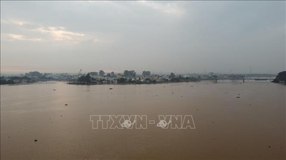
In particular, from the evening and night of August 29 to August 31, Ha Tinh area will have heavy to very heavy rain and thunderstorms. The average rainfall is 150 - 350mm, in some places over 550mm. Heavy rain also causes a flood in the rivers in Ha Tinh area and a high risk of flooding in low-lying areas along rivers, urban areas, and densely populated areas...

According to the assessment of the Director of the Ha Tinh Hydrometeorological Station, after the recent rains, the reservoirs and dams in the whole province have basically filled with water. It is very necessary for management units to proactively divert water before heavy rains to increase flood prevention capacity, ensuring the safety of works and downstream areas.
Source: https://baohatinh.vn/ho-dap-o-ha-tinh-ung-pho-truoc-du-bao-mua-500-mm-post294648.html

![[Photo] Draft documents of the 14th Party Congress reach people at the Commune Cultural Post Offices](https://vphoto.vietnam.vn/thumb/1200x675/vietnam/resource/IMAGE/2025/10/28/1761642182616_du-thao-tai-tinh-hung-yen-4070-5235-jpg.webp)
![[Photo] Flooding on the right side of the gate, entrance to Hue Citadel](https://vphoto.vietnam.vn/thumb/1200x675/vietnam/resource/IMAGE/2025/10/28/1761660788143_ndo_br_gen-h-z7165069467254-74c71c36d0cb396744b678cec80552f0-2-jpg.webp)
![[Photo] National Assembly Chairman Tran Thanh Man received a delegation of the Social Democratic Party of Germany](https://vphoto.vietnam.vn/thumb/1200x675/vietnam/resource/IMAGE/2025/10/28/1761652150406_ndo_br_cover-3345-jpg.webp)


![[Photo] President Luong Cuong attends the 80th Anniversary of the Traditional Day of the Armed Forces of Military Region 3](https://vphoto.vietnam.vn/thumb/1200x675/vietnam/resource/IMAGE/2025/10/28/1761635584312_ndo_br_1-jpg.webp)


Comment (0)