
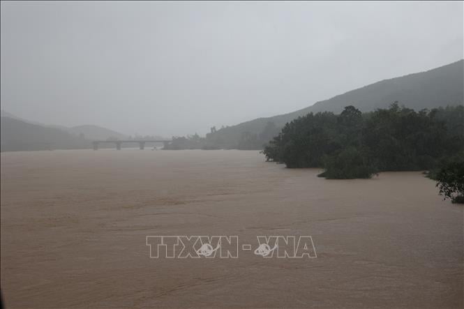
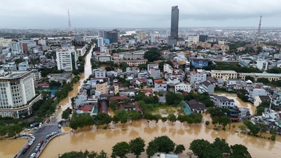
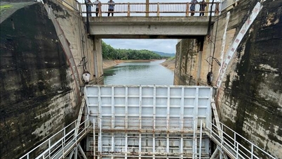
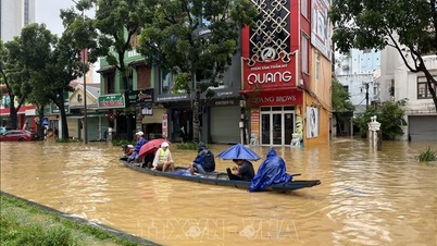
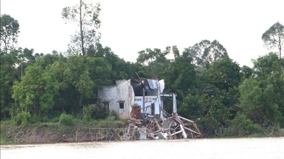
According to the Central Hydrometeorological Station, the water level at most measuring stations on the Vu Gia - Thu Bon River has exceeded Alert Level 3. The flood peak is expected to reach in the next 6 - 12 hours (from 7:00 p.m. on October 27 to 7:00 a.m. on October 28) with particularly dangerous levels:
In the next 6 - 12 hours, the flood on Vu Gia - Thu Bon river will rise above level 3, the flood peak on Vu Gia river at Ai Nghia will be 10.4m (on level 3: 1.4m, higher than the exceptionally large flood of 2007 by 0.04m, higher than the flood of 2017: 0.29m), at Cau Lau it will be 5.2m (on level 3: 1.2m, higher than the exceptionally large flood of 2007 by 0.10m, higher than the flood of 2017 by 0.45m).
Flood on Thu Bon River at Giao Thuy is 10.0m - above alert level 3: 1.2m (higher than the exceptionally large flood of 2007: 0.0m, higher than the flood in 2017: 0.3m). Flood on Tien River is above alert level 3: 1.2m (lower than the exceptionally large flood of 2007: 0.19m, higher than the flood in 2017: 0.05m). At Hoi An, above alert level 3: 1.1m (lower than the flood in 2017: 0.07m), Tam Ky River is approximately at alert level 1.
It is forecasted that in the next 12-24 hours, flood in Vu Gia - Thu Bon area will slowly recede and will be at Alert Level 3 to above Alert Level 3; Tam Ky River will be at Level 1-2. (Please pay close attention).
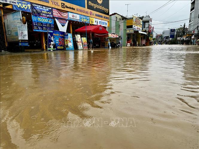
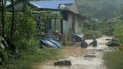
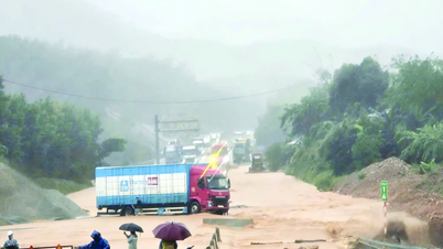
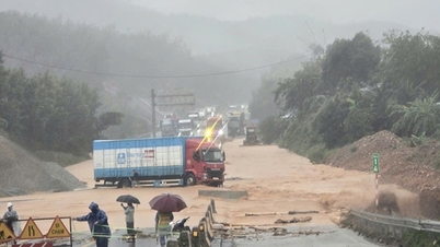
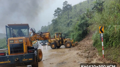
The meteorological agency warns that deep, widespread, and prolonged flooding will occur in low-lying areas along rivers and serious flooding in urban areas. Especially in the communes of Que Phuoc, Nong Son, Duy Xuyen, Thu Bon, Xuan Pho, Thanh My, Truong Duc, Ha Nha, Phu Van, Vu Gia, Dai Loc, Go Noi, Dien Ban, Tien Dien, Ban Ben, Hoi Tien, Hoi An, Hoi An Tay, Hoi An Dong, Nam Phuoc, Duy Nghia, An Thang,... There is a very high risk of flash floods and landslides on the slopes of mountainous areas of Da Nang city.
Source: https://baotintuc.vn/van-de-quan-tam/lu-dac-biet-lon-tren-song-vu-gia-thu-bon-du-bao-vuot-lich-su-nam-2007-20251027223429746.htm

![[Photo] The 5th Patriotic Emulation Congress of the Central Inspection Commission](https://vphoto.vietnam.vn/thumb/1200x675/vietnam/resource/IMAGE/2025/10/27/1761566862838_ndo_br_1-1858-jpg.webp)


![[Photo] Prime Minister attends the 28th ASEAN-China Summit](https://vphoto.vietnam.vn/thumb/402x226/vietnam/resource/IMAGE/2025/10/28/1761624895025_image-2.jpeg)


![[Photo] National Assembly Chairman Tran Thanh Man receives Chairman of the House of Representatives of Uzbekistan Nuriddin Ismoilov](https://vphoto.vietnam.vn/thumb/1200x675/vietnam/resource/IMAGE/2025/10/27/1761542647910_bnd-2610-jpg.webp)

![[Photo] Party Committees of Central Party agencies summarize the implementation of Resolution No. 18-NQ/TW and the direction of the Party Congress](https://vphoto.vietnam.vn/thumb/1200x675/vietnam/resource/IMAGE/2025/10/27/1761545645968_ndo_br_1-jpg.webp)


Comment (0)