
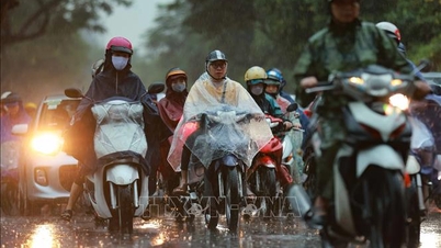
(NLDO) - Strong cold air strengthens near Tet, causing severe cold in the North, drizzle, and some mountainous areas below 3 degrees Celsius; rain in the Central region

The North celebrates Tet in the cold, drizzle and cold wind.
According to the National Center for Hydro-Meteorological Forecasting, the strong cold air mass is still moving south.
It is forecasted that around the night of January 25 and the morning of January 26, this cold air mass will affect the Northeast region, then affect the North Central region, the Northwest region, the Central Central region and some places in the South Central region. Northeast wind inland will strengthen to level 3, coastal areas level 3-4, some places will have gusts of level 6.
In the North and North Central regions, from the afternoon and night of January 26, the weather will be very cold, with severe cold in mountainous areas and the possibility of frost and frost in high mountainous areas.
In the Central Central region from the night of January 26, the weather will turn cold. The lowest temperature during this cold air mass in the North and North Central regions is generally 9-12 degrees Celsius, in the mountainous areas of the North 6-8 degrees, in the high mountainous areas below 3 degrees in some places; in the area from Quang Binh to Hue, it is generally 14-17 degrees; in the area from Da Nang to Quang Ngai, it is generally 16-19 degrees.
Hanoi area from the evening and night of January 26th will be very cold. The lowest temperature in this cold air mass is commonly 9-12 degrees.
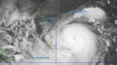
At sea, from early morning on January 26, in the Gulf of Tonkin, the Northeast wind gradually increased to level 7, gusting to level 9, rough seas, and waves 2-4 m high. From the afternoon of January 26, in the North East Sea (including the waters of the Hoang Sa archipelago), the Northeast wind gradually increased to level 6-7, gusting to level 8-9, rough seas, and waves 3-5.5 m high.
From the evening of January 26, the sea area from Quang Tri to Ca Mau , the Central and Southern East Sea area (including the sea area of Truong Sa archipelago), the Northeast wind gradually increased to level 6, sometimes level 7, gusting to level 8-9, rough seas, waves 3-5 m high.
Due to the influence of cold air strengthening from the night of January 25 to 26, the Northern and North Central regions will have scattered showers and thunderstorms. From January 26 to 28, the Central Central region will have rain, showers, and locally heavy rain and thunderstorms. Mountainous areas are likely to experience severe cold, while high mountainous areas are likely to experience frost and frost.
Source: https://nld.com.vn/mien-bac-don-tet-trong-ret-buot-va-mua-phun-196250124100138054.htm

![[Photo] Da Nang: Hundreds of people join hands to clean up a vital tourist route after storm No. 13](https://vphoto.vietnam.vn/thumb/1200x675/vietnam/resource/IMAGE/2025/11/07/1762491638903_image-3-1353-jpg.webp)


Comment (0)