

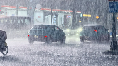
From early morning until the end of November 8, from Thanh Hoa to Ha Tinh, there will be moderate to heavy rain with common rainfall of 20-50mm, locally very heavy rain over 90mm. Warning of risk of heavy rain over 60mm/3 hours.
In addition, in the afternoon and evening of November 8, the Southern region and Lam Dong will have scattered showers and thunderstorms with rainfall of 10-30mm, with some places experiencing heavy rain of over 70mm. Warning of the risk of heavy rain of over 60mm/3 hours.
The risk level of natural disasters due to heavy rain, tornadoes, lightning, and hail is level 1.
Areas under precaution during thunderstorms are likely to experience tornadoes, lightning, hail and strong gusts of wind. Heavy rains are likely to cause flooding in low-lying areas, urban and industrial areas; flash floods on small rivers and streams, and landslides on steep slopes.
The National Center for Hydro-Meteorological Forecasting said that from 3:50 a.m. to 8:50 a.m. on November 8, the provinces of Ha Tinh, Quang Tri and Lam Dong will continue to have rain, with the risk of flash floods and landslides.
Specifically, the accumulated rainfall from Nghe An to Quang Tri is from 25-60mm, in some places over 80mm; Lam Dong province from 5-15mm.
Warning of the risk of flash floods on small rivers and streams, landslides on steep slopes. Disaster risk level due to flash floods, landslides, land subsidence due to heavy rain or level 1 flow.
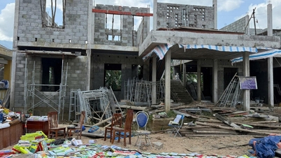
Flash floods and landslides can have very negative impacts on the environment, threaten people's lives; cause local traffic congestion, affect the movement of vehicles; destroy civil and economic works, and cause damage to production, economic and social activities.

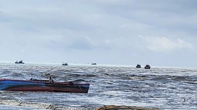
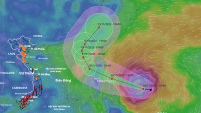
At sea, the tropical convergence zone is currently located at about 11-14 degrees North latitude. In the sea area from Ca Mau to An Giang and the Gulf of Thailand, there are scattered showers and thunderstorms in some places.
It is forecasted that in the evening and night of November 8, the eastern sea area of the North and Central East Sea will gradually strengthen to level 6-7, gusting to level 8-9, with rough seas and waves 3-5m high.
In addition, on the day and night of November 8, the sea area from Ca Mau to An Giang and the Gulf of Thailand will have scattered showers and thunderstorms in some places. During thunderstorms, there is a possibility of tornadoes and strong gusts of wind.
Warning for the day and night of November 9, the eastern sea area of the North and Central East Sea will have winds gradually increasing to level 7-8, gusting to level 9-10, rough seas, waves 4-6m high. Risk level of natural disasters at sea is level 2.
Weather forecast for regions across the country:
Hanoi capital is cloudy, rainy, some places have moderate rain. Northeast wind level 2-3. Cold morning and night. Lowest temperature 21-23 degrees Celsius. Highest temperature 23-25 degrees Celsius.

The Northwestern provinces are cloudy and rainy, with rain in some places in Lai Chau - Dien Bien. Light wind. Cold in the morning and at night, with some places getting cold. The lowest temperature is 19-22 degrees Celsius, with some places below 19 degrees Celsius. The highest temperature is 24-27 degrees Celsius, with Lai Chau - Dien Bien being 27-30 degrees Celsius.
The Northeast region is cloudy with rain, especially in the plains with rain, moderate rain, locally heavy rain and thunderstorms. Northeast wind level 2-3. Cold mornings and nights, some mountainous areas are cold. The lowest temperature is 20-23 degrees Celsius, some mountainous areas are below 19 degrees Celsius. The highest temperature is 23-26 degrees Celsius, some places are above 26 degrees Celsius.
Provinces from Thanh Hoa to Hue: In the North, it is cloudy with moderate to heavy rain during the day, with some places having very heavy rain and thunderstorms. At night, there is rain, showers and thunderstorms in some places. In the South, it is cloudy with showers and thunderstorms in some places. Wind from the north to northwest is level 2-3. During thunderstorms, there is a possibility of tornadoes, lightning and strong gusts of wind. In the North, it is cold in the morning and at night. The lowest temperature is 21-24 degrees Celsius. The highest temperature in the North is 23-26 degrees Celsius; in the South, it is 27-30 degrees Celsius, in some places above 30 degrees Celsius.
The South Central Coast region is cloudy with scattered showers and thunderstorms. Light winds during the day, and northeast winds at night at level 2-3. During thunderstorms, there is a possibility of tornadoes, lightning, and strong gusts of wind. The lowest temperature is 23-26 degrees Celsius, in some places below 23 degrees Celsius. The highest temperature is 29-32 degrees Celsius.
The Central Highlands is cloudy with scattered showers and thunderstorms. Light winds. Thunderstorms may include tornadoes, lightning, and strong gusts of wind. Lowest temperature 19-22 degrees Celsius. Highest temperature 27-30 degrees Celsius, some places over 30 degrees Celsius.
The South has clouds, scattered showers and thunderstorms; in the afternoon and evening there will be scattered showers and thunderstorms, with some places having heavy rain. The southwest to west wind is level 2-3. During thunderstorms, there is a possibility of tornadoes, lightning and strong gusts of wind. The lowest temperature is 23-26 degrees Celsius. The highest temperature is 29-32 degrees Celsius, with some places above 32 degrees Celsius.
Ho Chi Minh City is cloudy with scattered showers and thunderstorms; in the afternoon and evening there will be scattered showers and thunderstorms, with some heavy rain in some places. Southwest wind level 2-3. During thunderstorms there is a possibility of tornadoes, lightning and strong gusts of wind. Lowest temperature 24-26 degrees Celsius. Highest temperature 30-32 degrees Celsius.
Source: https://www.sggp.org.vn/mien-trung-mua-lon-co-xu-huong-giam-canh-bao-nguy-co-lu-quet-post822408.html

![[Photo] Cutting hills to make way for people to travel on route 14E that suffered landslides](https://vphoto.vietnam.vn/thumb/1200x675/vietnam/resource/IMAGE/2025/11/08/1762599969318_ndo_br_thiet-ke-chua-co-ten-2025-11-08t154639923-png.webp)


![[Photo] "Ship graveyard" on Xuan Dai Bay](https://vphoto.vietnam.vn/thumb/1200x675/vietnam/resource/IMAGE/2025/11/08/1762577162805_ndo_br_tb5-jpg.webp)


![[Video] Hue Monuments reopen to welcome visitors](https://vphoto.vietnam.vn/thumb/402x226/vietnam/resource/IMAGE/2025/11/05/1762301089171_dung01-05-43-09still013-jpg.webp)


Comment (0)