
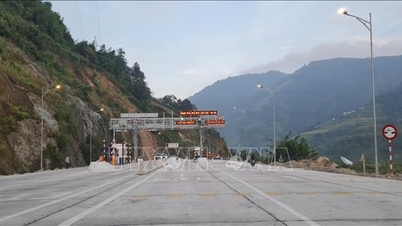
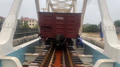
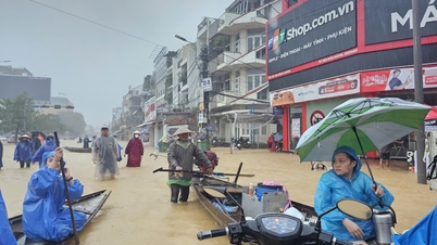
Chau O Bridge is located at Km1036+261 of National Highway 1. Authorities have closed the bridge and redirected traffic to the Da Nang - Quang Ngai Expressway.
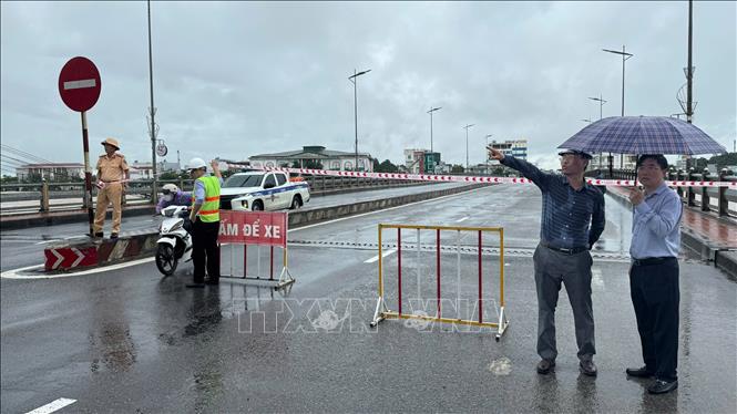
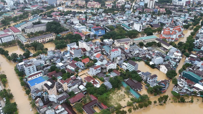
At noon on October 29, Road Management Area III (Vietnam Road Administration) informed that at 12:40 on the same day, the flood water reached the bottom of the Chau O bridge girder at Km1036+261 of National Highway 1 through Binh Son commune, Quang Ngai province. To ensure the safety of the project, Road Management Area III directed people to go directly to the scene to monitor the situation, coordinate with local forces to ensure the safety of the project, divide traffic, regulate and guide traffic.
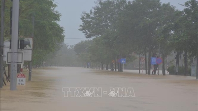
Faced with the possibility of floodwaters continuing to rise, at 1:15 p.m., the road management unit coordinated with the Quang Ngai Provincial Traffic Police and the Quang Ngai Provincial Department of Construction to erect barriers, prohibiting vehicles and people from crossing the bridge, and at the same time arranged forces on duty at both ends of Chau O Bridge.
To ensure smooth traffic on the North-South route, Road Management Area III has coordinated with the Traffic Safety Committee, the Department of Construction, the Traffic Police Department, the Quang Ngai Provincial Police and Da Nang City to separate traffic from a distance. Accordingly, vehicles traveling on National Highway 1 from the North to Doc Soi intersection (Km1028) turn left to Dung Quat, then return to National Highway 1 at Binh Long intersection (Km1040+200) and vice versa.
Source: https://baotintuc.vn/xa-hoi/quang-ngai-nuoc-lu-cham-dam-cau-chau-o-tren-quoc-lo-1-20251029151014991.htm
![[Photo] Hue: Inside the kitchen that donates thousands of meals a day to people in flooded areas](https://vphoto.vietnam.vn/thumb/1200x675/vietnam/resource/IMAGE/2025/10/29/1761738508516_bepcomhue-jpg.webp)
![[Photo] Flooding on the right side of the gate, entrance to Hue Citadel](https://vphoto.vietnam.vn/thumb/1200x675/vietnam/resource/IMAGE/2025/10/28/1761660788143_ndo_br_gen-h-z7165069467254-74c71c36d0cb396744b678cec80552f0-2-jpg.webp)

![[Photo] Prime Minister Pham Minh Chinh chaired a meeting to discuss solutions to overcome the consequences of floods in the central provinces.](https://vphoto.vietnam.vn/thumb/1200x675/vietnam/resource/IMAGE/2025/10/29/1761716305524_dsc-7735-jpg.webp)


![[Infographic] Vietnam's socio-economic situation in 5 years 2021-2025: Impressive numbers](https://vphoto.vietnam.vn/thumb/402x226/vietnam/resource/IMAGE/2025/10/29/1761730747150_anh-man-hinh-2025-10-29-luc-16-38-55.png)


Comment (0)