
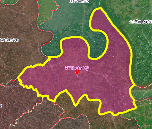
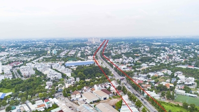
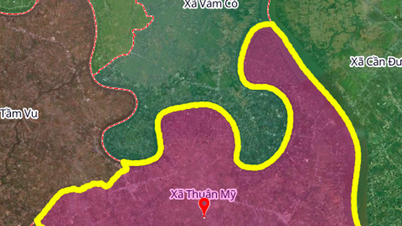
Overview of Thuan My commune
Thuan My commune is one of 96 communes and wards of Tay Ninh province. In terms of geographical location, the north of Thuan My commune borders Vam Co commune; the east borders Can Duoc commune and Binh Xuan ward; the south borders Phu Thanh, Dong Son and Tan Thuan Binh communes; the west borders An Luc Long and Tam Vu communes. The commune's terrain has a river network with natural canals such as Ba Ly canal, Tram canal and Vam Co river, creating favorable conditions for the development of combined water and road transport.
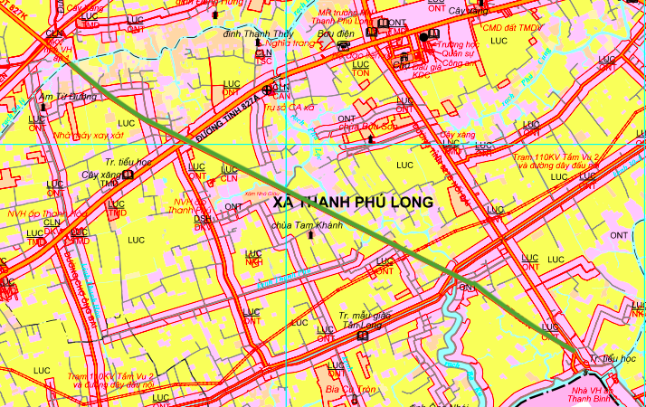
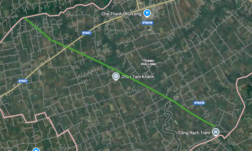
Provincial Road 827K
Provincial Road 827K is the route that connects the center of Thuan My commune with neighboring areas. Within the commune, one end of the road crosses Ba Ly canal (near Tu Duong hermitage), the other end is on Provincial Road 827B (near Rach Tram culvert), about 3.7 km long.
This route is shown in the adjusted land use planning map until 2030 in green on the map, showing that this is a priority transport development corridor. The connection with Provincial Road 827B at Rach Tram culvert will create a complete provincial road network, improving the ability to circulate goods and travel of people.
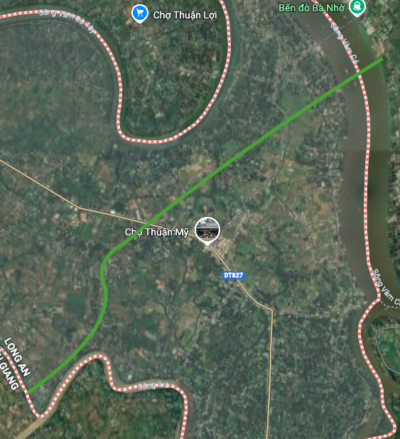
Ho Chi Minh City – Tra Vinh – Soc Trang Expressway
The Ho Chi Minh City – Tra Vinh – Soc Trang expressway passing through Thuan My commune is about 7.4 km long, twice as long as provincial road 827K. This is a key national traffic project, connecting the Mekong Delta with Ho Chi Minh City.
Within the commune, the road has one end near Rach Tram ferry, the other end crosses the Vam Co River (near Ba Nho ferry). Crossing the Vam Co River requires the construction of a large bridge, which will be an important technical highlight of the local expressway. This route will significantly shorten the travel time from Tay Ninh to the Western provinces and vice versa.

Impact on socio-economic development
The implementation of the above two routes will create many development opportunities for Thuan My commune:
- Transport connectivity: Improve accessibility to district and provincial centers, promote trade of goods
- Urban development: Highway corridors often lead to the formation of new residential and service clusters.
- Investment attraction: Complete infrastructure will attract industrial, commercial and service projects.
- Environmental impact: Need to assess the impact on the ecosystem of Ba Ly canal, Tram canal and Vam Co river
Warnings and recommendations
Important note: Residents and investors should note that the planning information in the article refers to "the adjusted land use planning map to 2030 of Chau Thanh district, Long An province" while the main content refers to Thuan My commune, Tay Ninh province. This may be a mistake in the source data or the reference to inter-regional planning.
Recommendations:
- Planning information may change according to adjustments by competent state agencies.
- People need to verify the exact project boundary at the People's Committee of Thuan My commune and the Department of Construction of Tay Ninh province.
- Real estate transactions in planning areas need to be carefully checked for legality.
- Project implementation time depends on investment capital and approval process of competent authority.
(The diagram in the article is drawn relatively based on the Map of land use planning adjustment to 2030 of Chau Thanh district, Long An province)
Source: https://baolamdong.vn/quy-huach-giao-thong-xa-thuan-my-duong-tinh-827k-va-cao-toc-tp-hcm-tra-vinh-soc-trang-403649.html

![[Photo] Prime Minister Pham Minh Chinh and his wife meet the Vietnamese community in Algeria](https://vphoto.vietnam.vn/thumb/1200x675/vietnam/resource/IMAGE/2025/11/19/1763510299099_1763510015166-jpg.webp)

![[Photo] General Secretary To Lam receives Slovakian Deputy Prime Minister and Minister of Defense Robert Kalinak](https://vphoto.vietnam.vn/thumb/1200x675/vietnam/resource/IMAGE/2025/11/18/1763467091441_a1-bnd-8261-6981-jpg.webp)


![[Photo series] 1.8 thousand day journey from vast rubber plantations, villages to 'super' Long Thanh International Airport](https://vphoto.vietnam.vn/thumb/402x226/vietnam/resource/IMAGE/2025/11/19/1763536112717_anh_14_20251119115609_20251119133613.jpeg)


Comment (0)