
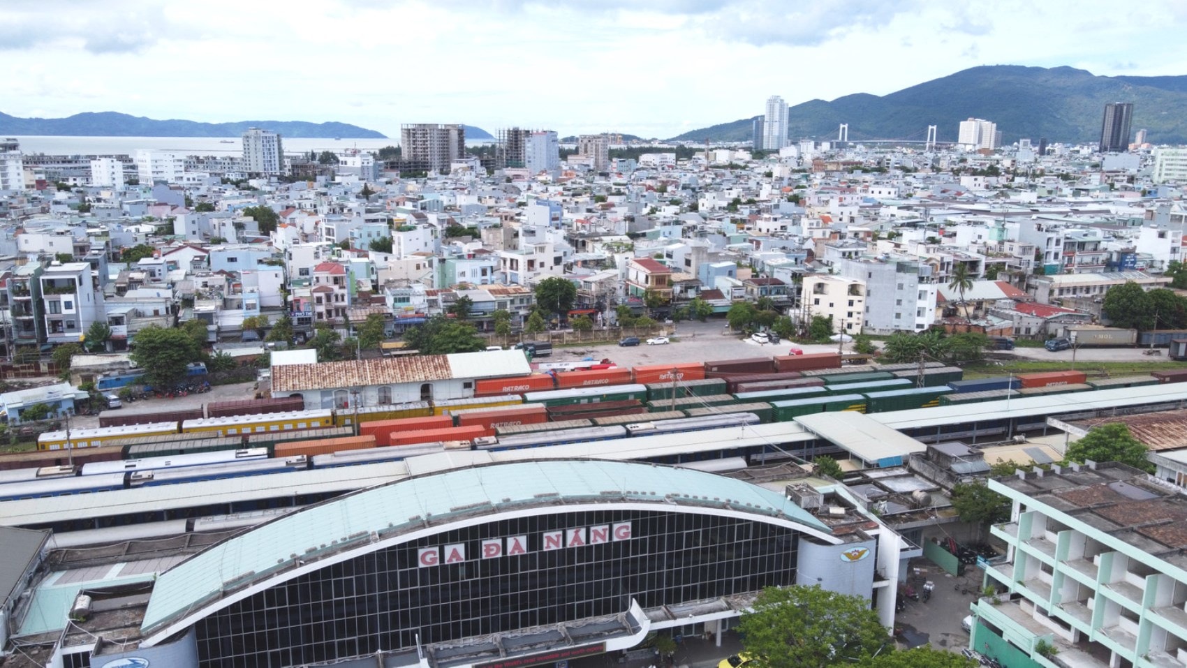
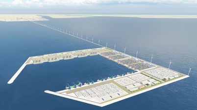
Driving force of urban development
In recent years, the connection of traffic and urban infrastructure planning has created conditions for the formation of an urban space area from Da Nang (old) extending to South Hoi An.
After the merger, the urban space of the new Da Nang city will be expanded along the coastal plain corridor connecting with Tam Ky urban area and connecting with a chain of densely populated areas and urban areas in the west through national highways.
Architect Hoang Hai Dang (residing in Son Tra ward) said that experts and planners are predicting that the future urban development structure of Da Nang will be a development corridor, two main centers, one secondary center, multiple secondary centers and many urban areas following the cluster model, TOD (urban development model with the public transport system as the center)...
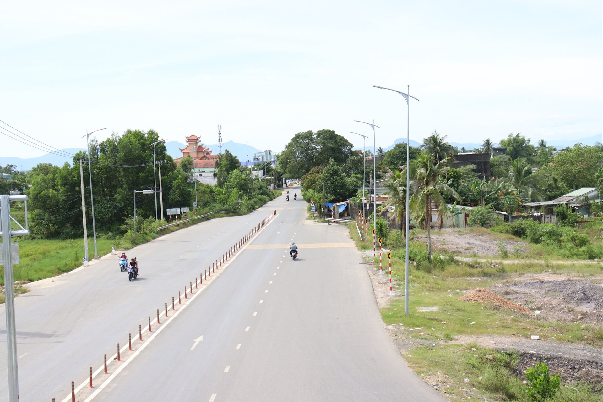
Accordingly, this development corridor is a coastal urban development strip along the coast in the east and a high-speed railway in the west. The two main centers are the center of Da Nang city in the north, Tam Ky urban area in the south, which are also two core urban development areas, concentrating most of the urban functions. A secondary center in the middle, Hoi An urban area, develops in addition to the central area of Da Nang city. Secondary multi-centers are population centers, urban areas in the western mountainous area, closely linked with the center of Da Nang city and Tam Ky and Hoi An urban areas.
“The coastal urban corridor in general and the main and secondary centers in particular connect with secondary centers in the western mountainous region through national highways. Specifically, the center of Da Nang city connects with secondary centers through national highway 14G and national highways 14B, 14D; Tam Ky urban area connects with secondary centers in the west through national highway 40B; Hoi An urban area connects through national highway 14E and Ho Chi Minh road.
In order for the secondary centers along the above 4 connecting routes to develop into 4 urban chains, the city needs to plan and mobilize resources to invest in transport infrastructure to increase speed, traffic, and volume of connections with secondary centers in the west. Along with investing in urban railways, urban expressways, etc., the city needs to combine the development of urban and commercial areas, services around traffic hubs in the direction of TOD, airport urban areas, seaport urban areas, etc. to promote the strong development of coastal urban corridors and urban centers in the west," Architect Hoang Hai Dang proposed.
One of the driving forces for urban transport and urban development is the construction of urban railways. Many experts and managers have suggested that the city integrate urban development planning in the direction of TOD when planning urban railways, especially in areas around stations. Deputy Director of the Department of Construction Luong Thach Vy said that the city is studying a plan to call for investment in urban railways from private capital. In particular, investors will invest in all infrastructure and equipment to operate urban railways and combine urban development in the direction of TOD in areas near stations on the route.
Need to integrate drainage planning
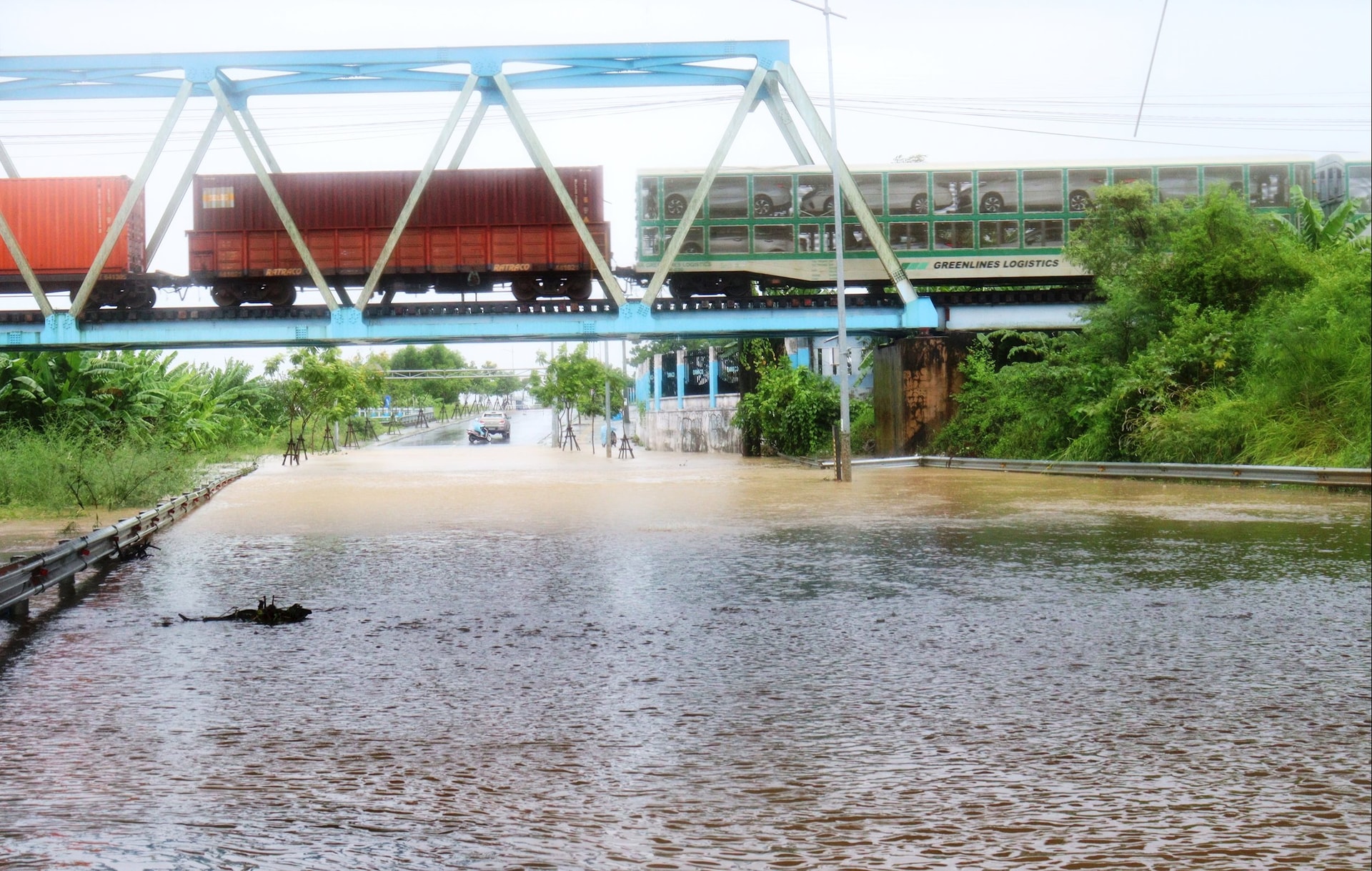
According to some experts, in addition to focusing on road expansion, urban railway development combined with urban development or TODs, it is necessary to integrate drainage planning.
In fact, the rapid and widespread urbanization process has become a key driving force for economic growth and international integration, but this development also entails many environmental and social consequences, notably traffic congestion and urban flooding. If the planning or improvement of the drainage system is ignored, the city will have to bear double costs in terms of both economy and operational efficiency. Integrated planning between traffic, urban and drainage has become an urgent requirement for large cities, especially coastal cities like Da Nang city.
According to Associate Professor Dr. Nguyen Vu Phuong, senior lecturer at the Academy of Strategy and Training of Cadres (Ministry of Construction), the Law on Urban and Rural Planning, effective from July 1, 2025, has established the principle of integrated planning, ensuring connectivity between urban and rural areas, while integrating green, smart and climate change adaptive elements in all planning stages.
It is necessary to shift the mindset of responding to traffic and urban incidents to an integrated planning approach. This approach requires synchronous connection between traffic infrastructure, drainage systems and urban space right from the design stage. At the same time, flexibly apply models such as: green - smart city, compact city, sponge city, resilient - sustainable city.
“This comprehensive approach not only requires a harmonious combination of green and grey infrastructure, but is also linked to reforming management mechanisms and promoting the role of the community. This is an inevitable direction to build safe, livable and climate-resilient cities,” Associate Professor Dr. Nguyen Vu Phuong emphasized.
Source: https://baodanang.vn/tich-hop-quy-hoach-giao-thong-voi-phat-trien-do-thi-3309509.html


![[Photo] "Ship graveyard" on Xuan Dai Bay](https://vphoto.vietnam.vn/thumb/1200x675/vietnam/resource/IMAGE/2025/11/08/1762577162805_ndo_br_tb5-jpg.webp)
![[Photo] Heavy damage after storm No. 13 in Song Cau ward, Dak Lak province](https://vphoto.vietnam.vn/thumb/1200x675/vietnam/resource/IMAGE/2025/11/08/1762574759594_img-0541-7441-jpg.webp)


![[Video] Hue Monuments reopen to welcome visitors](https://vphoto.vietnam.vn/thumb/402x226/vietnam/resource/IMAGE/2025/11/05/1762301089171_dung01-05-43-09still013-jpg.webp)


Comment (0)