
 |
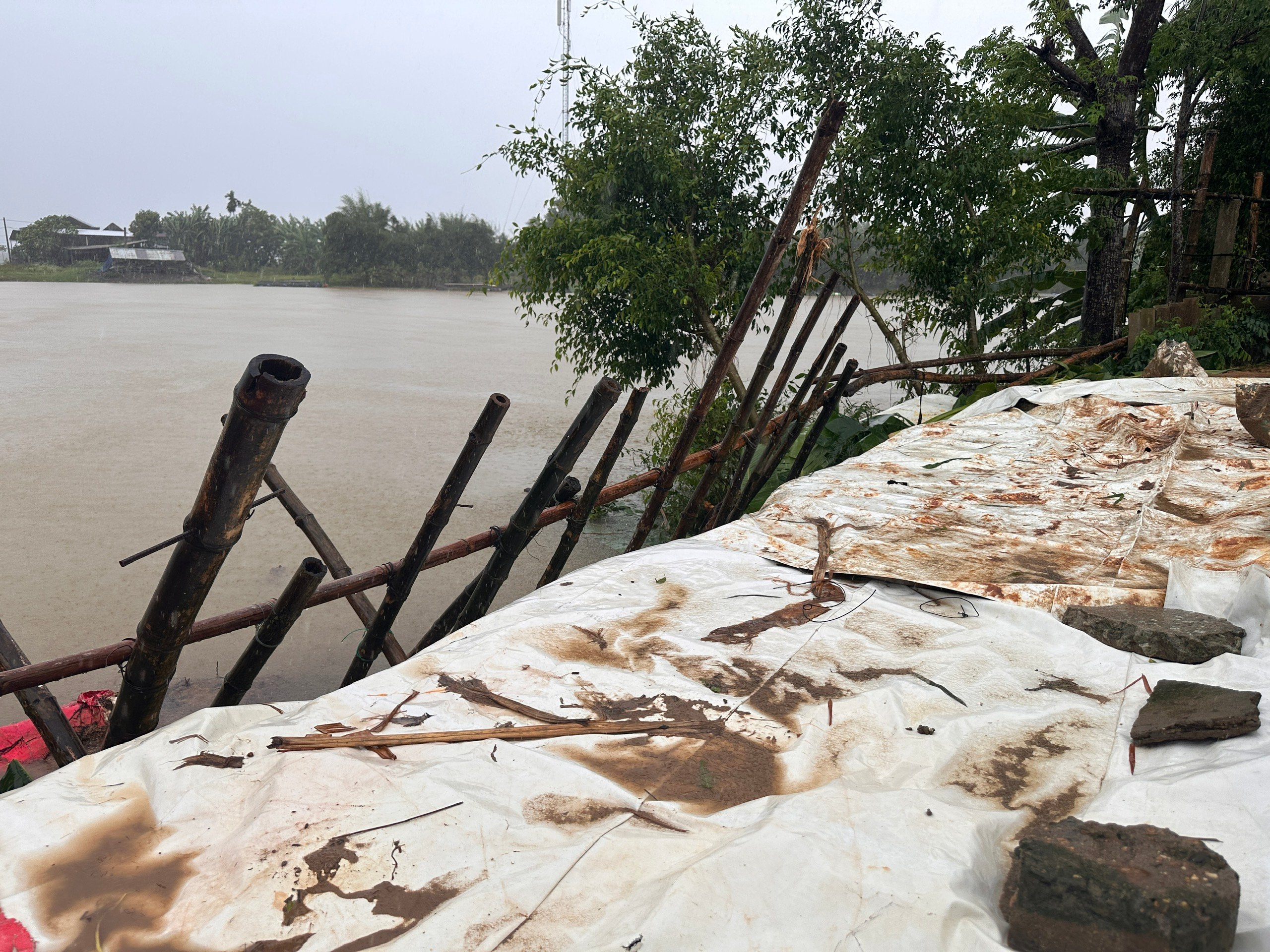
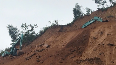
| Heavy rain lasting for many days, the risk of continuing landslides along the Bo River through Quang Dien commune is very high. |
29/40 communes and wards in Hue city are identified as being in high-risk landslide areas .
A Luoi 1 has 80 households located in areas at risk of landslides and traffic route landslides such as: Ho Chi Minh Road, Ta Rinh River bank. In A Luoi 2, up to 393 households are affected along Ho Chi Minh Road through the old communes of A Ngo, Hong Bac, Quang Nham; Le Ninh stream and Ta Rinh River always have the potential risk of landslides when heavy rain lasts for a long time. In A Luoi 3 and A Luoi 4, hundreds of households living along A Sap River, Khe Triet, Khe Chai, Tam Lanh Stream... can be directly affected when heavy rain combined with flash floods. In A Luoi 5 alone, high risk appears along National Highway 49A through the old commune of Hong Ha and the headwaters of Bo River.
In Nam Dong, Khe Tre, and Long Quang communes, hundreds of households live along the hillsides at the foot of the La Son – Tuy Loan highway, which is considered a complex landslide site, especially the section passing through La Hy pass. The upstream area of the Ta Trach river is often affected by strong currents after heavy rains, posing many potential safety risks.
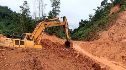
In the plain and coastal areas, the communes and wards of Phong Dien, Phong Thai, Phong Dinh, Phong Quang, and Phong Phu are also on the list of landslide warnings. Many sections of the O Lau and Bo rivers have been eroded and landslides, directly affecting the residential groups of Tu Chanh, Phe Tu, Hien Sy, Phong Dinh, and Phong Phu. Along Highway 71 from Phong Xuan to Rao Trang - A Lin, many positive slopes have collapsed, threatening traffic safety and hydropower projects.
In Chan May - Lang Co and Phu Loc communes, locations at risk of coastal and mountainous landslides were recorded in the villages of Phu Gia, Tho Son, Bach Thach, Trung Phuoc Tuong, Trung An... Phuoc Tuong, Phu Gia and Hai Van pass areas, the road to Bach Ma, and the slope along National Highway 49B are the areas that need to be closely monitored in the coming days...
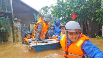
The Department of Irrigation and Climate Change requires localities to proactively develop response plans according to the "four on-site" principle (on-site forces, on-site command, on-site means, on-site logistics). Communes and wards at high risk focus on reviewing and inspecting residential areas along hills, rivers, streams, and coastlines, and proactively evacuating people.
For dam owners, hydroelectric and irrigation projects, the city requires regular inspection and timely handling of vulnerable points such as: upstream and downstream dams, deep discharge culverts, penstocks, dam shoulder areas and lake banks. Operation management units must ensure the safety of the project, prevent landslides on the lake banks or blockage of flow.
Along with that, the Economic and Industrial Zone Management Board, project management boards and construction units in the area are also required to proactively reinforce the works, ensure the safety of human resources and equipment before heavy rain. The leaders of the Irrigation and Climate Change Department recommend that localities need to closely follow weather developments, check vulnerable areas, and prepare emergency evacuation plans when there are signs of landslides and flash floods.
| According to the forecast of the Hue City Hydrometeorological Station, from early this morning (October 18) to early morning (October 20), Hue City will continue to have moderate rain, heavy rain, very heavy rain in some places and prolonged thunderstorms, especially from October 20. In the last days of October 2025, the heavy rain situation in Hue City is still very complicated. Heavy rain is likely to cause floods, flash floods and landslides, landslides in mountainous areas and along rivers and streams. In addition, heavy rain also has a high risk of causing flooding in low-lying areas downstream of rivers throughout the city; heavy rain can cause widespread urban flooding throughout the city, especially in the city center. |
Source: https://huengaynay.vn/kinh-te/nong-nghiep-nong-thon/29-xa-phuong-co-nguy-co-sat-lo-cao-158934.html

![[Photo] Lam Dong: Close-up of illegal lake with broken wall](https://vphoto.vietnam.vn/thumb/1200x675/vietnam/resource/IMAGE/2025/11/03/1762166057849_a5018a8dcbd5478b1ec4-jpg.webp)
![[Photo] Fall Fair 2025 and impressive records](https://vphoto.vietnam.vn/thumb/1200x675/vietnam/resource/IMAGE/2025/11/03/1762180761230_ndo_br_tk-hcmt-15-jpg.webp)

![[Photo] Prime Minister Pham Minh Chinh receives the Chairman of the Japan-Vietnam Friendship Association in the Kansai region](https://vphoto.vietnam.vn/thumb/1200x675/vietnam/resource/IMAGE/2025/11/03/1762176259003_ndo_br_dsc-9224-jpg.webp)
![[Photo] General Secretary To Lam receives Singaporean Ambassador Jaya Ratnam](https://vphoto.vietnam.vn/thumb/1200x675/vietnam/resource/IMAGE/2025/11/03/1762171461424_a1-bnd-5309-9100-jpg.webp)


Comment (0)