
Due to the short timeframe and heavy workload, various sectors and localities are urgently implementing measures to ensure progress and quality meet the set requirements.
According to the plan, the entire province will conduct a review and classification of land data that has been compiled to date, covering nearly 3.5 million land parcels in all 102/102 communes and wards; build land and housing data for areas where no database has yet been established; synchronize, connect, and share a unified, common land database; and manage and operate the land database and online public services.
The implementation of this campaign encountered several difficulties and obstacles, which local authorities proactively addressed and resolved. For example, in Krông Pắc commune, there are over 80,000 land parcels, of which more than 1,300 lack a database. The current difficulty is that the Land Management Information System only shows the commune's name and address, not the specific village or hamlet. Therefore, the commune has assigned its specialized department to review the commune's cadastral map to verify and identify which village or hamlet these land parcels belong to; then, they will coordinate with the village/hamlet self-governing committees to collect land use right certificates from the households. In addition, for land parcels within Krông Pắc commune whose owners are from other localities, the commune's Economic Department will conduct a thorough review and compile a specific list to implement the collection and updating of the database, striving to complete it before November 15th.
 |
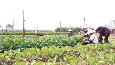
| Officials in Hoa Phu commune collect and process land data for local residents. Photo: M.Chi |
In Hoa Phu commune, the local authorities have established a Steering Committee and issued a plan to implement a campaign to enrich and clean up the land database in the commune. Tasks have been assigned to all 43 villages and hamlets in the commune, and a Zalo group has been formed to facilitate implementation. There are 298 households in the commune that require information collection and review. The local authorities have coordinated with villages and hamlets to compile statistics and guide residents in declaring land information. To date, villages and hamlets have scanned and sent files to the commune for 86 households and entered data for 43 households.
To contribute to the campaign to enrich and clean up the land database, people should proactively bring their land use right certificates, citizen identification cards, etc., to the village/hamlet/neighborhood cultural center for guidance from officials to check, verify, and update information. In addition, people can send photos or scanned files of the above documents through the village/hamlet/neighborhood Zalo groups. |
However, in Hoa Phu commune, there are currently 65 households whose land plots could not be surveyed (no names or information available); most village and hamlet leaders are elderly, so scanning and photographing the information does not meet the required standards, resulting in blurry or missing images. In addition, some households have land use right certificates that have been used as collateral for bank loans, making information collection impossible; commune officials have many other tasks to perform, preventing them from focusing on information collection and data entry. Mr. Y Ni Wa Bya, Head of the Economic Department of Hoa Phu commune, said that to complete the information collection and data update as soon as possible, the task force took advantage of weekends and rainy weather to visit villages and hamlets, conduct surveys of each case, and verify and determine the location of the land plots.
According to data from the Department of Agriculture and Environment, the province has completed the re-numbering of land parcels and cadastral maps after the reorganization of commune-level administrative units, updating and adjusting the cadastral space according to the two-tiered local government model in 102 out of 102 commune-level units; and completed the creation of land parcel identification codes and system synchronization in all 102 communes and wards. Regarding the review and classification of the number of land parcels for which databases have been built to date, 0.93 million parcels have had databases built and the data is currently in use, ensuring accuracy, completeness, cleanliness, and viability; 1.65 million parcels have had databases built but the data needs to be accurate, complete, supplemented, and verified with information on land users and owners of assets attached to the land.
The compiled list of land users/house owners who have been issued land use certificates in the land database needs to be matched and verified with the national population database. 1.46 million plots have been updated in the land data; 0.52 million plots are not in the national population database; and the agriculture, environment, and police sectors are coordinating to enrich, clean, and verify the information of land users for 1.12 million plots…
Several difficulties and obstacles have affected the progress of building, updating, and exploiting the land database of the entire province. For example, the province's cadastral data, which was formed, built, and put into operation in 2016, currently manages approximately 3.4 million spatial land parcels and 2.58 million land parcels with attribute data, of which 1.92 million land parcels (accounting for about 76%) have scanned records.
With a large volume of data, the process of downloading data from the system to synchronize it with the national land database takes a long time, affecting the progress and efficiency of data synchronization. In addition, the province is operating land databases for 102 communes and wards across two separate IT infrastructure regions in the East and West, resulting in land data that is not centralized, synchronized, or shared uniformly.
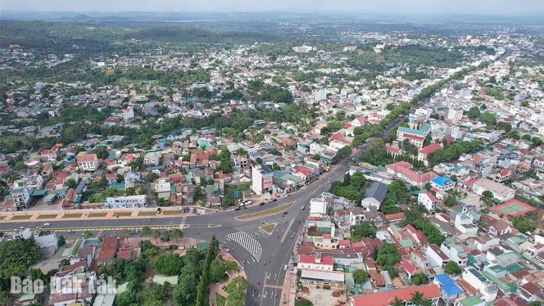 |
| Enriching and cleaning up land data is a crucial step in the process of building a digital government, a digital society, and a digital economy. (In the photo: A view of Buon Ma Thuot ward. Photo: M. Chi) |
The Department of Agriculture and Environment recommends that the Central Government promptly issue regulations on leasing software services and information technology infrastructure to build, manage, operate, and exploit the national land information system at the local level. Simultaneously, a plan should be developed to consolidate land data from the existing infrastructure in both regions into a single, centralized system.
According to Vice Chairman of the Provincial People's Committee Nguyen Thien Van, enriching and cleaning up the land database aims to improve its quality, enabling the government to manage it better, more transparently, protect the legitimate rights of each citizen, and enhance the effectiveness of administrative reform in the land sector. This is also an important step in the process of building a digital government, digital society, and digital economy in Dak Lak province. Therefore, departments, agencies, and localities must strengthen their direction and management, identifying this as a key political task requiring the synchronized participation of all levels and sectors.
The People's Committee at the commune level needs to link the responsibility of the head of the organization with the results of implementation, establish a steering committee, working group, detailed plan, and assign responsibilities clearly, ensuring the quality and effectiveness of the work. Information and communication should be strongly disseminated down to the village, hamlet, and residential group levels, thereby creating high consensus and mobilizing the combined strength of the entire political system and the whole population in successfully achieving the campaign's goals. At the same time, inspection and supervision should be strengthened, difficulties and obstacles should be resolved, and serious action should be taken against those who are negligent, irresponsible, or hindering progress.
Minh Chi - Minh Thuan
Source: https://baodaklak.vn/kinh-te/202511/gap-rut-lam-giau-lam-sach-co-so-du-lieu-dat-dai-a521520/


![[Photo] Prime Minister Pham Minh Chinh presides over a meeting on private sector economic development.](/_next/image?url=https%3A%2F%2Fvphoto.vietnam.vn%2Fthumb%2F1200x675%2Fvietnam%2Fresource%2FIMAGE%2F2025%2F12%2F20%2F1766237501876_thiet-ke-chua-co-ten-40-png.webp&w=3840&q=75)


Comment (0)