
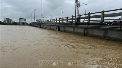
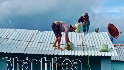
The Southern Hydrometeorological Station said: In the past 24 hours (from 1pm on May 27 to 1pm on May 28), heavy rain (50mm) to very heavy rain (100mm) occurred in many places in the South. Specifically, Phu Tan (Ca Mau) 129.2mm, Cam My (Dong Nai) 107.8mm, Hoi An (An Giang) 100.6mm, Tam Thon Hiep (HCMC) 70.6mm, Vi Thanh 85.8mm, Soc Trang 75.8mm, U Minh (Ca Mau) 77.4mm, Giong Rieng (Kien Giang) 71mm...

In the coming days, Ho Chi Minh City and the South will continue to have heavy to very heavy rain.
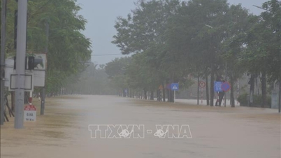
It is forecasted that by the end of May 29, the Southern region will continue to have widespread showers and thunderstorms, scattered moderate rain, heavy rain in some places, and very heavy rain in some places. Specifically, in the Eastern region, there will be places with over 70mm, in the Western region, there will be places with over 90mm.
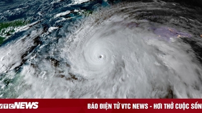
MSc. Le Thi Xuan Lan, a hydrometeorological expert, said: Although storm Mawar (Betty) is quite far from Vietnam, because it is a super storm with the strongest wind speed of 225 km/h, it stimulates the southwest monsoon to become more active. In addition, the equatorial trough (which provides moisture) also moves up closer to the South. These factors have caused heavy rain in many places in the South in the past few days.
According to Japanese and American forecast models, the typhoon will not hit Luzon (Philippines) and Taiwan but will also have a major impact on these places. There is a possibility that the typhoon will affect Japan.
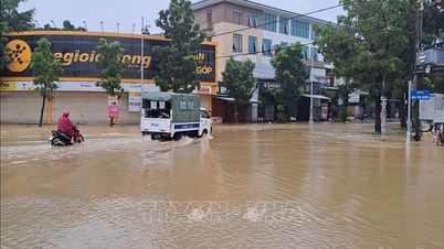
The National Center for Hydro-Meteorological Forecasting said: During the night of May 28-29, in the area from Binh Dinh to Ca Mau, Ca Mau to Kien Giang , the Gulf of Thailand, the central and southern East Sea (including the waters of the Truong Sa archipelago), there will be showers and strong thunderstorms. During the thunderstorms, there is a possibility of tornadoes and strong gusts of wind of level 7-8.
Warning: On the night of May 29-30, in the western sea area of the North and Central East Sea, there will be strong winds of level 6, sometimes level 7, gusting to level 8-9; wave height of 2-4m; rough seas.
All vessels and other activities in the above sea areas are at high risk of being affected by strong winds and large waves.
Source link


![[Photo] Opening of the 14th Conference of the 13th Party Central Committee](https://vphoto.vietnam.vn/thumb/1200x675/vietnam/resource/IMAGE/2025/11/05/1762310995216_a5-bnd-5742-5255-jpg.webp)


![[Photo] Panorama of the Patriotic Emulation Congress of Nhan Dan Newspaper for the period 2025-2030](https://vphoto.vietnam.vn/thumb/1200x675/vietnam/resource/IMAGE/2025/11/04/1762252775462_ndo_br_dhthiduayeuncbaond-6125-jpg.webp)


Comment (0)