
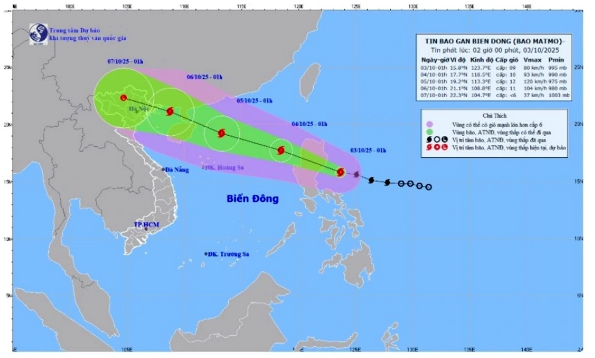
According to the National Center for Hydro-Meteorological Forecasting, at 1:00 a.m. on October 3, the center of the storm was located at about 15.8 degrees North latitude; 123.7 degrees East longitude, in the sea east of Luzon Island (Philippines). The strongest wind near the center of the storm was level 9 (75 - 88 km/h), gusting to level 11. Moving in the West Northwest direction, speed about 25 km/h.
Storm forecast (in the next 24 to 72 hours):
Storm warning (from next 72 to 120 hours): From the next 72 to 120 hours, the storm will move in the West Northwest direction, traveling 15-20km per hour, the storm intensity will gradually decrease.
Storm impact forecast : Strong winds, large waves
At sea: From noon and afternoon of October 3, the sea area east of the North East Sea will have winds gradually increasing to level 6 - 7; then increasing to level 8 - 9, the area near the storm center will have strong winds of level 10 - 11, gusting to level 13, waves 4.0 - 6.0m high. The sea will be very rough.
Warning: During October 4-5, the northern sea area of the North East Sea is likely to be affected by strong winds of level 11-12, gusting to level 15.
Vessels operating in the above mentioned dangerous areas are susceptible to the impact of storms, whirlwinds, strong winds and large waves.
Source: https://baolaocai.vn/bao-matmo-giat-cap-13-dang-huong-vao-bien-dong-post883535.html


![[Photo] General Secretary To Lam and National Assembly Chairman Tran Thanh Man attend the 80th Anniversary of the Traditional Day of the Vietnamese Inspection Sector](https://vphoto.vietnam.vn/thumb/1200x675/vietnam/resource/IMAGE/2025/11/17/1763356362984_a2-bnd-7940-3561-jpg.webp)


Comment (0)