
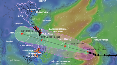
This is a strong, fast-moving storm, posing a risk of direct and serious impacts to coastal and inland areas.
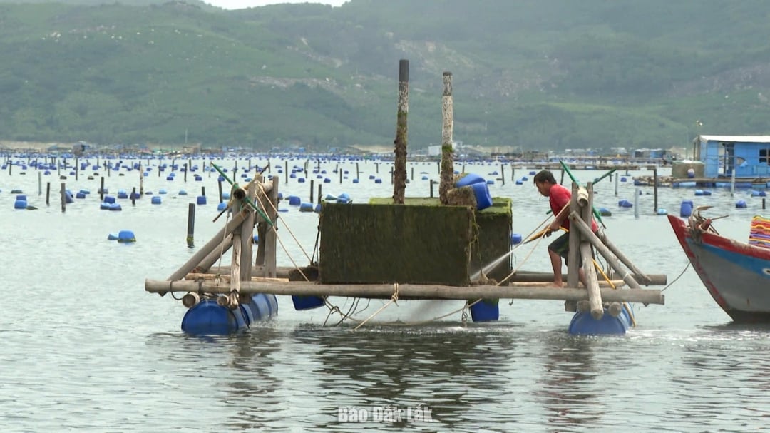 |
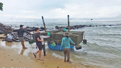
| Fishermen in the eastern part of Dak Lak province check aquaculture cages before the storm hits. Photo: Tuyet Huong |
Specifically, at 4:00 a.m., the center of the storm was at about 11.4 degrees North latitude; 119.4 degrees East longitude, about 560 km east of Song Tu Tay island. The strongest wind near the center of the storm was level 13 (134 - 149 km/h), gusting to level 16; the storm moved in a West Northwest direction at a speed of 20 - 25 km/h.
At sea, it is forecasted that on the morning of November 6, the sea will have winds gradually increasing to level 6 - 7, then increasing to level 8 - 11, the area near the storm's eye will have strong winds of level 12 - 14, gusting to level 17. Coastal areas will have waves 4.0 - 6.0m high, the area near the storm's eye will have waves 6.0 - 8.0m high, the sea will be very rough.
Storm surge and flood warning in coastal areas: Coastal areas of Dak Lak province have storm surges of 0.3 - 0.6m high. Warning from the evening of November 6, coastal areas of Dak Lak province are on guard against rising sea levels accompanied by large waves causing flooding in low-lying areas, waves overflowing dikes, coastal roads, coastal erosion, slowing down flood drainage in the area. All ships, boats, and aquaculture areas in the above-mentioned dangerous areas are strongly affected by storms, whirlwinds, strong winds, large waves, and rising sea levels.
On land, from the evening of November 6, coastal areas will gradually increase to level 6 - 7, then increase to level 8 - 9, near the storm center will be strong at level 10 - 12, gusting to level 14 - 15. Heavy rain from November 6 to the end of November 7, in Dak Lak province there will be heavy to very heavy rain with common rainfall: Eastern and Northern areas from 200 - 300 mm, some places over 350 mm/period; Western mountainous areas from 80 - 150 mm, some places over 200 mm/period.
From November 8, heavy rain tends to decrease. Warning of risk of heavy rain (>100 mm/3 hours).
Due to the influence of the wide storm circulation, it is necessary to guard against the risk of thunderstorms, tornadoes and strong gusts of wind both before and during the storm's landfall.
Local authorities at all levels and functional forces warn fishermen and boats to urgently seek safe shelter, people in coastal and midland areas should reinforce their houses, stock up on necessities, and guard against power outages, flooding, and flash floods.
Source: https://baodaklak.vn/thoi-su/202511/bao-so-13-kalmaegi-manh-nhat-giat-cap-17-trong-24-gio-toi-9bb0139/
![[Photo] Ca Mau "struggling" to cope with the highest tide of the year, forecast to exceed alert level 3](https://vphoto.vietnam.vn/thumb/1200x675/vietnam/resource/IMAGE/2025/11/04/1762235371445_ndo_br_trieu-cuong-2-6486-jpg.webp)

![[Photo] Ho Chi Minh City Youth Take Action for a Cleaner Environment](https://vphoto.vietnam.vn/thumb/1200x675/vietnam/resource/IMAGE/2025/11/04/1762233574890_550816358-1108586934787014-6430522970717297480-n-1-jpg.webp)
![[Photo] Panorama of the Patriotic Emulation Congress of Nhan Dan Newspaper for the period 2025-2030](https://vphoto.vietnam.vn/thumb/1200x675/vietnam/resource/IMAGE/2025/11/04/1762252775462_ndo_br_dhthiduayeuncbaond-6125-jpg.webp)

![[Photo] The road connecting Dong Nai with Ho Chi Minh City is still unfinished after 5 years of construction.](https://vphoto.vietnam.vn/thumb/1200x675/vietnam/resource/IMAGE/2025/11/04/1762241675985_ndo_br_dji-20251104104418-0635-d-resize-1295-jpg.webp)


Comment (0)