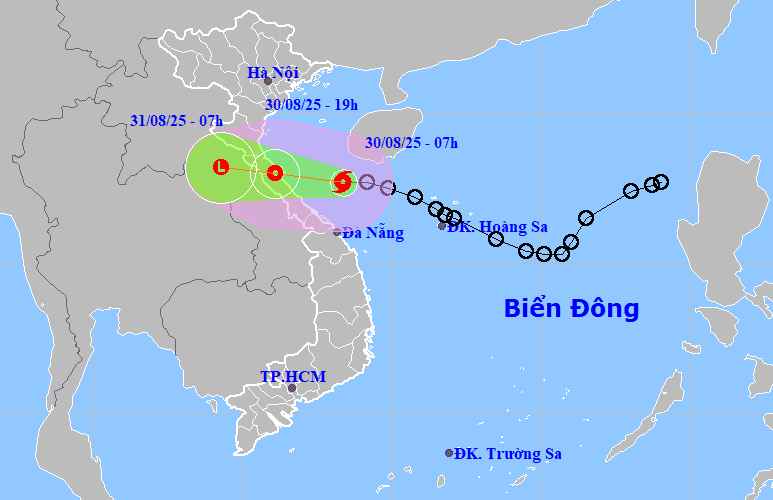
The strongest storm wind on land is level 8, gusting to level 10.
According to the National Center for Hydro-Meteorological Forecasting, at 7:00 a.m. on August 30, the eye of the storm was at about 17.7 degrees north latitude, 108 degrees east longitude, on the sea from Ha Tinh to Hue (about 210km east of northern Quang Tri ) with the strongest wind at level 8, gusting to level 10.
The storm moved west-northwest at a speed of 20km/h, moved inland from Ha Tinh to northern Quang Tri provinces and gradually weakened into a tropical depression.
At 7:00 p.m. on August 30, the center of the tropical depression was at about 18 degrees north latitude, 106.1 degrees east longitude, on the mainland from Ha Tinh to northern Quang Tri with the strongest wind at level 7, gusting to level 9.
The tropical depression continued to move west-northwest inland at a speed of about 20km/h and weakened into a low pressure area.
Due to the storm's influence, the northwestern area of the East Sea (including Hoang Sa special zone) has strong winds of level 6-7; waves 2-4.5m high, and rough seas.
The sea area from Thanh Hoa to Hue (including Hon Ngu and Con Co islands) has storms with strong winds of level 6-7, near the storm center level 8, gusting to level 10; waves 2-4m high, near the storm center 3-5m high, rough seas.
Coastal areas from Nghe An to Hue have sea levels rising from 20-40cm.
It is forecasted that coastal areas are very dangerous and unsafe for vehicles and structures operating in dangerous areas such as: cruise ships, passenger ships, transport ships, cages, rafts, and aquaculture areas.
From noon on August 30, coastal areas from Nghe An to Quang Tri will have winds gradually increasing to level 6, gusting to level 8. In particular, coastal mainland areas from Ha Tinh to northern Quang Tri will have winds of level 6-7, areas near the storm's eye will have winds of level 8, gusting to level 10.
The National Center for Hydro-Meteorological Forecasting warns that there may be strong thunderstorms and tornadoes before the tropical depression and storm have a direct impact.
From August 30 to August 31, the area from Thanh Hoa to Hue will have heavy to very heavy rain with rainfall of 150 - 300mm, locally over 500mm.
Da Nang city has moderate rain, heavy rain, locally very heavy rain with rainfall of 70 - 150mm, in some places more than 300mm.
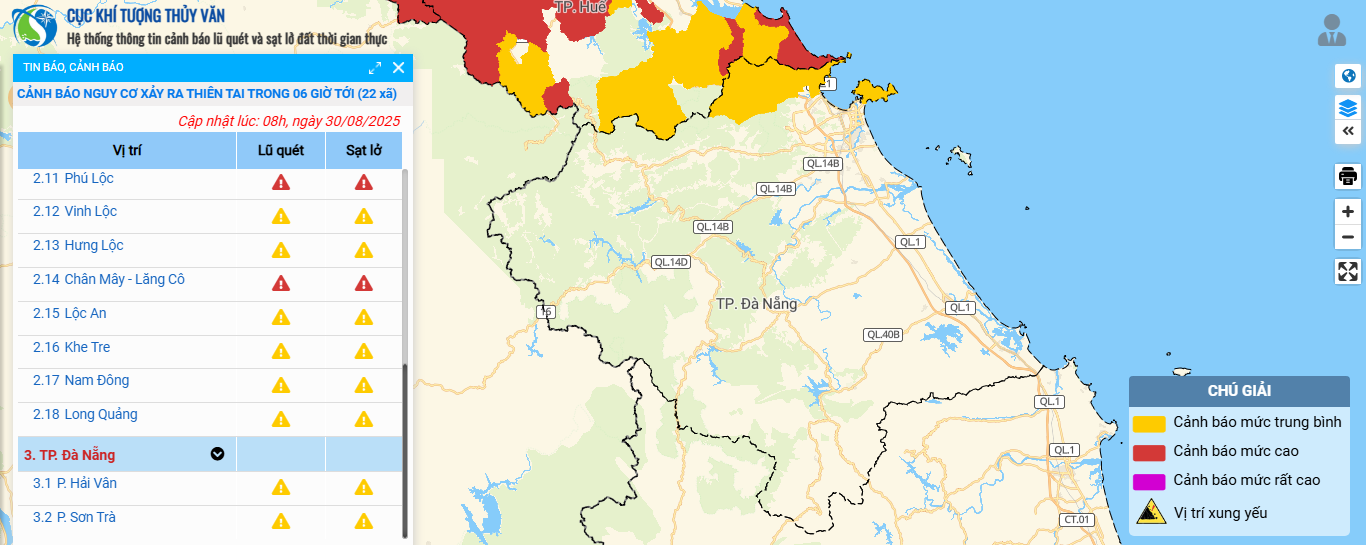
Da Nang issues telegram to respond to natural disasters
To proactively respond to natural disasters, especially heavy rains on land, and minimize damage caused by natural disasters, the Da Nang City Civil Defense Command issued a telegram requesting armed forces, departments, branches, localities and related units to regularly and closely monitor disaster forecasts and warnings. Timely notify people of natural disaster situations to proactively respond. Proactively handle possible situations; prepare forces and means to respond, deploy disaster prevention and control plans...
At the same time, proactively deploy the work of ensuring safety for people, vehicles, and property, especially tourist spots, aquaculture, fishing, seafood and constructions at sea, on islands, and coastal areas. Take advantage of harvesting agricultural products and aquaculture areas according to the motto "green house is better than old field".
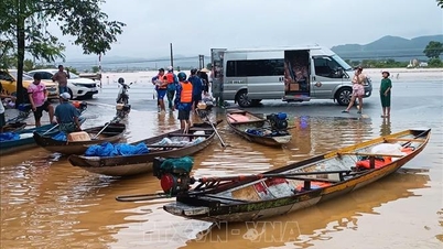
The City Military Command, the City Border Guard Command, the Department of Agriculture and Environment, and the People's Committees of coastal communes and wards continue to promptly notify owners of vehicles and vessels operating at sea of the location, direction of movement and developments of the storm to proactively avoid; escape or not enter dangerous areas. Call on vessels to urgently come ashore or find safe shelter. Proactively develop plans to ensure the safety of vessels and have appropriate production plans to ensure the safety of people and property.
The City Border Guard Command, based on the developments of tropical depressions and storms, proactively manages ships going out to sea.
The City Police coordinated with the City Border Guard Command, the Department of Agriculture and Environment and coastal localities to guide fishermen to implement measures and arrange a permanent force for fire prevention and fighting when anchoring boats to avoid storms at planned harbors and anchoring points, to prevent fires and explosions; to ensure security, order and safety of State and people's property.
Da Nang Maritime Port Authority inspects and reviews anchoring to ensure safety for cargo ships and transport ships when anchoring in Da Nang Bay.
Source: https://baodanang.vn/bao-so-6-di-chuyen-nhanh-vao-dat-lien-tu-ha-tinh-den-bac-quang-tri-chieu-toi-30-8-3300748.html




















































Comment (0)