
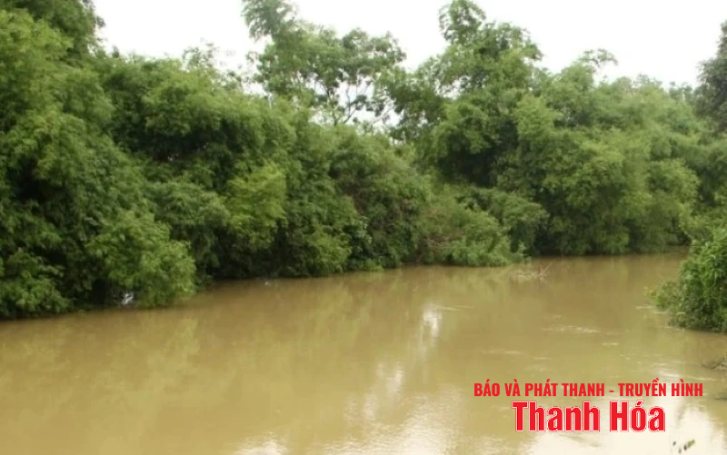
Risk of flooding in communes along Cau Chay river, especially Thieu Hoa, Xuan Tin and Xuan Lap communes.
Accordingly, the flood water level upstream of Ma River is fluctuating down. The water level at the midstream stations of Ma River has peaked and is slowly falling.
At 7:00 a.m. on July 28, water levels at some stations were as follows:
On the Ma River at Muong Lat hydrological station, it is 170.22m, above BĐ1 is 0.22m; at Hoi Xuan hydrological station, it is 58.54m, below BĐ1 is 0.46m; at Cam Thuy hydrological station, it is 16.93m, below BĐ1 is 0.57m; at Ly Nhan hydrological station, it is 7.55m, below BĐ1 is 1.95m.
On Cau Chay River at Xuan Vinh hydrology is 8.66m, on BD1 is 0.66m.
Warning: From the next 12-24 hours, flood water levels at stations on the Ma River will gradually decrease and be below level 1. On the Cau Chay River at the Xuan Vinh hydrological station, flood water levels will gradually decrease and be at level 1, with a risk of flooding in communes along the Cau Chay River, especially Thieu Hoa, Xuan Tin, and Xuan Lap communes.
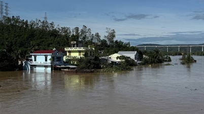
Warning of flood impacts that can cause flooding in low-lying areas along rivers, industrial zones, and urban areas, affecting traffic, aquaculture, agricultural production, people's lives, and socio- economic activities.
Flood disaster risk warning level: Level 1.
Lighthouse
Source: https://baothanhhoa.vn/canh-bao-nguy-co-ngap-lut-o-cac-xa-ven-song-cau-chay-256277.htm


![[Photo] Cutting hills to make way for people to travel on route 14E that suffered landslides](https://vphoto.vietnam.vn/thumb/1200x675/vietnam/resource/IMAGE/2025/11/08/1762599969318_ndo_br_thiet-ke-chua-co-ten-2025-11-08t154639923-png.webp)


![[Photo] "Ship graveyard" on Xuan Dai Bay](https://vphoto.vietnam.vn/thumb/1200x675/vietnam/resource/IMAGE/2025/11/08/1762577162805_ndo_br_tb5-jpg.webp)


![[Video] Hue Monuments reopen to welcome visitors](https://vphoto.vietnam.vn/thumb/402x226/vietnam/resource/IMAGE/2025/11/05/1762301089171_dung01-05-43-09still013-jpg.webp)


Comment (0)