
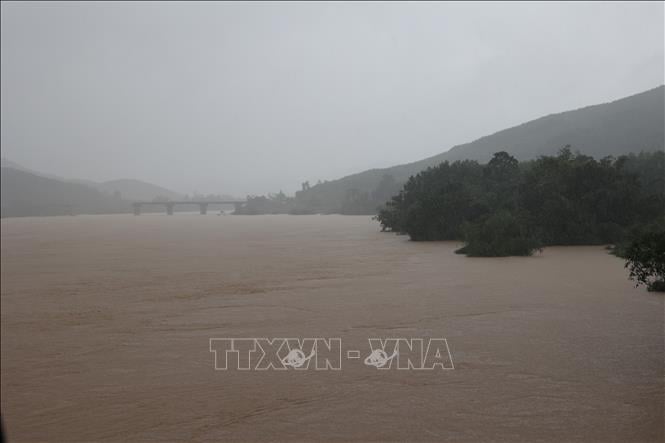
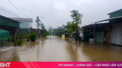
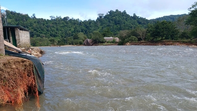
It is forecasted that in the next 24 hours, there will be widespread deep flooding in low-lying areas along rivers and fields, local flooding in villages and flooded residential areas in urban areas. The flooding depth is generally from 0.25 - 1.25m and in some places higher in the following communes and wards: Hoi An, Hoi An Tay, Hoi An Dong, Duy Nghia, Thang An, An Thang, Ban Thach, Huong Tra, Quang Phu, Tay Ho, Thang Dien, Thang Truong, Que Xuan, Cam Le, Hoa Xuan, Ngu Hanh Son, Ba Na, Hai Van, Tam Ky, Ban Thach, Huong Tra, Chien Dan, An Khe, Thanh Khe, Lien Chieu, Hoa Khanh, Hoa Cuong, Hai Chau, Son Tra.
Flood depth is generally from 0.5-1.5m and in some places is higher than 2.5m in the following communes/wards: Hoa Tien, Dien Ban, Dien Ban Bac, Dien Ban Tay, Go Noi, Nam Phuoc, Dai Loc, Tam Xuan, Huong Tra.
Common flooding depth is from 1.0 - 2.5m and the largest flooding is over 3.0m in the following communes/wards: south of Dien Ban Bac, south of Dai Loc, Thuong Duc, west of Dien Ban Tay, Vu Gia, Phu Thuan, Thu Bon, Nong Son, Que Phuoc.
Flood disaster risk warning level: Level 1-2.
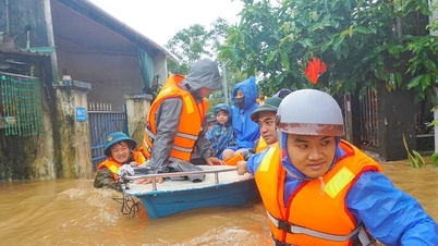
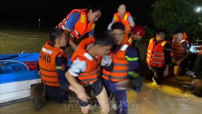
Flooding causes local traffic congestion, affects vehicle movement, damages houses, buildings and people's property, and negatively impacts socio- economic activities.
Source: https://baotintuc.vn/xa-hoi/da-nang-mua-lon-nuoc-tren-song-vu-gia-thu-bon-len-nhanh-20251103075230854.htm
![[Photo] Lam Dong: Close-up of illegal lake with broken wall](https://vphoto.vietnam.vn/thumb/1200x675/vietnam/resource/IMAGE/2025/11/03/1762166057849_a5018a8dcbd5478b1ec4-jpg.webp)
![[Photo] General Secretary To Lam receives Singaporean Ambassador Jaya Ratnam](https://vphoto.vietnam.vn/thumb/1200x675/vietnam/resource/IMAGE/2025/11/03/1762171461424_a1-bnd-5309-9100-jpg.webp)
![[Photo] Prime Minister Pham Minh Chinh receives the Chairman of the Japan-Vietnam Friendship Association in the Kansai region](https://vphoto.vietnam.vn/thumb/1200x675/vietnam/resource/IMAGE/2025/11/03/1762176259003_ndo_br_dsc-9224-jpg.webp)
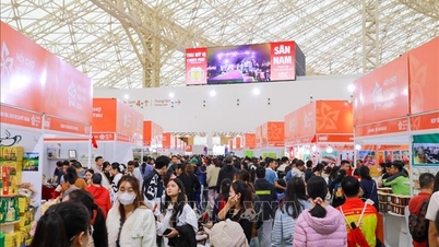
![[Photo] Fall Fair 2025 and impressive records](https://vphoto.vietnam.vn/thumb/1200x675/vietnam/resource/IMAGE/2025/11/03/1762180761230_ndo_br_tk-hcmt-15-jpg.webp)


Comment (0)