
Eastern Region: A dynamic urban area
The eastern region is defined as a region with dynamic urban centers and brands of international and regional significance. These urban areas are oriented towards greater diversity and flexibility in function, with prominent functions including: administrative cities, financial and technological cities, heritage cities, tourism cities, industrial cities, seaport cities, airport cities, educational cities, etc., to create momentum and a socio -economic and technical foundation for urban development.
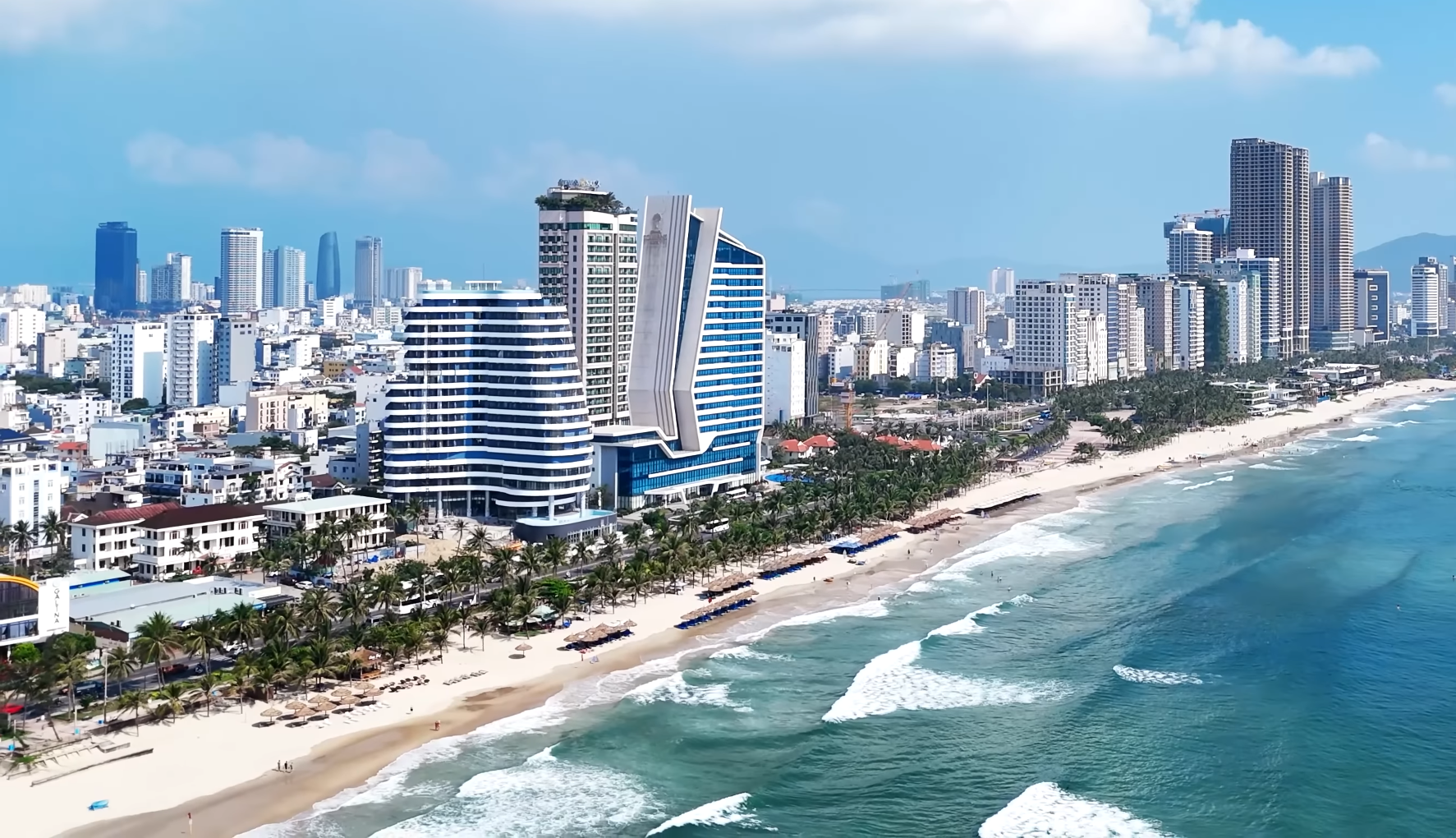
Specifically, the northern dynamic urban cluster includes: the international administrative and financial city (Da Nang city center) and the world heritage and tourism region (Hoi An - Duy Xuyen), with the goal of becoming a regional and international-level city based on a modern, smart urban foundation and a global economy.
The core of the city's distinctive character is formed by the process of building an international financial center and free trade zones, a regional hub attracting resources and serving as a gateway for international trade.
In terms of tourism , based on heritage elements, people, and the Thu Bon River ecosystem, Hoi An, with its status as a World Cultural Heritage site, will be the center of a heritage city connecting with the My Son World Cultural Heritage site along the Thu Bon River ecological corridor.
This area possesses many cultural values and unique landscapes, forming a chain of world-class cultural, ecological, and resort tourism connections, combined with the dredging of the Co Co River to restore the waterway along the urban strip, and ecotourism along the river and coast.
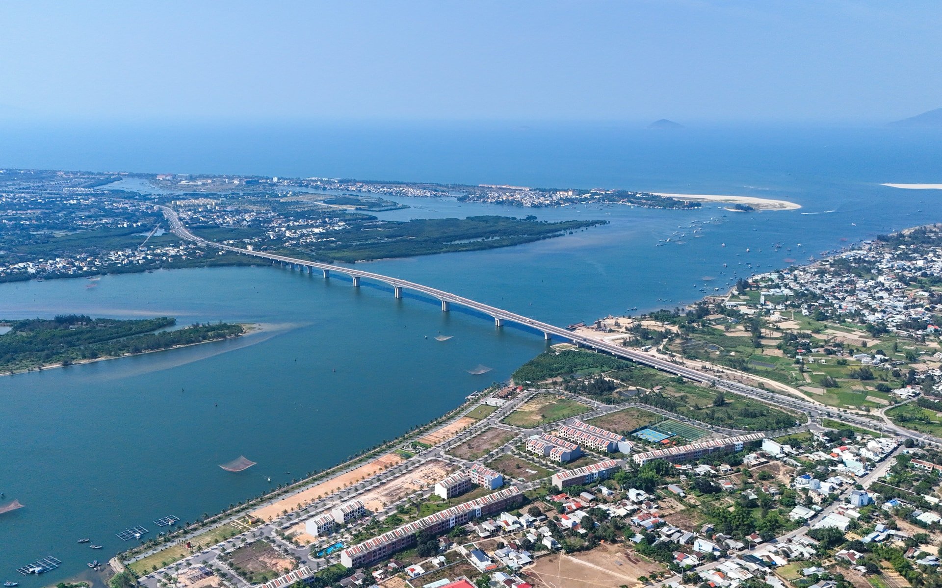
The Tam Ky - Nui Thanh industrial, logistics, seaport, and airport urban cluster is an urbanized area stretching over 20km along the Truong Giang River and the coast, with two expressway interchanges.
This urban cluster also concentrates important economic and technical facilities and major strategic infrastructure in the south of the city (airport, seaport, open economic zone), becoming a major support in terms of development space and production impetus for the city.
The South Hoi An New Urban Cluster is a highlight in the city's new urban development plan. This vast area south of the Thu Bon River possesses all the necessary elements to clearly demonstrate the city's vision and aspirations for future development, including land resources, landscape, natural conditions, infrastructure connectivity, scientific and technological capabilities, and lessons and new models from urban development practices around the world.
The plan is to develop the new South Hoi An urban cluster into a comprehensive, innovative, green, smart city and a regional center for events, tourism, entertainment, and sports.
Western Region: Satellite Cities
Satellite cities in the western region play a role in sharing functions and expanding development space. These cities are oriented to become ecological bridges and gateways for international links with Laos, Thailand, and the Central Highlands region.
Before the merger, the western urban areas were type V urban areas, towns within districts. Currently, there are about 10 urban areas concentrated in the midland and mountainous regions, serving as existing centers linked to the expanded administrative boundaries of the newly merged communes. These smaller urban areas will gradually transform and adapt to the new spatial conditions following the merger of the communes.
In themselves, cities will focus on solutions to improve infrastructure quality and urban standards according to regulations, through mechanisms and investments such as: perfecting institutions (planning, architectural regulations); investing in framework infrastructure according to approved plans (creating a mechanism to attract other social resources); investing in public spaces and public infrastructure (parks, green spaces, festival spaces, community spaces, etc.).
The hierarchical development model ensures both concentration to form a strong urban hub capable of regional competitiveness and maintains connectivity and diffusion so that the entire urban system within the city develops harmoniously, sustainably, and adapts flexibly to climate change.
Currently, with improved conditions and a view to preventing urban areas from falling behind, the Department of Construction continues to review and compare the new situation to finalize the mechanism and report to the competent authorities for approval, aiming to create breakthroughs and flexibly transform the functions of urban areas in line with new development opportunities.
After the merger, Da Nang not only expanded its administrative boundaries but also had the opportunity to become one of Vietnam's pioneering models of sustainable urban development. However, this opportunity will only become a reality if it is accompanied by determination, vision, and the collective efforts of both the political system and the people.
With clear direction, sound planning solutions, and the synchronized involvement of the political system and the people, the city has reason to believe that in the not-too-distant future, Da Nang will be firmly positioned on the regional and international development map.
INFRASTRUCTURE AND REGIONAL CONNECTIVITY SOLUTIONS
To bridge the East-West gap, we must start with infrastructure. The key is for the city to succeed in its strategy of linking urban areas and development regions.
During the period from now until 2030:
For the eastern region, the city is focusing on completing planning and institutional work; shaping smart infrastructure linkage frameworks; investing in digital infrastructure; and ensuring that all travel times and connections between hubs are shortened (estimated maximum travel time of approximately 1.5 hours from Da Nang Airport to Chu Lai Airport, with hubs spaced about 15-20 minutes apart).
The western region focuses on investing in and upgrading the connecting routes with the eastern region, which are the development and urbanization corridors. Accordingly, there are four main routes, including: the National Highway 40B to Provincial Road DT617 connecting the southern urban cluster (Tam Ky, Nui Thanh) to the west, encompassing the areas of Tien Phuoc, Tra My, and Kon Tum (Quang Ngai province).
National Highway 14E and National Highway 14H connect the South Hoi An area (Thang Binh - Duy Xuyen) with the Phuoc Son and Hiep Duc areas, linking to the Central Highlands and facilitating trade with Laos via the Bo Y border gate.
National Highway 14B and National Highway 14D connect the urban areas of Da Nang, Dien Ban, and Dai Loc with the western region, aiming to exploit the Nam Giang border gate as an international gateway and complete the East-West connecting corridor (EWEC).
National Highway 14G and Provincial Road DT606 connect Da Nang city, Dong Giang, and Tay Giang with the Tay Giang sub-border gate, opening a gateway for economic cooperation with Sekong province and the southern provinces of Laos and northeastern Thailand.
Period up to 2035:
In the eastern region, it is necessary to operate a synchronized infrastructure framework, including: urban railway lines, rapid bus routes, and increasing the speed and capacity of goods transportation on national highways connecting the western region with the seaports at both ends of the city. Simultaneously, expand connections with the Central Highlands and international gateways to the west of the city; complete the infrastructure of Chu Lai Airport and Chu Lai Seaport to complete the logistics axis linking Tien Sa Port - Chu Lai - Ky Ha.
In addition, the plan includes operating an international financial center; developing the South Hoi An tourism and entertainment center, and the Chu Lai - Tam Ky industrial and human resource training center.
The western region focuses on building and attracting investment in large-scale economic and technical facilities and industrial zones in the eastern region, adjacent to the western region, to address labor and migration issues; to promote the value of the region's raw material crops; and to form residential and service clusters as a foundation for developing new urban areas and functional zones linked to the region's advantages (high-tech agriculture, tourism, etc.).
The period after 2035, vision for 2050:
The city continues to strengthen its smart digital infrastructure system for international integration and cooperation; focusing resources on further developing the city center to create a driving force for the entire Central region, capable of competing with other major cities nationwide and in Southeast Asia, thereby spreading development to the entire eastern and western regions.
Furthermore, connecting the plains, midlands, and mountainous regions; forming western gateways, concentrated development points, and a system of urban areas (formerly towns) to complete the open urban area model, the urban chain model, regional linkages, green growth, digitalization, cultural preservation, and climate change adaptation will create a foundation for Da Nang city to have solid internal strengths, ensuring long-term, continuous, and sustainable development.
Source: https://baodanang.vn/giai-phap-quy-hoach-phat-trien-thanh-pho-da-nang-can-bang-dong-tay-ban-sac-va-ben-vung-ky-cuoi-xay-dung-he-sinh-thai-do-thi-co-thu-bac-3305172.html


![[Image] Close-up of the newly discovered "sacred road" at My Son Sanctuary](/_next/image?url=https%3A%2F%2Fvphoto.vietnam.vn%2Fthumb%2F1200x675%2Fvietnam%2Fresource%2FIMAGE%2F2025%2F12%2F13%2F1765587881240_ndo_br_ms5-jpg.webp&w=3840&q=75)


Comment (0)