Minh Hai used to be a province in our country. Through the period of merger and separation, the administrative boundaries of this province have changed a lot.
1. Which two provinces merged to form Minh Hai?
- Kien Giang – An Giang0%
- Bac Lieu – Kien Giang0%
- Ca Mau – Bac Lieu0%
Exactly
After the complete liberation of the South, in February 1976, the Provisional Revolutionary Government of the Republic of South Vietnam issued a decree to merge several provinces in the South. Accordingly, the two provinces of Ca Mau (An Xuyen) and Bac Lieu became Minh Hai province.
Minh Hai province has Minh Hai town, Ca Mau town and 7 districts: Vinh Loi, Hong Dan, Gia Rai, Chau Thanh, Thoi Binh, Tran Van Thoi, Ngoc Hien.
2. When Bac Lieu - Ca Mau was first merged, what was the name of the new province?
- Bac Lieu – Ca Mau0%
- Minh Hai0%
Exactly
In February 1976, the Provisional Revolutionary Government Council of South Vietnam merged the two provinces of Bac Lieu and Ca Mau into Bac Lieu and Ca Mau provinces. By mid-1976, Bac Lieu and Ca Mau provinces changed their name to Minh Hai province. Thus, when the two provinces were first merged, their initial name was Bac Lieu and Ca Mau provinces.
3. How long did Minh Hai province exist?
- 19 years0%
- 20 years0%
- 23 years0%
Exactly
Minh Hai province existed for 20 years.
In February 1976, the Provisional Revolutionary Government of the Republic of South Vietnam issued a decree to merge several provinces in the South. Among them, two provinces, Ca Mau (An Xuyen) and Bac Lieu, became Minh Hai province.
On November 6, 1996, at the 10th Session, the 9th National Assembly approved the separation of Minh Hai province into two provinces: Ca Mau and Bac Lieu. The separation took effect from January 1, 1997.
4. Where can you see the sun rise from the East Sea in the morning and set in the West Sea in the afternoon?
- Dien Cape0%
- Ca Mau Cape0%
- Double Nose0%
Exactly
Ca Mau is the southernmost province of Vietnam, located in the Mekong Delta region.
The mainland of the province is located at 8034' to 9033' North latitude and 104043' to 105025 East longitude, 370km from Ho Chi Minh City, 180km from Can Tho city to the south. The north borders Kien Giang province, the northeast borders Bac Lieu province, the east and southeast borders the East Sea and the west borders the Gulf of Thailand.
Ca Mau is located on a peninsula, with a very special geographical position, with 3 sides bordering the sea. Ca Mau Cape is the only place on the mainland where you can see the sun rise from the East Sea in the morning and set into the West Sea in the afternoon.
5. What does the name Bac Lieu mean?
- Rich neighborhood0%
- Rich neighborhood, gold and silver processing0%
- Poor village, working as a fisherman, fishing, going to sea0%
Exactly
The name “Bac Lieu” read in Chinese with the Teochew accent is Po Leo, which means a poor village, working in the silver industry, that is, fishing, going to sea. Po is pronounced “Bac” in Sino-Vietnamese and Leo is pronounced “Lieu”.
Another hypothesis is that Po means police station, and Lieu means Lao (Ai Lao) in Khmer, because before the Chinese came to live there, there was a Lao military post there.
The French, based on the name Po Leo in the Teochew language, called this land Phecheri-chaume (fishing and cogon grass). There are also some other hypotheses.
6. Which of the following provinces does not have mountains?
- Kien Giang0%
- An Giang0%
- Bac Lieu0%
Exactly
Bac Lieu province is located in the Southwest, in the Mekong Delta region, with coordinates from 9000'00'' to 9037'30'' North latitude and from 105015'00'' to 105052'30'' East longitude, 280km from Ho Chi Minh City (to the North). The North borders Hau Giang and Kien Giang provinces; the East and Northeast borders Soc Trang province; the West and Southwest borders Ca Mau province; the East and Southeast borders the East Sea.
Bac Lieu province has a fairly flat terrain, without hills or mountains, so there are no major seismic tremors. The terrain is basically plains with vast fields, rivers, canals and crisscrossing canals.
7. At Hung Vuong Square, Bac Lieu City, there are symbols of 3 ethnic groups. What are they?
- Kien Giang
- Rich neighborhood
- Dien Cape
- 19 years
- Bac Lieu – Ca Mau
Source: https://vietnamnet.vn/hai-tinh-nao-tung-sap-nhap-thanh-minh-hai-2353748.html


![[Photo] Prime Minister Pham Minh Chinh receives United Nations Secretary-General Antonio Guterres](https://vphoto.vietnam.vn/thumb/1200x675/vietnam/resource/IMAGE/2025/10/25/1761390212729_dsc-1484-jpg.webp)
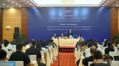
![[Photo] Prime Minister Pham Minh Chinh and United Nations Secretary-General Antonio Guterres attend the Press Conference of the Hanoi Convention Signing Ceremony](https://vphoto.vietnam.vn/thumb/1200x675/vietnam/resource/IMAGE/2025/10/25/1761391413866_conguoctt-jpg.webp)

![[Photo] National Assembly Chairman Tran Thanh Man receives United Nations Secretary-General Antonio Guterres](https://vphoto.vietnam.vn/thumb/1200x675/vietnam/resource/IMAGE/2025/10/25/1761390815792_ctqh-jpg.webp)









![[Photo] General Secretary To Lam meets with General Secretary and President of Laos Thongloun Sisoulith](https://vphoto.vietnam.vn/thumb/1200x675/vietnam/resource/IMAGE/2025/10/25/1761380913135_a1-bnd-4751-1374-7632-jpg.webp)






































Comment (0)